This is the second article in my short series on the New River. This summer we canoed and fished several sections of the New River, first exploring the upper section in North Carolina, then the middle section that flows through Virginia, and finally the section that flows through the New River Valley and into West Virginia. In the first article, I reviewed the section of the New River below the confluence of the North and South forks of the river. This article is about our second trip where we fished and camped at Foster Falls in August 2011.


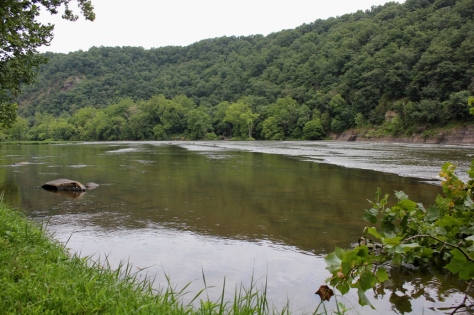
The New River leaves Ashe County and Alleghany County in North Carolina and crosses the state line and flows into Virginia at Mouth of Wilson in Grayson County. It then briefly crosses back into North Carolina and then back into Virginia again near Fries, Virginia. The river then flows through the eastern part of Grayson County and into Wythe County. As the river flows through the eastern part of the Appalachian Mountains in these counties it gains considerable volume and size as various tributaries add water to its flow.
Shortly after flowing under I-77, the New River has a series of step-like waterfalls that spand the entire width of the river and are collectively classified as a class 3 whitewater. This area is known as Foster Falls and is the site of Virginia’s New River Trail State Park.
Great Biking
The New River Trail State Park is a unique Virginia park: A 57-mile linear state park with various facilities located at different segments of the trail. The main facilities are located at Foster Falls, where there is a small “walk in” campground, river access for fishing and a boat ramp, picnic areas, horse stables, and a canoe livery with a small shop.
The New River Trail itself is a converted railroad bed. The trail is a packed dirt/ash trail that is excellent for mountain bikes or cross bikes. The trail has several trestles that cross the river and also has a tunnel or two that cyclists travel through. The trail is a level grade, with only a few minor hills, and generally follows the New River between Fries and Pulaski. Foster Falls is the approximate half-way mark on the trail, and makes a good base camp to cycle in either direction on the trail.
This trail is scenic with minimal traffic and road crossings. After the Virginia Creeper Trail, it’s probably the nicest off-road cycling trail in Southwest Virginia.
Smallmouth Country
The New River is renowned as one of the premier smallmouth fisheries in Virginia. Actually, it’s one of the premier smallmouth fisheries in the United States. The river also has large populations of musky and other game fish. The New holds Virginia’s state records for largest smallmouth bass (8 pounds, 1 ounce) and largest musky (45 pounds, 8 ounces.)

There are several areas to fish right at Foster Falls. I believe the key to fishing any large river, but especially the New, is to spread your casts methodically over fairly large areas of water to reach the most fish as possible and then move on. Unless you are bait fishing and patient, covering a section of water and then moving on to another section is the best way to cover this river.
We therefore first bank fished the river, then waded parts of the river where it was shallow and fished across a large island adjacent to the campground. I fly fished with streamers and caught about 10 smallies with a size 8 olive wolly bugger. My sons Karl and Isaac used Mepps and Blue Fox spinners on light and ultra light spinning tackle. They caught about a dozen fish between them.
Great Camping

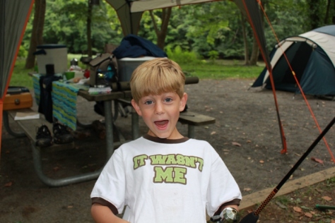
There are only 12 campsites at Foster Falls. Thus, although it is a group camping area, the sites are dispersed and there is a wonderful absence of what I sometimes call the “Camp Jellystone Effect”−hundreds of sites jammed together creating a permanently smoky area that from a distance resembles a foreign refugee encampment as sometimes seen on the evening news.

Also, because these are “walk in” sites, there are no RVs or trailers. You have to park in a designated parking area and carry your camp gear between 100-200 feet to the designated campsites. This is not that difficult, and, much to my surprise, the state park provides little wagons for campers to transport their gear from the car to the campsites.

Most of the campsites are either right on the river, or very close to the river (with river views). The camground also provides a sheltered area with dry wood for the campers. You simply have to pay a daily fee, and then you may transfer the firewood to your site for your own use. This was convenient and a reasonable way to provide firewood (if you run out, you simply go back to the covered area and get a few more logs).
Kayaking and Canoeing
Although we didn’t do any boating, there is the possibility of boating both up river and down river from Foster Falls. Running the falls looked a bit sketchy. When we were there in August, there did not appear to be sufficient water to successfully navigate the falls. We saw one kayaker dragging his kayak down the river; it didn’t look fun.
I have kayaked the section of the river above the falls previously (my brother-in-law once took me down this section when a summer lightning and thunderstorm developed in which I feared for my life−getting caught on the water under these conditions can be scary). During higher flows, this can be a moderately challenging kayak with lots of riffles and fast water, but there are not too many obstacles. Downriver from the falls the river slows considerably as it approaches and eventually forms the upper part of Claytor Lake.
We will definitely return to Foster Falls, probably with a bike focus on our next trip. However, I will also have to bring more marshmellows, Hersheys chocolate, and graham crackers next time. Because this time, these ingredients seemed to mysteriously disappear each night.


