On Sunday, October 13, 2013, we went over to the North Carolina High Country to hike Grandfather Mountain during the peak color change. Unfortunately, it was cloudy and drizzling.
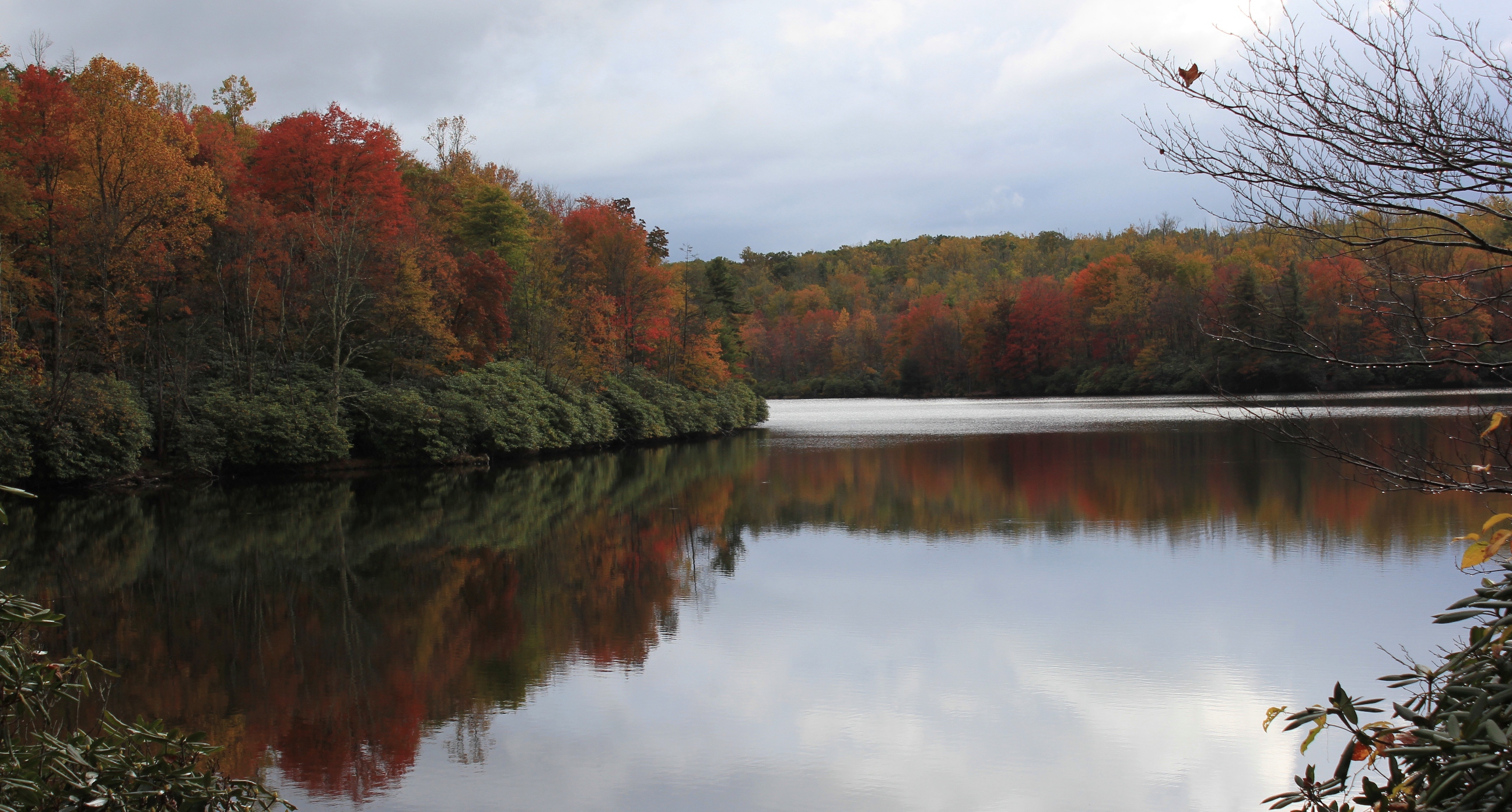
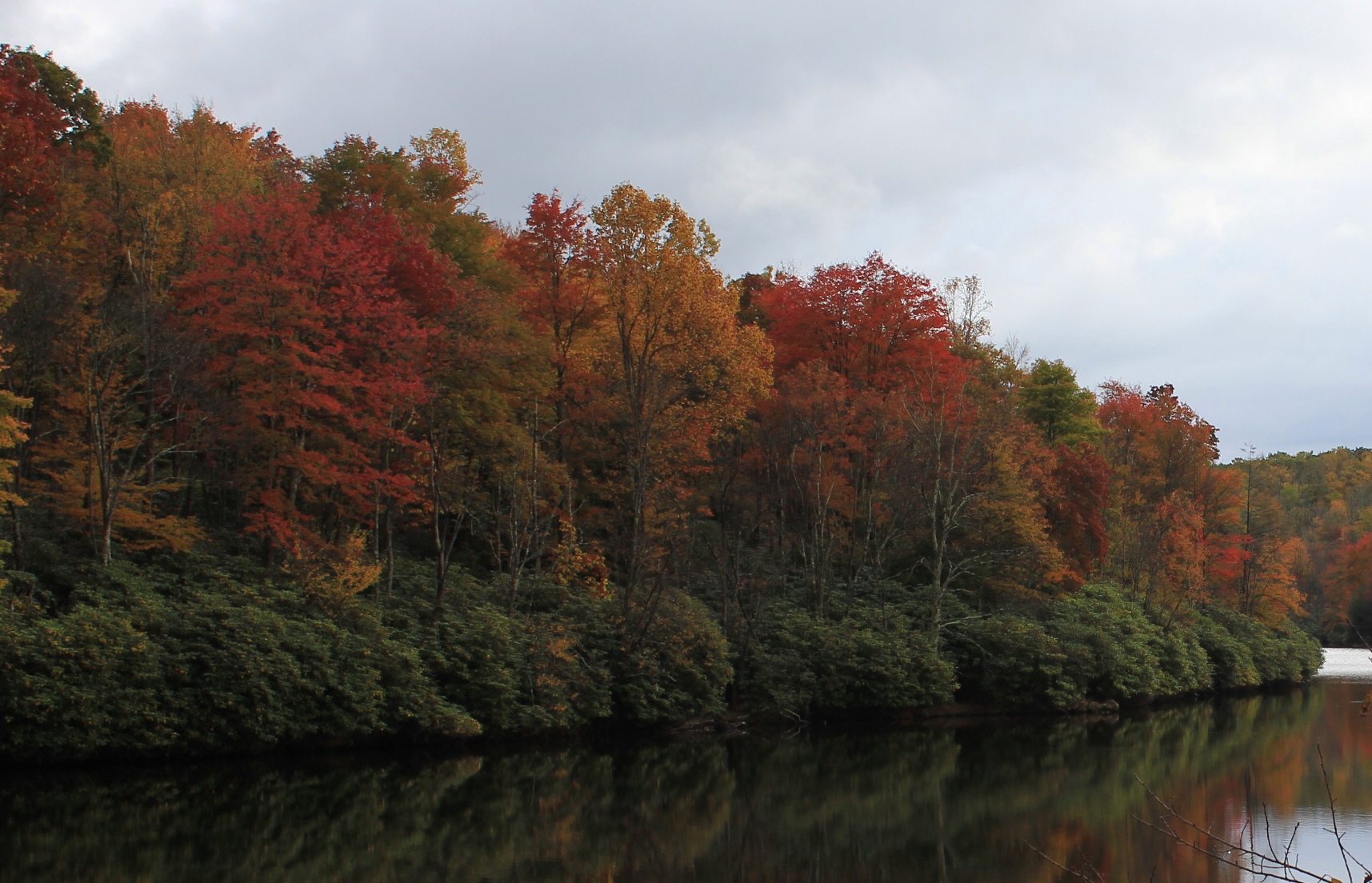
As we drove down the Blue Ridge Parkway towards Blowing Rock, the skies below 4000 feet cleared and created ideal conditions for these photos showing the fall colors and reflections on Julian Price Lake.
Immense ReflectionPerfect SymmetryBlue Sky ReflectionFall Colors Reflect on the LakeRhododendron on the LakeBlue Ridge Mountains – Ramparts of Grandfather MountainJulian Price Lake
The section of the Blue Ridge Parkway that skirts around Grandfather Mountain is most impressive. This is the site of the famous Linn Cove Viaduct, where the Parkway is raised up on pylon-like stilts and skirts around part of the mountain as if suspended in midair. This whole section of road has impressive views of the mountain, and off to the east and southeast, all the way to the Piedmont region.
The photo above was taken in March near mile marker 302—right before you begin rounding Grandfather Mountain when approaching from the Blowing Rock Area. Low hanging cumulus clouds accentuate the blueish hue of the mountains. The photo views the mountains and hills to the southeast (Grandfather Mountain is not in the picture but is to the right from this viewpoint, on the other side of the Parkway from this turnoff).
The three-mile section of the Appalachian Trail from Route 601 to the top of Whitetop Mountain rewards hikers in all seasons. In the late fall and winter, vistas open through the canopy on the mountainside, and the generally clearer skies provide better long-range views.
Hawthorn Berries Contrast Against an Azure Sky on Whitetop
This is a staple hike for our family; it’s distance is just about right as a challenging, yet quite doable hike for children. (It’s also a great training hike.) In late November, my son Isaac and I did this out-and-back hike up to Buzzard Rocks, the name of the rocky outcroppings at the base of the bald on Whitetop. The majority of this hike is in the deep forest, but in the last 1/4 you leave the larger hardwoods behind, go through some smaller scrub-like trees, and eventually come up onto the large Whitetop bald that is visible from most high points in Abingdon.
The view from the top of Whitetop is one of the best in Virginia. Here is the classic mountaintop shot from our hike:
Vista from Whitetop
During the summer, this hike can be the quintessential AT walk through a “tunnel of trees” until you reach the very top. In winter, however, you can look up and down the mountain at the various boulders and formations, and you can peer deep into the forest. In the photo below, the leafless canopy affords a view of the top part of Grandfather Mountain in North Carolina. During summer you can’t see this until you get to the balds:
Grandfather Mountain View from the Appalachian Trail Between Route 601 and Buzzard Rocks
Here, you can see the treeline giving way to the balds as my son and dog climb the trail. Note also that there was snow on the trail. It is invariably significantly colder up on the balds than below, usually to the tune of about 20° if there is any wind. It is almost as if you break out into the jet stream.
Emerging from the Trees Below
We were treated to a large, migrating flock of goldfinches when we arrived at the bald.
Migrating Flock of Goldfinches on Tall Hawthorn Bushes
The large Hawthorn bushes with their clumps of red berries reminded us that fall was almost over, and the Christmas season fast approaching. Soon similar berries would adorn mantles and wreaths as holiday decorations in people’s homes far below.
Outcroppings near Buzzard Rocks
Hawthorn Bush with Berries Screens View of Iron Mountain and Clinch Mountain
The big-ticket item—the main reason to do this hike—is the fabulous view from the top of Whitetop. The Whitetop bald is one of the largest individual balds in the Appalachian Mountains.
Looking into North Carolina
The vistas are superb from the bald. In the accompanying article, I have put together a panoramic photograph showing how expansive the view is. The photos in this article do not capture how open it is on top of the mountain.
High Altitude Cirrus Clouds Give Way to Long Stratocumulous Cloud on the Horizon
The winds picked up while we were at the summit; I estimated they were in excess of 30 or 35 mph. The ambient air temperature felt like it dropped about 30° from when we were below treeline. We only had on t-shirts, and we began shivering. Fortunately, I had come prepared: Out came the down jackets, the hats and the gloves.
Isaac Thiessen in the Puffy Jacket
It was extremely windy; note in the photo below how the wind has inflated my pants:
Eric Thiessen in the Puffy Vest
The Whitetop hike is not only a fabulous hike; it’s relatively close to home. Coming from Abingdon, you never leave Washington County (except perhaps while on the trail at the summit). At about 23 miles from Abingdon to trailhead, the Route 601-Buzzard Rocks hike is the closest access point to Whitetop and Mount Rogers from Abingdon.
These two panoramic photos taken from a recent trip to Whitetop Mountain show the expansive vista to the southeast at the summit.
If you click on them in an updated browser, they should open in a much larger format that is pretty awesome viewed on 16:9 monitor. There is a slight overlap in the two photographs, but together they form almost a single, panoramic image.
Virginia into North Carolina Panorama
The Blue Ridge in North Carolina Panorama
As I state in the main article, the views at the top of Whitetop certainly justify the climb to the summit.
There is also a gravel road from the east side of Whitetop that goes to the summit of Whitetop. It is Route 89, and it connects to Route 600 near Elk Graden. Route 89 is usually open even in winter, although it is covered in snowpack and requires a 4 x 4.
It is 3:30 AM. We are parked on a rural hilltop next to a gas station that closed for the night five hours ago.
Blue Ridge Relay Runners with Headlamps at the Grandfather Mountain Entrance Gate
The gas station is several miles outside the little town of Bakersville, North Carolina. We’re less than 10 miles from the Tennessee state line. Dozens of other passenger vans are lined up on the hill next to us, here, in a place that can only be described as the middle of nowhere.
Wincing, I slowly extend my right leg in order to begin to exit the cramped van. My teammates and I have just traveled 100+ miles over winding, mostly secondary mountain roads in North Carolina since leaving Grayson Highlands State Park in Virginia at 10:30 AM yesterday morning. At least one of us has run every single mile of this journey. And we’re only a little over half way to our destination.
After 15 miles of hard running yesterday and no sleep this night, my legs are sore and my eyes are bleary. This is the third time I’m doing this running drill.
I don my headlamp and a reflective vest with blinky lights in that cool, slightly foggy air so typical of the wee morning hours in Southern Appalachia. I gingerly walk over to the “exchange zone,” an area consisting of orange cones with race officials carrying clip boards and stop watches. I inform them of my race number, 314, and the race number of our team captain, Jasen, who is currently on the course and who will shortly hand off to me the large, blue wristband stamped “BLUE RIDGE RELAY” that we are carrying by foot to Asheville.
Many of our competitors are wandering around the same area, several like me trying to loosen up their knotted muscles before the exchange. Some of my own teammates are awake, too, perhaps ingesting a nutrition bar or banana or drinking water to get much needed calories or fluids. (“Ingesting” is a better description than eating, for there is little pleasure in forcing the food down at this hour after the latest gut-wrenching ride). Others on the team are in the van trying to get at least a few moments of uncomfortable shut-eye before their next run.
Those of us who are awake peer into the blackness where the road disappears. We are waiting. After a while, a few headlamps and blinky lights begin to appear at the base of the hill. Human shapes emerge slowly as we begin to recognize the runners who approach.
“DIRTBAGGERS!, DIRTBAGGERS!,” one of the runners exclaims. It’s Jasen. He is letting us know he’s coming and for me to get ready to start the next leg. Lumbering up the long hill, panting hard, he hands me the wristband. I turn back to salute his effort, but he’s yelling at me and pointing down the road. “GO! GO! GO! GO! GO!”
So motivated, I run off into the darkness, continuing the race. Within a few minutes, I am once again all alone. It’s just me and another long stretch of asphalt, though I can only clearly see about thirty feet ahead by the illumination of my headlamp. Although running alone, I’m not lonely. That’s near impossible when your legs are windmilling downhill and your heart rate is pushing past your aerobic threshold.
The Dirtbaggers’ passenger van whizzes by, leapfrogging me to the next exchange zone. My teammates in the van hoot and holler and shout encouragement as they roll past. I acknowledge them with a raised right arm. Geez, I can’t let these guys down by cracking on this leg of the race.
My first, foremost thought at this ungodly hour is that I must get to the next exchange zone as quickly as possible and hand the wristband to Aaron, who will carry it through Bakersville and another stretch of darkness until the next teammates—Keith, Sean, Scott, Mike, Cam, Bruce, Jim and Byrum—do the same thing as we travel the remaining miles of our meandering route (and then three of us will run yet a fourth time to reach the finish line in Asheville).
My second, intermittent thought is, “What the hell am I doing here?”
My third thought—organically evolving from the second, contemplating the totality of this event—causes an almost imperceptible sideways head nod of virtual disbelief and a slight grin: “This is so totally and utterly insane, it’s awesome!”
Then there’s no further deliberative thought. There is only movement. Movement, and the will to keep pushing through this run.
Race to beyond the horizon: View from the Little Pinnacle at Grayson Highlands State Park the morning of the Blue Ridge Relay, September 9, 2011.
The Blue Ridge Relay, or BRR, is a 208 mile running relay race that traverses back and forth across the spine of the Blue Ridge Mountains with a cumulative elevation gain of 27,000 vertical feet. It’s arguably the toughest relay road race in the nation. The tagline for the race is “Consider All Others a Warm Up.”
BRR has 27,000 vertical feet of climbing. That’s like climbing Mount Everest more than twice (remember Everest climbers start at 17,000 feet). No, it’s not a truly analogous comparison, but it gives you an idea of the vertical climbing in this monster race.
The start of the 10:30 AM wave. There were waves of runners from 6:00 AM through 1:30 PM.
On September 9th and 10th, 2011, our team, named “The Dirtbaggers,” ran the 208 miles in just under 27 hours at a 7:47 minute per mile average pace. We came in 20th place out of the 120 teams that started the race (several teams DNF’d). Amazingly, the winning team, the Asheville Running Collective, ran 208 miles in a little over 20 hours with a scorching 5:53 minute per mile average pace.
36 Individual Races
The BRR is one of the oldest road relay races in the Eastern United States. The concept of super long relay races goes back a couple decades or so, with several of the first ones out West, most notably the Hood to Coast 200 mile relay race in Oregon. They have picked up much greater interest in the last decade on the heels of the big running boom the United States is currently experiencing (marathon running is up 37% percent since 2000; this year was the first year that even those runners who qualified for the Boston Marathon had to be chosen by a lottery in order to get a place on the starting line). While most runners still consider ultra-running and other mega running events like the Blue Ridge Relay as extreme, these kinds of races are enjoying a concomitant growth and increased interest for those looking for the next challenge after the marathon.
Relay Sign near Todd on the New River on Leg 9
The relay has 36 sections, each of which is between 3 and 11 miles in length. Starting at Grayson Highlands State Park at over 5000’ elevation in Virginia, the race includes some of the most scenic and highest mountains in North Carolina, including a climb up the ramparts of iconic Grandfather Mountain (5900’) and around Mount Mitchell (6600’), the highest mountain in the East. Several legs are on or adjacent to the Blue Ridge Parkway.
Generally, the race bounces between 1500’ and 4000’ vertical feet practically every three or four legs. The map of the entire course shows it generally travels south. The race officials generated topographical maps (which do not do the course justice and don’t show all of the hills) for each of the 36 legs. I ran legs 2, 13, 24, and the brutal, penultimate 35 (containing a 7-11% gradient climb up to the Blue Ridge Parkway).
Each leg is rated easy, moderate, hard, very hard, or “mountain goat hard.” As we ran this race, we realized, however, that easy, moderate, and hard are relative terms.
Vans lined up at the top of the first "Mountain Goat" leg near Mt. Mitchell
Even the so-called easy runs usually had hills that, in their own right, would be called hard by anyone other than the organizer of a 208-mile race in the mountains. The longest leg was 10 mile all-uphill run on Route 220 that essentially paralleled the Blue Ridge Parkway as it climbed the bottom half of Grandfather Mountain.
There were two mountain goat legs, each of which had climbs that exceeded 13% gradient in places. There were also long, unrelenting downhill runs that would punish the hamstrings and knees. One all-downhill run was nine miles in length!
A Group Effort
I love individual races; they provide their own reward. There’s no hiding in an individual race. You wholly own the result, for better or worse. The Blue Ridge Relay was not necessarily a “better” race than a solo race, but it was definitely different.
The Dirtbaggers aka TPE: Byrum Geisler, Jasen Eige, Sean Murphy, Jim Thompson, Bruce Coakley, Keith Polarek, Eric Thiessen, Cameron Bell, Aaron Sink, Scott Sikes, Mike Owens (Click to Enlarge)
The beauty of the relay race concept is that while only one member of the team is racing against the clock at a time, there is a collective team effort that in some ways elevates the event beyond an event of comparable or greater individual effort such as a solo marathon. At the same time, because the BRR is a mountainous course, no leg is exactly like any other leg in length or topography, and direct comparisons between the runners is difficult. Each team member just has to run the best they can on their unique segments of the course.
Not just a fashion statement: Reflective vests were mandatory on Blue Ridge Parkway. Byrum describes leg 11, a Parkway run, to teamates Sean, Mike, Bruce, Cam and Aaron. Mountains near Boone frame the background.
Running for a team puts a different sort of pressure on you; for me, this different motivation was refreshing. The camaraderie and fellowship of doing the relay together with my teammates was more “fun” than a purely individual race. Obviously, how much “fun” a race like this is depends on who your teammates are—you need to think about with whom you want to spend a sleep-deprived night in a van in the mountains when you put together your crew. Although every single one us had not been on a team with every other one of us before this race, most of us had a connection to several others on the team. We were fortunate, too, in that the guys on the team were cool, got along, and jelled well.
The Blue Ridge Relay is as much about the non-running aspects as the runs themselves. The whole thing was a great experience that is very different than an ordinary race. On top of this, not knowing exactly what to expect (none of us had done the BRR before) and the grand scale of the race made it a true adventure.
A Logistical Nightmare
The race organizers did a good job putting this race together. When I first learned about this race, it seemed to me to be a logistical nightmare. In addition to organizing a start and a finish as in a traditional race, there were 35 “exchange zones,” or finish lines to the individual legs and staging areas for the teams who were starting the next legs. The various exchange zones were post offices, volunteer fire rescue stations, church parking lots, the Penland School of Crafts, and the odd gas station.
BRR was an undulating course with lots of scenery. A sign in Barnardsville, NC warns a steep climb on the next leg.
Since a lot of these were in very rural areas and were used in the middle of the night, there obviously was a lot of planning done before the race. In addition, there was a lot of local support from the communities through which we ran, including police support (most notably when a red Trans Am type vehicle zoomed through one of the late-night exchange zones and had to be chased down by a local police officer). Literally 100s of portable toilets were at the exchange zones throughout the race. The courses for the most part were well-marked, with signage at almost all of the turns.
A Laid-Back Race
"Pimp My Stride" Runner
While there definitely was some nervous energy at the beginning, this race was informal from the get-go. Most of the passenger vans were decorated in some fashion or, like ours, at least had some race-related graffiti written on the windows. For example, before the 10:30 start of our wave of runners, one of the teams huddled its members together and loudly, publically proclaimed that it was time for “The Prayer.” I was not sure what to expect. The team then opened their passenger van to reveal a jacked up speaker system, and blasted the audio of the Prayer from Talladega Nights for everyone. Some of the runners were dressed up in costumes for the intial leg of the race.
As far as any nutrition, the teams were pretty much on their own. You had to bring all of your own water, food, etc. that your team would need. There were very few places during most of the race where you could re-supply; in addition, since the race is through the night, most of the few stores that were on the course were closed when we passed them.
The finish line was at Battery Park in Asheville. While the location was good, there was no significant designated area for racers or their friends or family after the race. This may have been because the teams necessarily come into town in waves throughout the day.
The Dirtbaggers' Van, Our Home for the Night
There was not as much “swag” as I expected for such a large race (actually, there was none); the finish line reward was a refrigerator magnet (not a medal, trophy, or anything to memorialize actually finishing the race); there was no congregating area or water or food at the finish. You just sort of went through the finishing chute, got your magnet, and were told you did a good job. The thought may be that finishing in Asheville, you have tons of eating and drinking options within a couple of blocks from the finish line. In any event, these are minor criticisms to what was an overall fantastic experience.
After the race and after some rest, our team went out for refreshments at Asheville’s local watering hole, Barley’s Tap Room (while aging a little bit, it’s ambiance still equals that of the Barley’s in Knoxville, see my story about that one here). The winning team, the Asheville Running Collective, was there, too. One of their members came over and talked to us about the race. He had run the Hood to Coast relay previously, and he told us that BRR blows it away in terms of vertical climbing and overall difficulty.
Finishing the Blue Ridge Relay was a tour de force for our team. If you have a group of 6 to 12 individuals who want to punish themselves and have fun doing so, this is a great race. Bring your A-game, though, and save some for the middle. Because at 3:30 AM, this race is a beast.
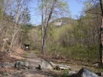
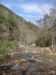
St. Mary’s Wilderness is in the George Washington National Forest in Augusta County. St. Mary’s River, a small river that is better characterized as a large creek, empties a large drainage area on the west slopes of the Blue Ridge Mountains. It’s about three hours from Abingdon via I-81. In fact, it’s as close to Washington, DC and Richmond as it is to Abingdon.In April 2011 I hiked and did some trail running up the main St. Mary’s “trail”—if you would call it that—on a weekend trip to the Shenandoah Valley. The last time prior to this that I hiked in the St. Mary’s Wilderness was as a student and member of the Washington & Lee University Outing Club in the late 1980s. Unlike most hiking areas, St. Mary’s Wilderness has become more inaccessible since my trips there when I was in college.
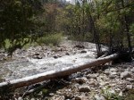
There is a sign at the entrance to St. Mary’s Wilderness that states that the trail was destroyed during Hurricane Katrina in 2005. There was a well-established trail prior to the hurricane. Now it starts out as a trail but within a half-mile deteriorates to sporadic rocky areas and only remnants of a trail. There are numerous areas where the “trail” is blocked by blow-downed trees, and where the trail meanders or peters out and then reappears several hundred feet further along the river. The trail also runs along some embankment areas that are somewhat dangerous, requiring hand-holds on tree branches. This trail could be challenging with a large, heavy pack for these reasons.
Due to limited time, I was only able to get several miles up the trail, so I cannot comment on the further reaches of the trail. However, the lower areas are not in very good condition. In fact, the conditions were so poor that I carefully retraced my hike back to the entrance parking lot, to make sure that I had not missed the trail somehow. Considering that this was early in the season, with the leaves not fully out and the underbrush not obscuring the trail, I do not think was this the case.
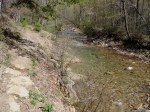
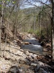
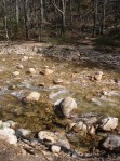
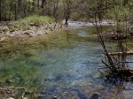
While there are interesting cliff faces, views up the gorge, and glimpses of the Blue Ridge mountains above, the reason to hike this trail is the St. Mary’s River itself. The river is clear, runs over a light-colored stone bed, and has a couple of waterfalls. There are also numerous deep pools, several which are suitable as swimming holes or places to take a dip on a hot day. Here is a typical deep water pool:
The St. Marys River is purportedly a good trout fishery. The river is not part of Virginia Department of Game and Inland Fisheries’ stocking program, however it is a designated special regulation trout water. Only single hook artificial lures may be used; no bait may in possession of the angler; and all trout less than the minimum—for St. Mary’s River, a 9-inch minimum—must be released.
Comprising 9,835 acres, St. Mary’s Wilderness is one of the largest federally designated wildernesses area in Virginia. Under the Wilderness Act of 1964 a federally designated wilderness is described as: “A wilderness, in contrast with those areas where man and his own works dominate the landscape, is hereby recognized as an area where the earth and community of life are untrammeled by man, where man himself is a visitor who does not remain.”
Although designated as a wilderness, it is not remote compared to many areas of national forest southwest of Roanoke in the Abingdon area such as the Mount Rogers National Recreation Area, parts of the Clinch Mountain Ranger District, or the Cherokee National Forest in Upper East Tennessee. St. Mary’s Wilderness is nonetheless remarkable for being such a large, contiguous wilderness area so close to the major metropolitan areas of Virginia.
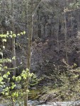
Here are some additional thumbnail photos of the St. Mary’s Wilderness. Click to enlarge them.