Tag Archives: Mountain Biking

Seng Mountain National Scenic Area

This article reviews the newest federally protected area in Southwest Virginia, the Seng Mountain National Scenic Area. 

Rowland Creek Falls

In 2009 the United States enacted the Virginia Ridge and Valley Act of 2008.   Sponsored by Senator John Warner (R-VA) and Rick Boucher (D-VA), the Act preserved over 50,000 acres of wilderness areas in the western part of Virginia.  Part of the Act created the Seng Mountain National Scenic Area, a 6,500 acre tract, and the Bear Creek National Scenic Area, a 5,500 acre tract (I will review the Bear Creek National Scenic Area in a future article).  See 16 U.S.C. § 546b.  The designation of these tracts as “scenic areas,” as opposed to “wilderness,” was a compromise to allow continued non-motorized recreational use by cyclists (mostly single track mountain biking).

Some groups and individuals have known about this part of the northern ramparts and mountainsides of Iron Mountain for a long time.  The Seng Mountain area has been part of the Mount Rogers National Recreation Area for 25+ years.  The scenic area designation simply gives it more protection and makes permanent the designation of the area as one for the limited recreational uses enumerated in the statute.  Ok—enough with the legal mumbo jumbo—let’s talk about the area itself:

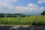
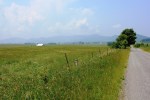
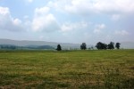
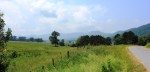
 The area is located in the southern section of Smyth County and is about 30 miles as the crow flies from Abingdon.  Its boundaries are roughly Route 600 (Skulls Gap) on the west, Hurricane Campground on the east (off of Route 16), Forest Road 84 near the top of Iron Mountain on the south, and private land near the Stony Battery community on the north. 

There are two major single track trails that cross the scenic area, Jerrys Creek Trail on the west side, and Rowland Creek Trail on the east side.  Each of the trails follows a small creek that runs down the mountainside.  The high point in the scenic area is Round Top Mountain, 4626′. 

Mountainsides Draw Close Together to Form Miniature Gorge

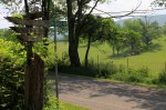
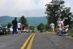
In mid-April my family and I drove to the upper trail head of Rowland Creek Trail.    Our starting point was at 3850′.  You reach this trailhead by traveling on FR 84, which is a gravel forest road.  Getting to the trailhead from Route 600 takes about 20-25 minutes. 

This is an unusual mountain hike, in that the hike starts the top, so you start hiking downhill, and return going back uphill.  Rowland Creek trail starts out wide as it descends around Seng Mountain, down towards the headwaters of the creek below.  The area forms a mini-gorge, as the mountainsides are steep and drop quickly down into Rowland Creek. 

Rowland Creek Trail - Steep Switchbacks

 Where we started, on FR 84, there were no leaves.  However, within a half mile of going down the trail, we descended into the foliage of springtime.  The protection of the gorge-like formation protects the trees below from the elements, creating a micro-climate that is much milder than at the top. 

Leafed Out Trees Below Contrast with 4000'+ Bare Ridge Lines

After several switchbacks, you arrive at the headwaters of Rowland Creek.  There are some nice potential campsites at the upper end of the trail, within easy walking distance of the creek.

Moss Covered Rocks and Boulders
Photo by Karl Thiessen

One thing we noticed is that the trail was quite moist and rutted out from horses near the creek.  It is probably extremely muddy after rains.  The trail roughly parallels the creek the rest of the way down the mini-gorge. 

The area along the creek is lush.  We spotted numerous flowers.  A bit of research shows that the trilliums we saw are native to the Southeastern United States, particularly in mountainous, gorge-like hollows such as that on this trail.  They bloom in April or May at the earliest, while sunlight reaches the forest floor before the trees are fully leafed out.

Southern Red Trillium
Photo by Karl Thiessen

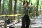
One thing we were not anticipating, but had some fun with, were the creek crossings. 

Rowland Creek Crossing Number 1

While none of the creek crossings were too difficult, we were hiking after several dry days.  The trail could likely become completely washed out, and the creek crossings more difficult (at least to get across without getting soaked) under wetter conditions.

Rowland Creek Crossing 2

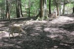
Even our dog, Magnus, was enjoying the creek crossings (here is creek crossing 3): 

The highlight of this trip is most definitely Rowland Creek Falls, a 50′ cascade-type waterfall that drops down a series of stairs for about 80-100′. 

Upper Rowland Creek Falls

The falls are not directly on the trail, so we needed to go down a hill in order to get some clean shots of the cascades.

Multiple Cascades

My son Karl made it all the way to the bottom and took some nice shots of the lower end of the falls, including this photo:

Lower Rowland Creek Falls
Photo by Karl Thiessen

 Below is a map of the entire scenic area.  Rowland Creek Trail and Jerrys Creek Trail can be connected by either FR 84, or an older, no longer used forest road that parallels FR 84 about 100′ downslope of it.  This loop is about 12 miles in length.  It is also used by mountain bikers, although there are sections that are very difficult due to the grade and the wetness near the creek beds.    

Seng Mountain Map

Burkes Garden and The Varmint Half-Marathon

In eastern Tazewell County lies Burkes Garden, an isolated, circular mountain valley nicknamed “God’s Thumbprint.”  The people who have lived here for generations apparently have known for a long time they own one of the most idyllic mountain valleys in the South.  In fact, at one time agents of George Vanderbilt inquired about building his gilded age mountain estate here.  The local population refused to sell out, and he instead built his house, The Biltmore, at another location outside of Asheville, North Carolina.

Burkes Garden is the location of a scenic half-marathon called “The Varmint.”  Saturday, June 11, 2011, was the 18th consecutive running of The Varmint.  The race is named after a peculiarly large coyote that was killing sheep in the valley in 1952.  As the story goes, this varmint was difficult to catch or kill, so a professional big game hunter was called in to get the beast.  They eventually did get it.  The coyote itself can be viewed at nearby Crab Orchard Museum

Prior to this year I had run this 13.1 mile race a couple of times, so I was curious to go back and see how the race had changed.  To get to Burkes Garden, you have to drive over a mountain that separates the valley from the rest of Tazewell County.  The road, named Burkes Garden Road (Route 663), is about 2.5 miles in length from the base to the top and climbs considerably; I would estimate somewhat less than 1000 vertical feet.  Coming down into Burkes Garden at 7:30 AM, there was a fog which completely engulfed the valley.

As I approached the race, I was surprised by how many people were there.  There were well over 300 people.  The Varmint Half-Marathon is run in conjunction with a 5K road race, so some of the people who were there were obviously there for the 5K.  Nonetheless, the half-marathon has grown a lot since 2002 and 2004 when I last participated.  This year there were groups of runners from Virginia Tech University and West Virginia as well as the more expected contingent of runners from Southwest Virginia and Northeast Tennessee with the State of Franklin Track Club.

The half-marathon is essentially a tour of Burkes Garden.  The race is staged and the start/finish line is at a school in the community.  Racers travel in a counter-clockwise fashion around the valley.  This is one of the more scenic races in the region.  You have to appreciate the scenery, because this is a tough and very hilly course.  The first six miles are constant hills.  Your legs will get pounded.  Thereafter the hills continue, but they are less pronounced.  The last three miles of the race is one long, slow climb with one small out-and-back detour back to the finish line.

After I ran The Varmint this Saturday I retraced the race route and took some photos of the course.  These are presented in the order a runner would see these views during the race.  Click on any of the photos in this gallery to enlarge and read a description of them.

The roads are very lightly traveled in Burkes Garden.  This would make for a great afternoon family or casual mountain bike ride, or a challenging road bike route if combined with the climb over 663 from Tazewell. 

Route 663 actually continues southeast all the way through Burkes Garden and travels up over Brushy Mountain, where it eventually intersects with the Appalachian Trail at the peak of the mountain, then continues down the other side via switchbacks to connect with Route 42 in Bland County.  Leaving Burkes Garden Route 663 however turns to gravel and is essentially an unimproved forest road.  This could be another mountain bike option as well.

Burkes Garden is one of those increasingly rare places where the beauty of the countryside is simple and still pure.  There are no restaurants and no stores in Burkes Garden.  There are also no neon or electric signs, no flashy or tacky homes, and no unnecessary distubances to the pastoral countryside.  It’s easy on the eyes.  It’s just a great place to sit back and relax—especially after 13.1 miles.

Bays Mountain Park

Only 45 miles from Abingdon, Bays Mountain Park and Planetarium in Kingsport, Tennessee is one of the nicest large parks in the region.  It is right off of Interstate 26, Exit 3, Meadowview Parkway.  The entrance to the park is just a few miles to the south of the exit.

With 3,550 acres and an extensive network of 37 miles of trails, it offers a good place to do some trail running or mountain biking in an enclosed, very pretty natural park.  The trails are a mix of old fire roads and single track.  There are several good annual trail running races within the park, most notably the Bays Mountain 15 Mile Trail Race, which is in September and starts from the nature center area, and the Laurel Run Ascent, which is in April and starts in Laurel Run Park (accessed from Church Hill, Tennessee).  I did the Bays Mountain 15 miler several years ago and can attest to it being one of the nicer trail races in the region.

Bays Mountain Park has nature programs and dedicated habitat areas—essentially large pens—for bobcat, wolves, river otters, turtles, and raptors.  This area of Bays Mountain Park is similar to the Western Carolina Nature Center in Asheville, North Carolina.  There are not as many exhibits at Bays Mountain as at WCNC; however, the wolf exhibit at Bays Mountain is larger and better.

The photo gallery below shows some areas of the park close to the nature center.  Click on a photo to see a description of it.

I recently visited Bays Mountain with my son for an elementary school field trip.  (This park hosts many school field trips; during our visit there were also school field trips from Scott County, Va. and from Hawkins County, Tenn.).  With the school group, we visited the nature center, listened to a lecture on the wolves, and watched a program at the planetarium. 

During the wolf lecture, the park official explained how wolves live in packs, their feeding habits and pack behavior, and then demonstrated how the wolves howl.  She prompted the wolves to howl with her own human “howl,” which involved cupping her hands to her mouth and then initiating a howling sound and was unlike an ordinary human imitation of a wolf howl.  The wolves responded slowly at first, and then all of them seemed to howl together.  This lasted several minutes.  It was quite loud, actually pretty fascinating to hear, and was the highlight of the trip.

We then proceeded to the planetarium.  The planetarium has a modern Carl Zeiss planetarium projector that allows the audience to sit back and look up onto the domed ceiling to watch an accurate representation of the night sky.  This was the first time I had seen a planetarium show since I was a child at the Adler Planetarium in Chicago, so it was a treat.  The Bays Mountain Park website indicates they also have quality telescopes and allow the public to use them at designated times in the evenings.

Bays Mountain Park has a 44 acre lake named the Kingsport Reservoir that was apparently originally used as the major source of water for the city of Kingsport.  The lake has many inlets, lily pads, and bass and bluegill that were visible from the shore.  Overall, this park is a nice asset to the region, one often overlooked as a place for outdoor recreation considering how close it is to Abingdon and Southwest Virginia.  It’s definitely worth a day trip.