Category Archives: Tennessee

Tennessee’s Most Spectacular Hike

Several years ago, I wrote an article about Virginia’s Most Spectacular Hike.  While I acknowledge that a superlative description like that is subjective, I still stand by that description these years later.  In Tennessee, I believe the most spectacular hike is probably the section of the Appalachian Trail up on the balds near Roan Mountain, sometimes called the “Balds of Roan,” even though the main balds–Round Bald, Jane Bald, and Grassy Bald–are all to the north of Roan Mountain proper.

5.2.15 View of Black Mountains
Looking South from Jane Bald, May 2, 2015

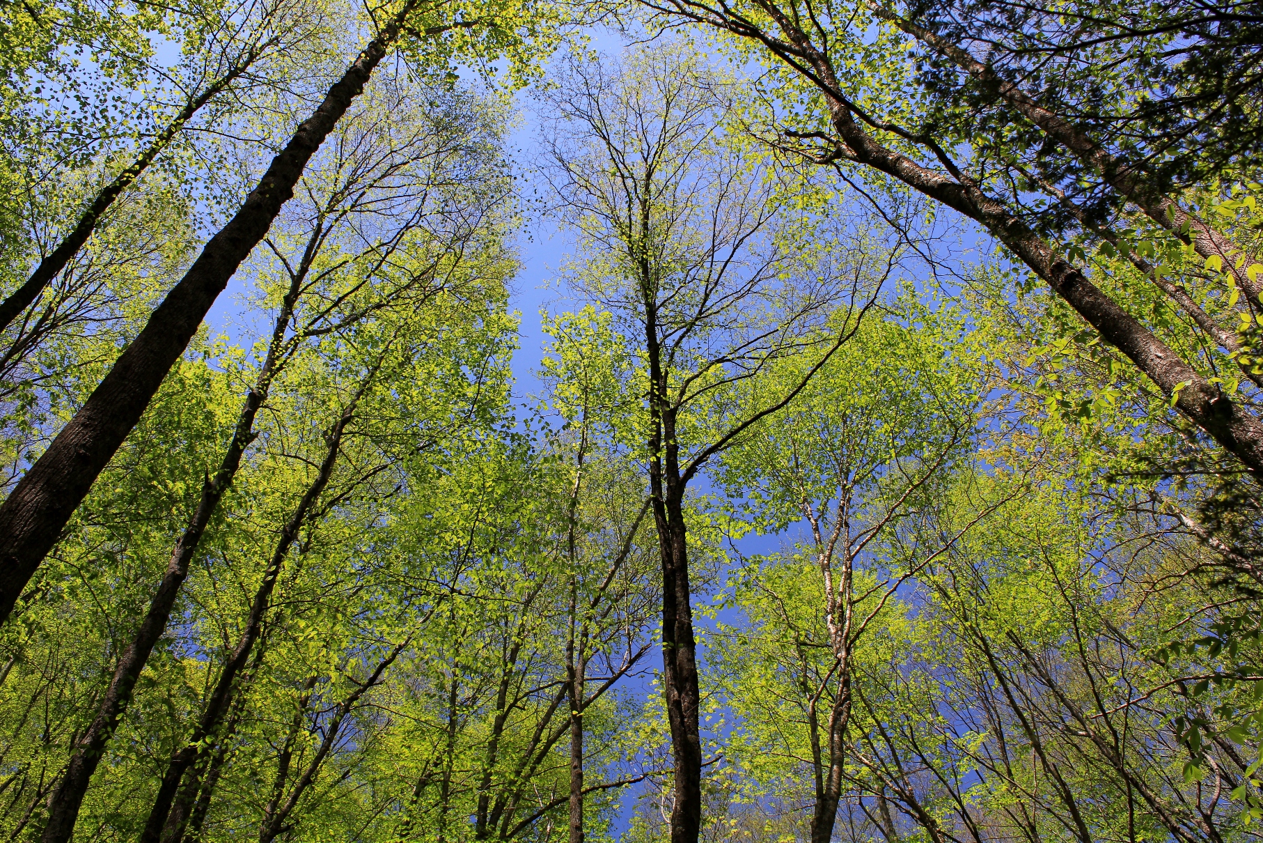
On May 2, 2015, we drove from Abingdon to Carver’s Gap and hiked the AT, which runs across the crest of the first two balds with a short side trail to the top of Grassy Bald.  The temperature was around 60° and mostly sunny, with relatively clear skies.  The mountains above 4000′ were still mostly devoid of foliage.  By late May, the hills will be verdant with hues of green, and by mid-June, the famous rhododendron gardens on Roan Mountain will be in full bloom.  This time of year—late April and early May—the AT is full of thru-hikers, those who are attempting to complete the entire AT on the traditional south to north route.

Backpacker on the crest of the AT on Jane Bald, 5820' above sea level. This view is looking north, back towards Bristol VA/TN and Southwest Virginia.
Backpacker on the crest of the AT on Jane Bald, 5820′ above sea level. This view is looking north, back towards Bristol VA/TN and Southwest Virginia.  Note the AT marker on the wooden post.  If you click and enlarge this photo you can clearly see the white mark on the post.

This section of the trail is relatively easily accessed from the Tri-Cities via Route 19 and Tennessee State Highway 143, which climbs to Carver’s Gap at 5512′, where there is a parking area next to the trail.  Because of the easy access and great views, this section of the AT is highly traveled and is busy on most nice weekends.

Camping on Grassy Ridge Bald, 6165'
Camping on Grassy Ridge Bald, 6165′


Grassy Ridge Bald is the highest of the balds.  It requires a short, moderate climb off a side trail to reach the top.  The round-trip hike from Carver’s Gap to the Grassy Bald area and back is approximately 5½ miles.

The top of the bald is roughly the size of a couple of football fields, with 360° views depending on where you walk.  There were some overnight campers on the mountain the day we were there.  The views on a clear night are probably phenomenal, although there is most surely some light pollution from Johnson City and Bristol on the western side.

5.2.15 Laid Back View
Laid back and relaxing at 6100′


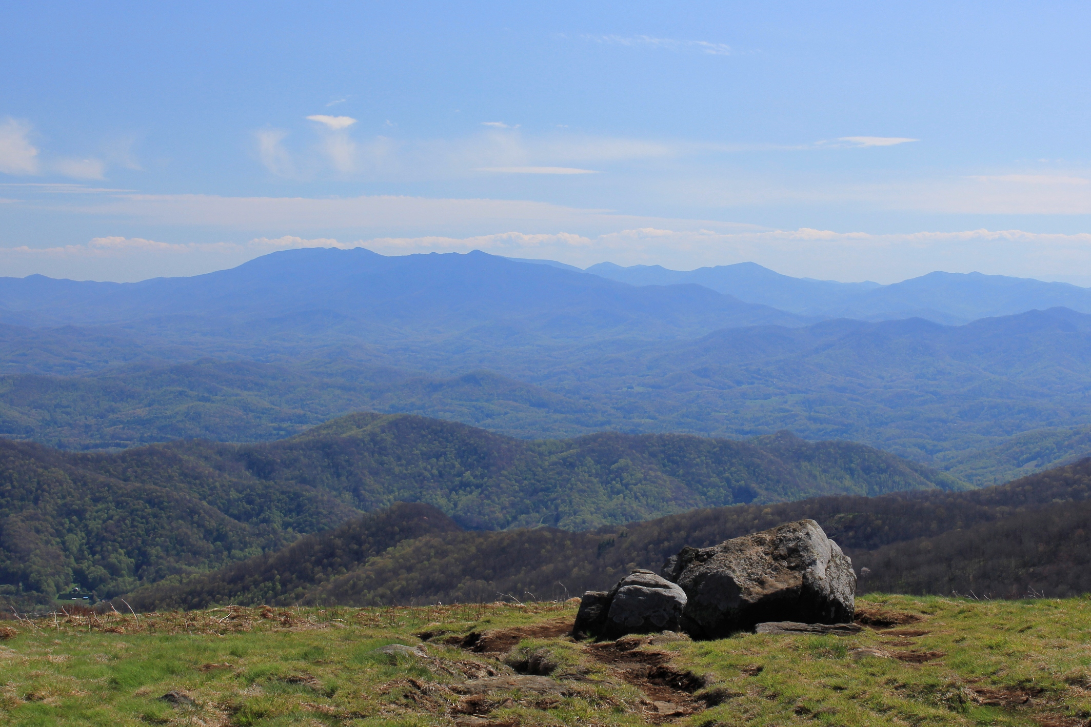
The two above photos show the immense views of the Black Mountains and surrounding peaks in North Carolina.  This is one of the best views in the South.  On the other hand, the views to the west aren’t too shabby, either.  Below is a view looking southwest, where the smaller mountains create layered views that are so appealing and distinctly Appalachian.

5.2.15 J and K on Grassy Bald
The view west towards Johnson City


Looking to the northwest, there are views as far as the Cumberland Mountains in Kentucky.  The photo below shows the view more directly north, into Virginia.  The larger massif on the right side of the photo is Whitetop, Mount Rogers, and possibly Pond Mountain in North Carolina.

5.2.15 looking north from Round Bald
The view north from Round Bald, 5826′

We were not able to stay until sunset, but came off the mountain just as the so-called Golden Hour was approaching.  The shadows grew and the colors softened as sunset approached.

5.2.15 Black Mtns
Looking into North Carolina, about an hour before sunset


This hike is not only accessible by car, but is also moderate in nature.  While there is some climbing, the fact that you start at 5500′ means most the climbing has already been done in your vehicle.  So the hike is also more accessible to individuals who are fit but not extreme hikers.

Because of the accessibility and great views, this hike is one of the most popular in region.  If you are here on a weekend, be prepared to have company.  Sometimes finding a parking spot is a challenge, too.  Those minor considerations notwithstanding, this is a truly spectacular hike that will take you into territory that is unusual for the South.  These are the largest contiguous balds in the Appalachian Mountains, and the above-treeline views are extraordinary.

Having hiked in the Smokies and most of the other better known spots in Tennessee, it’s my opinion that the balds here make up the most spectacular hike in the Volunteer State.

5.2.15 Coming off the mountain
Heading off the mountain. The views don’t let up until the final steps off the trail:  What a spectacular hike!


Leafing Out

The emergence of an abundance of foliage in the Appalachians is the surest sign that Spring is in full force. Every week the hues of green change on the mountains and in the valleys as the leaves grow on the hardwoods. These photos were taken today, Sunday, May 11, 2014, during a hike in the area where Virginia, Tennessee, and North Carolina meet.

Appalachian Hardwoods Leaf Out, May 11, 2014
Leafing Out, May 11, 2014

Shady Valley Peak Fall Foliage

Shady Valley, Tennessee is an idyllic circular mountain valley nestled between Bristol and Mountain City.  Surprisingly remote for being relatively close to the Tri-Cities, Shady Valley retains a rural, agrarian charm.

Peak Colors on Iron Mountain in Shady Valley

Route 421, the main road through the valley, is well known across the region as a favorite for motorcyclists and ordinary cyclists because it is one of the twistiest and scenic highways in the area.  Bicyclists can also ride several one-lane country roads around the valley, and the road from Damascus is the best way to access Shady Valley from Abingdon.

Bursting Orange, Red and Maroon Colors

I tend to think of Shady Valley as Tennessee’s analog to Burkes Garden.  With few houses on the hillsides and national forests on the perimeter of the valley, Shady Valley has one of the best mountain viewsheds in Northeast Tennessee.

Moon Rises Over the Vibrantly Colored Mountain

Beaverdam Creek

Beaverdam Creek in Virginia, October 20, 2012

This weekend I snuck in a few hours of afternoon fly fishing at Beaverdam Creek.  This creek flows out of Shady Valley, Tennessee and through a wildlife management area within the Cherokee National Forest and into Virginia.  The Virginia portion runs for just a few miles until it enters Damascus, where it crosses right through the main town park.

After catching a couple of rainbow trout, I exchanged my rod for a camera.  Wearing waders, I was able to capture some interesting colors from the middle of the creek.  Note the orange and yellow reflections in ripples in the center of the creek.  The 2012 fall colors have been the best and brightest in years in Southwest Virginia.

SoHo Eye Candy

This summer we’ve started earnestly fishing the South Holston River, a renowned tailwater trout fishery in Tennessee.  The clear water comes from deep in South Holston Lake, making for constantly cold temperatures, even when summer’s heat affects the other mountain streams.

South Holston River, Bristol, Tennessee

The tailwater is 17 miles from Abingdon, about a half-hour’s drive from town.  It’s probably the largest trout fishery in the region, and consequently one of the busiest.  I’ll write some more on the SoHo in some future articles, but for now here’s some nice trout we caught this weekend.  All photos by Karl Thiessen.

SoHo Brown Close Up
13″ Brown Trout
SoHo Speckles
Girthy Rainbow
16″ SoHo ‘Bow

Buzzard Rocks

Here is a photo identifying the major peaks visible from Buzzard Rocks, the outcroppings about 200 vertical feet below the summit of Whitetop Mountain.  Buzzard Rocks provides one of the best vistas towards Southwest Virginia, looking back into both Virginia and Tennessee.  The small communities of Whitetop and Green Cove can be seen in the foreground. 

View from Buzzard Rocks – Click to Enlarge

Buzzard Rocks can be accessed via the gravel road 89 from State Route 600 near Elk Garden, via the Appalachian Trail from Elk Garden from State Route 600, or via the climb from State Route 601.

The pointy mountain labeled 3700′ is Fodderstack Mountain.  This is a promentory that divides the valley towards Laurel Bloomery in Tennessee.  Tennessee Laurel Creek runs down this valley between Fodderstack and the Iron Mountains towards Damascus.

Between the Iron Mountains and Holston Mountain lies Shady Valley, Tennessee.  Beaverdam Creek runs down this valley from Shady Valley towards Damascus.  On the other side of Holston Mountain is South Holston Lake, the TVA impoundement that is the largest lake in region.

Between Holston Mountain and Clinch Mountain (which is barely visible on the far horizon) is the great valley that encompasses most of Washington County, Virginia, including Abingdon.

For a comparison, here is another view in the evening from the same vantage point, slightly below Buzzard Rocks.

View from Buzzard Rocks in the Evening

Tennessee Laurel Creek

Spring is high season for trout fishing in Southern Appalachia.   This evening I was able to get in a couple of hours of fishing on Tennessee Laurel Creek.

The Brown Trout Were Hungry Today

Tennessee Laurel Creek starts in Laurel Bloomery, Tennessee and flows north across the Virginia state line into Damascus.  There are bunches of turnouts next to Route 91, the road that parallels the creek, where you can fish. 

The creek is not limited to fly fishing, so some days—like today—there are way too many fisherman on the Virginia side, where VGIF stocks regularly.  I therefore drove across into Tennessee, where the stocking program is not as prominent, but where there are still numbers of wild trout.

Beautiful Fins and Colors

The creeksides are now lush and green.  The greenery is reason enough to get outside this time of year.

Tennessee Laurel Up The Creek

Tennessee Laurel is a typical Appalachian freestone creek, with lots of rifles and pocket water.  It has more chutes and slightly slacker water than its sister Whitetop Laurel Creek, allowing for longer and easier drifts in most sections.  When the water flow is right, it’s a pleasure to fish.

Tennessee Laurel - Down the Creek

Of Falcons and Falconry

Check out these photographs of falcons and falconry from a new Northern Virginian blog on photography.  Falconry, the ancient sport of taking quarry with raptors, is not widely practiced in the United States, although there is a Virginia Falconers Association

A Falcon's View in Tennessee

If you investigate a little bit you will learn there is normally an “apprenticeship” whereby an aspiring falconer will work with a more senior bird handler to learn how to trap, manage and train a falcon.  The apprenticeship may take years.  Falconers must obtain U.S. Fish and Wildlife Permits in order to trap and keep these birds. 

Having a falcon return to you and land on your arm would be exhilarating—presuming, of course, that you were wearing a protective gauntlet (otherwise your exhilaration would be tempered by extreme pain as the raptor’s talons clamped down on your forearm).

These photos reminded me of a backpacking trip a friend and I took several years ago wherein we accidentally came upon several wild raptors that flew extremely close to us.  It was a bit unnerving to have birds of prey buzz so closely by.  A few minutes later we would realize why the birds were flying so close to us.

We were hiking the Appalachian Trail in the Bald Mountains, up on the North Carolina-Tennessee border about 10 miles north of Sams Gap.  As we rounded some large boulders, we accidentally came upon the Big Bald Banding Station.  There were some individuals near the summit of Big Bald Mountain collecting data, and there were birds of prey that were either nesting or returning to the area.  There were also some large bird cages, and, if I recall correctly, we observed several birds being released. 

The sheer randomness of our coming upon these guys and watching the magnificent birds was pretty neat.  In fact, we were so surprised that neither of us remembered to take our cameras and photograph the birds.  We probably could have gotten some shots like those in the article highlighted above.  The birds we saw were not trained, but were wild and free and were probably just passing through, stopping briefly on their way south for the winter. 

On Top of the World - Eastern Falcon Migration Throughway

Big Bald Mountain, at 5516′, is one the higher points on the AT (and the highest between the Roan balds to the north and the Smokies to the south).  The hike on the AT from Spivey Gap (Route 19W, aka Spivey Mountain Road) to Big Bald Mountain is a steep, rugged hike.  The Bald Mountains are a natural bird migration throughway, and both large birds and smaller species cross the mountain during the seasons.

Southern Exposure: View of the Smokies from Big Bald Mountain

P.S. – North Carolina has a  North Carolina Falconer’s Guild; Tennessee does not  have any organization that supports falconry, although the Tennessee Wildlife Resources Agency administers the testing for falconry permits.

Winter Small Creek Fly Fishing

Southwest Virginia, Upper East Tennessee, and Western North Carolina have lots of small creeks that are usually more fishable in winter.  In winter the water levels may be higher than the summer or fall, there’s no foliage and less brush to block access to the water, and the creeks are no longer clogged with the fallen leaves.  It’s a great time of year to hit these creeks, especially during breaks of mild weather. 

Wild, Creek-Caught Brown Trout in Smyth County, Virginia, January 2012

You’re not likely to catch lunkers in these waters, but the trout are more likely to be wild and more beautiful than the stockers in the rivers and lakes.  They may also be willing to hit dry flies even when there’s no hatch coming off the water.  These small creek trout don’t have the luxury of waiting for a full-blown hatch.  They’re often stuck within the confines of small pools; this requires them to be particularly opportunistic feeders; and insects on the surface are opportunities to them regardless of season.

There is something especially rewarding about the adventure of hiking where few fishermen have been, where the trout may not have seen men or their fishing gear for a long time before you, and where you have a genuine belief that you are exploring the natural world.

In the Eastern United States, there are not many places that instill these feelings anymore.  It has been this way for almost a century:

Most of the truly secret streams were small.  The larger streams had names, a public sort of character, commercial importance, perhaps.  They were accessible:  if they held trout it became known and they were visited regularly throughout the open season.  Without restocking they became at last depleted of fish.

But the little back-country feeder brooks were nameless, and inaccessible save by long tramping over the ridges and upland meadows which lay deep beyond the infrequent roads.   In such remote rills, known only to ourselves and our most intimate partners, the brook trout swam and lurked to meet his chilly destinies much as he had in the first days of the world.  Some of these streams are still where they used to be. . . .

Howard T. Walden, II, Upstream & Down, at 171-72 (First Edition 1938). 

In Upstream & Down, Mr. Walden explained that in the East, except for in the “remote semi-wilderness counties,” most small streams were under increasing pressure from development and anglers in the early Twentieth Century.  He lamented “the loss of the virgin stream of olden time.”

These days, even in the “remote semi-wilderness counties” of the East (acknowledging that the definition of Eastern “remote semi-wilderness” is probably different today than in the 1930s), there are very few, if any, “nameless” small streams.  Nonetheless, the essence of what Mr. Walden wrote back in the 1930s is still true:  Remote small streams are still the most likely places to find unspoiled trout waters.

Wild Creek in the Jefferson National Forest, Smyth County, Virginia

In the reality of our increased population and the informational resources of modern times, there is not just a geographical dimension to being adventurous in the outdoors—whether fishing for trout, or otherwise (hiking, backpacking, etc.).  There is also a seasonal dimension.  Most fishermen hang up their rods and reels come late fall, and many do not take the sport up again until the traditional opening days of April.  Thus the ardent angler is far more likely to have a solitary and adventurous experience in winter than in spring, summer, or fall.  This is not to say that small creek fishing is not rewarding in the fairer seasons, just to point out the undeniable fact that it is more likely to hold an excitement that comes from undisturbed exploration in the wintertime. 

Trouty Water in the Virginia High Country, December 2011

So I will continue to fly fish in wintertime, even if I catch less trout during this season.  For while catching trout is the “point of the whole exercise” (as fellow small stream enthusiast and Trout Underground author Tom Chandler has stated), it is not the sole—or perhaps even driving—reason that we engage in this sport.

Exploring Quarrryish Water in Wintertime

 P.S. — I will write more about Upstream & Down, a fascinating book, and Mr. Walden’s thoughts about trout fishing in subsequent articles.

Tour de Rocky Top: A Twisty, Thirst-Quenching Metric Century

The Tour de Rocky Top is a metric century ride in Knoxville, Tennessee organized by Race Day Events, a private race organization.  This ride is unique in this region in that it starts and finishes at a large pub, Barleys Tap Room.

I did this metric century on Saturday, July 2, 2011.  The ride went through downtown, across the Tennessee River, and out into the country to the south and east of Knoxville towards the Smoky Mountains.  The ride never got into the mountains, but had many rollers, totaling about 3,000′ in total elevation in climbing (and descending) in the 62 mile course.   There were three well-stocked aid stations on the ride.

The staging area for this ride was excellent.  It began right next to Barleys Tap Room.  Adjacent to the tap room is a six lane off-ramp/overpass.  The City of Knoxville has turned the area under the overpass into a very large parking lot.  This was a perfect area to park and leave vehicles in the shade while cycling.  The ride started cool but became quite hot.  Who would have thought riding in Knoxville in July under a noon sun could get hot?  On the negative side, there was no place to shower at the end of the ride.  You pretty much had to just change into street clothes next to your car or go into Barleys and use the restroom to do so.

This is definitely more of true “tour” than a race.  While there may have been a lead group pushing the pace at the front (I don’t know if there was or not since I was at the back side of the starting line), there were about 45 turns on the course.  Every time you got up to speed or began to proceed in a good rhythm it seemed like there was a turn.  And many of these turns were not your gradual “bear to the right or left” turns, but true 45 degree turns on small country roads, several at stop signs.  So this ride was not conducive to a personal best time record, but it was nonetheless a pleasant tour of the countryside around Knoxville.  The race organizers did a good job of getting the riders out of and back into the downtown area on roads with relatively slight traffic, which was impressive.

I finished the ride in approximately 4 hours.  Actual riding time was about 3 hours, 40 minutes.  The average speed on my odometer was 16.2 mph.

The ride ended on a great note.  The ride ended at Barleys Tap Room, a restaurant with excellent pizza in the old town section of Knoxville.    The Barleys in Knoxville is an open, unfinished warehouse with brick interior walls, large rough-hewn beams, and a nice garden patio.  Barleys had two large flat screen TVs showing coverage of the first day of the Tour de France.  Watching part of “the” Tour with several hundred fellow cyclists after doing a century ride was a nice way to start off the Independence Day weekend.

A note on getting to the ride:  The venue is about 1 hour, 50 minutes from Abingdon.  It is a straight shot down I-81.  It makes for an early morning to do the trip in one day.  There are several nice hotels in downtown Knoxville close to the race staging area, and there are lots of restaurants and boutique stores in this area of Knoxville.  Going down the evening before would probably not be a bad idea.