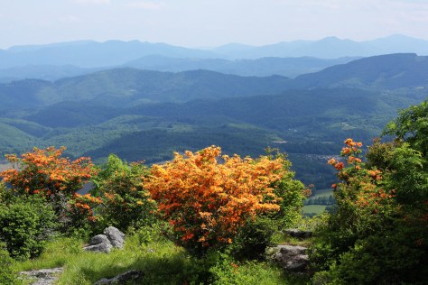
Flame Azaleas on Whitetop Mountain

Several years ago, I wrote an article about Virginia’s Most Spectacular Hike. While I acknowledge that a superlative description like that is subjective, I still stand by that description these years later. In Tennessee, I believe the most spectacular hike is probably the section of the Appalachian Trail up on the balds near Roan Mountain, sometimes called the “Balds of Roan,” even though the main balds–Round Bald, Jane Bald, and Grassy Bald–are all to the north of Roan Mountain proper.
On May 2, 2015, we drove from Abingdon to Carver’s Gap and hiked the AT, which runs across the crest of the first two balds with a short side trail to the top of Grassy Bald. The temperature was around 60° and mostly sunny, with relatively clear skies. The mountains above 4000′ were still mostly devoid of foliage. By late May, the hills will be verdant with hues of green, and by mid-June, the famous rhododendron gardens on Roan Mountain will be in full bloom. This time of year—late April and early May—the AT is full of thru-hikers, those who are attempting to complete the entire AT on the traditional south to north route.

This section of the trail is relatively easily accessed from the Tri-Cities via Route 19 and Tennessee State Highway 143, which climbs to Carver’s Gap at 5512′, where there is a parking area next to the trail. Because of the easy access and great views, this section of the AT is highly traveled and is busy on most nice weekends.

Grassy Ridge Bald is the highest of the balds. It requires a short, moderate climb off a side trail to reach the top. The round-trip hike from Carver’s Gap to the Grassy Bald area and back is approximately 5½ miles.
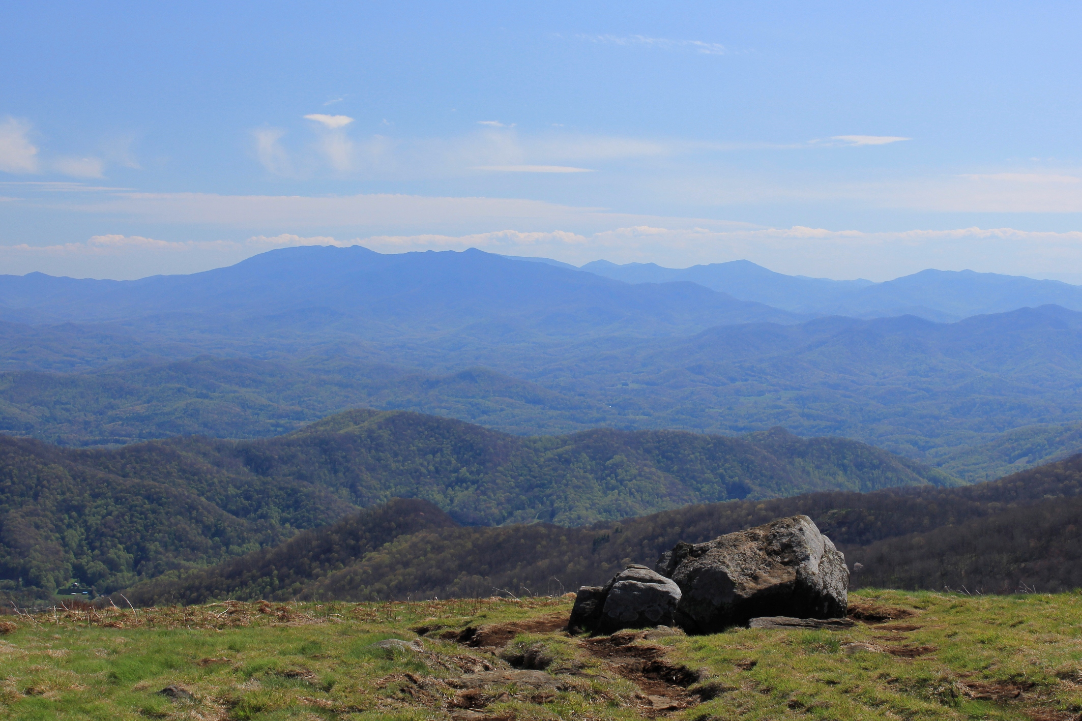
The top of the bald is roughly the size of a couple of football fields, with 360° views depending on where you walk. There were some overnight campers on the mountain the day we were there. The views on a clear night are probably phenomenal, although there is most surely some light pollution from Johnson City and Bristol on the western side.

The two above photos show the immense views of the Black Mountains and surrounding peaks in North Carolina. This is one of the best views in the South. On the other hand, the views to the west aren’t too shabby, either. Below is a view looking southwest, where the smaller mountains create layered views that are so appealing and distinctly Appalachian.

Looking to the northwest, there are views as far as the Cumberland Mountains in Kentucky. The photo below shows the view more directly north, into Virginia. The larger massif on the right side of the photo is Whitetop, Mount Rogers, and possibly Pond Mountain in North Carolina.

We were not able to stay until sunset, but came off the mountain just as the so-called Golden Hour was approaching. The shadows grew and the colors softened as sunset approached.

This hike is not only accessible by car, but is also moderate in nature. While there is some climbing, the fact that you start at 5500′ means most the climbing has already been done in your vehicle. So the hike is also more accessible to individuals who are fit but not extreme hikers.
Because of the accessibility and great views, this hike is one of the most popular in region. If you are here on a weekend, be prepared to have company. Sometimes finding a parking spot is a challenge, too. Those minor considerations notwithstanding, this is a truly spectacular hike that will take you into territory that is unusual for the South. These are the largest contiguous balds in the Appalachian Mountains, and the above-treeline views are extraordinary.
Having hiked in the Smokies and most of the other better known spots in Tennessee, it’s my opinion that the balds here make up the most spectacular hike in the Volunteer State.

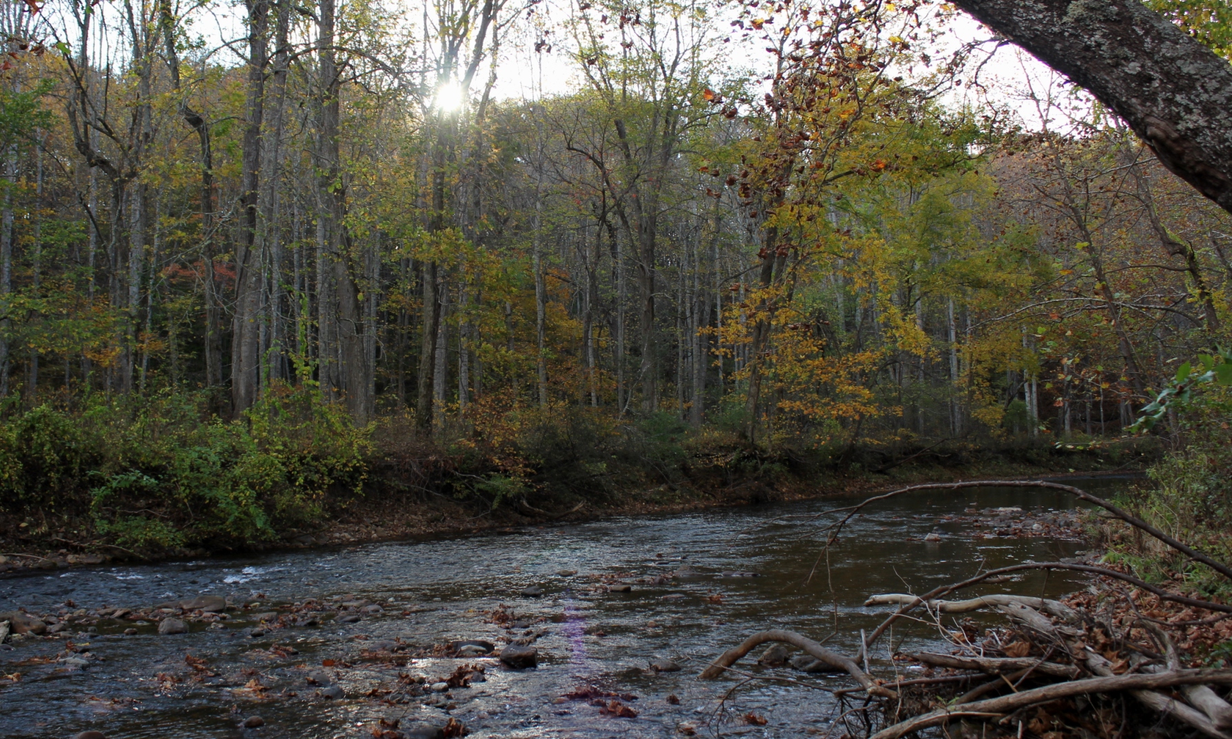
The Jackson River is one of the most renowned trout streams in Virginia, flowing south until it merges with the Cowpasture River forming the beginning of the James. There are two generally known sections of the Jackson River—the lower Jackson, below the dam at Moomaw Lake in Alleghany County, and the upper Jackson, a free-flowing river in Bath County with headwaters reaching almost into Highland County.
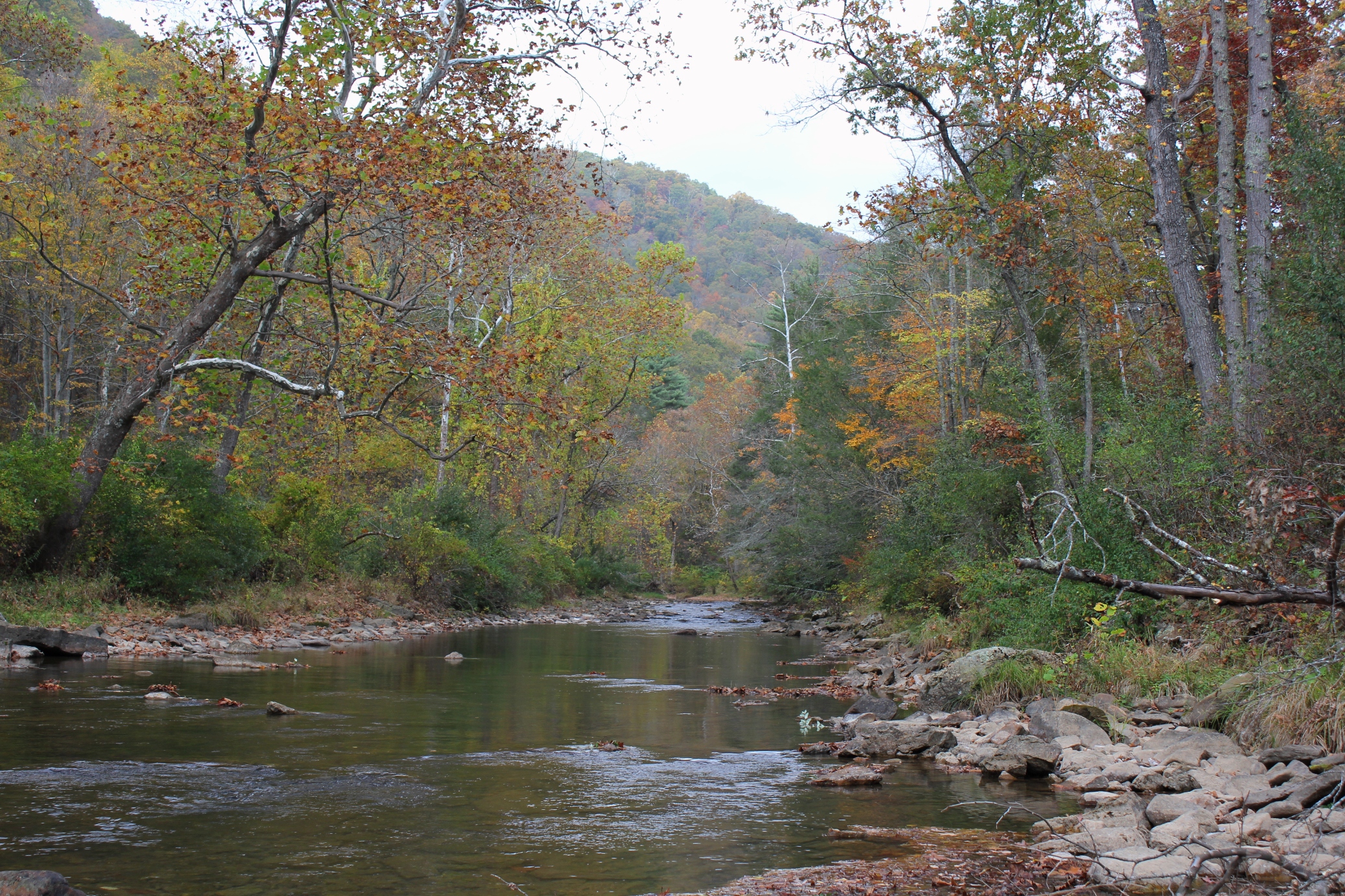
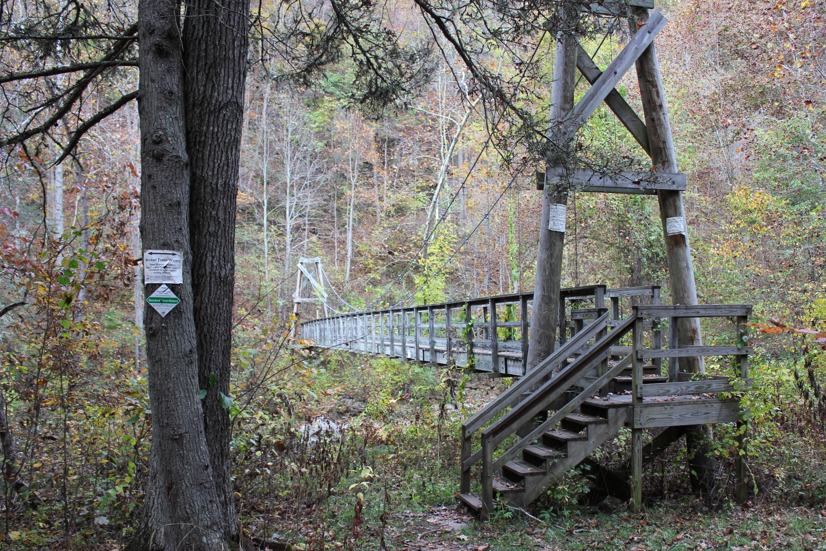
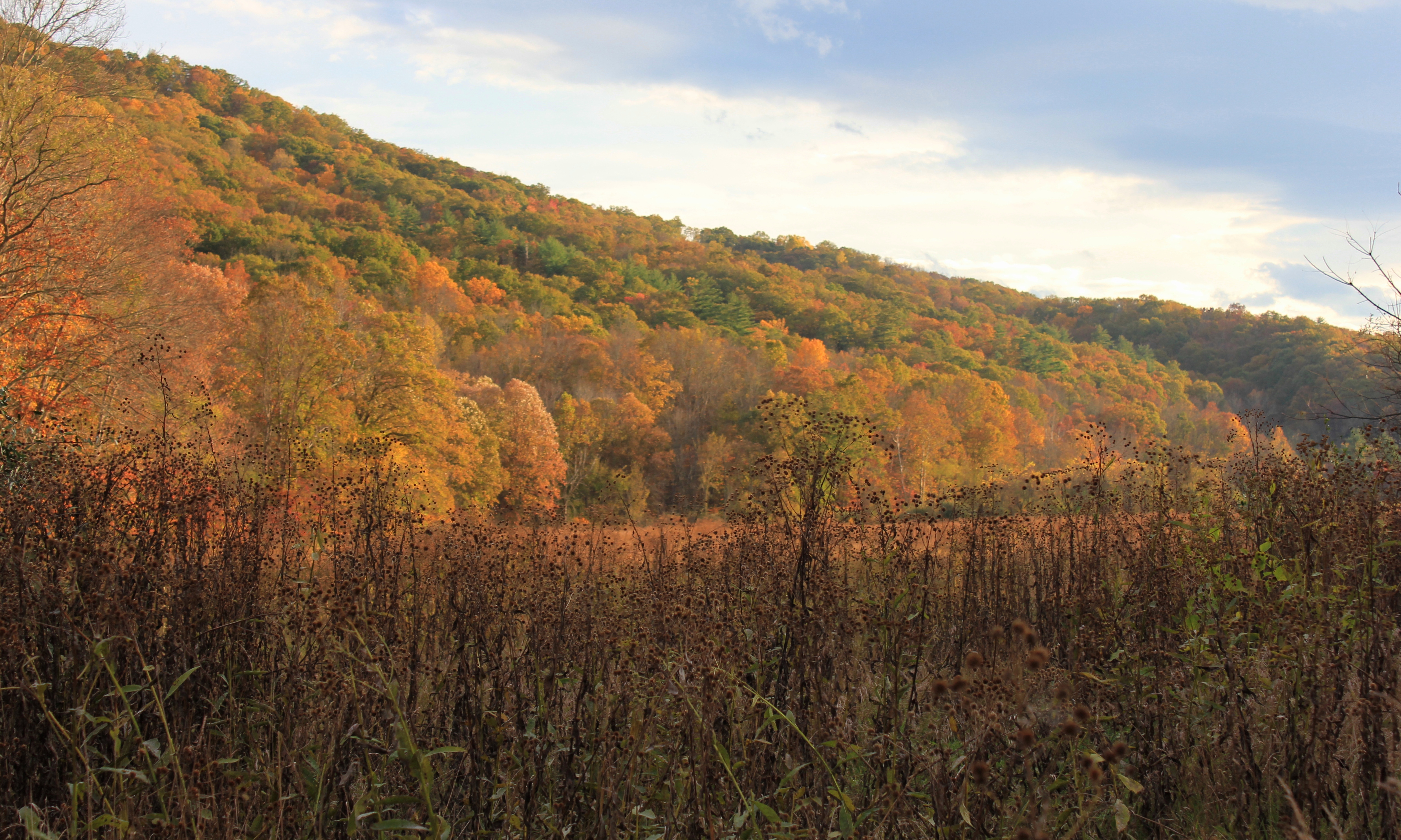
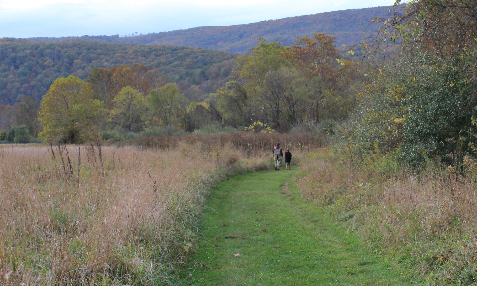
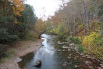
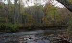
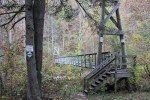
The photos in this article are about the upper Jackson. This section of the river flows through a lengthy, roadless section of the George Washington National Forest, about three and a half miles of nothing but river with a walking trail. For Virginia (and most any Eastern state), this is a lot of pristine riverfront without road access.
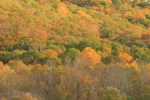
In October 2013, my sons and I traveled here, and we walked and fly fished most of the river. The fall colors were at their peak, absolutely stunning.


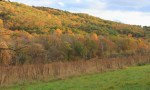


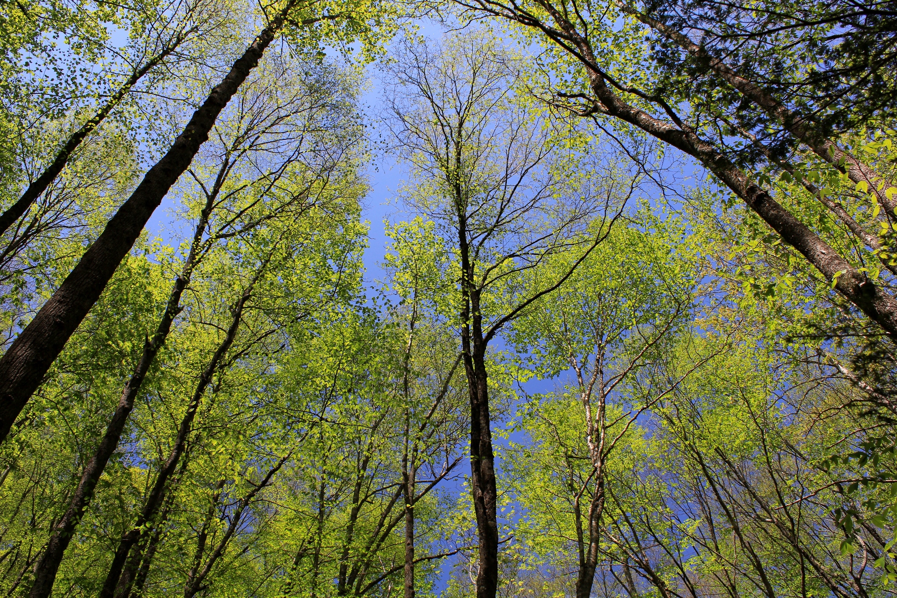
The emergence of an abundance of foliage in the Appalachians is the surest sign that Spring is in full force. Every week the hues of green change on the mountains and in the valleys as the leaves grow on the hardwoods. These photos were taken today, Sunday, May 11, 2014, during a hike in the area where Virginia, Tennessee, and North Carolina meet.

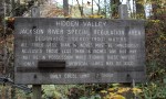
Because of its prominence, Clinch Mountain affords some of the best views over the Holston River and Clinch River watersheds. The best views are available during the winter when there is no foliage. On clear winter days you can see almost 100 miles south. On Saturday, February 22, 2014, I drove to the Hidden Valley Management Area and hiked the southeastern section of Clinch Mountain on access roads and trails in that area.
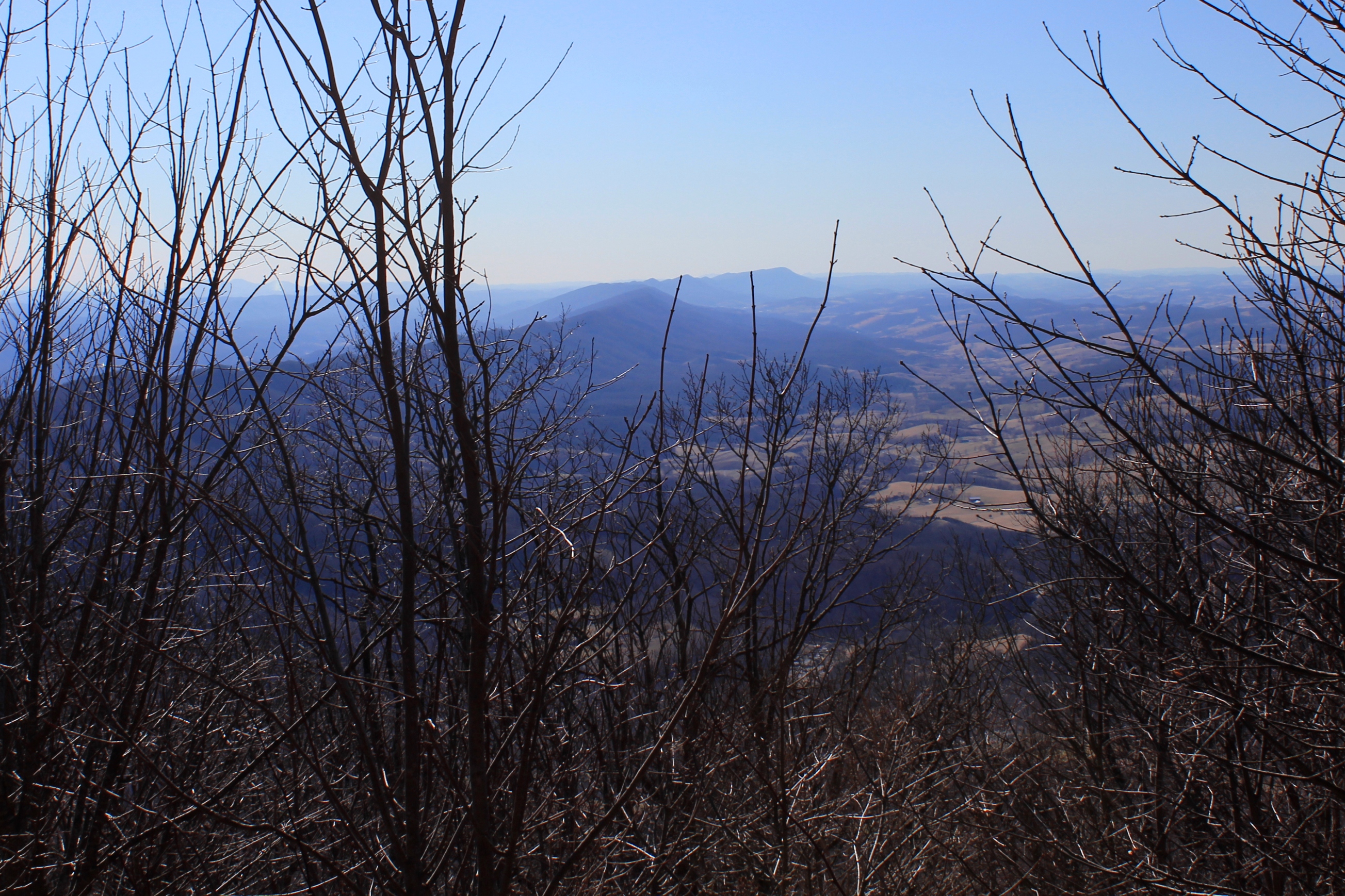
Clinch Mountain overlooks the small community of Hansonville and Moccasin Creek. Clinch Mountain divides two significant river basins: the three forks of the Holston River drain the valleys to the east and south of the mountain (which is to the left of the ridge in the photos), and the Clinch River to the west and north of the mountain (which is to the right in the photos).

In the photo above, the view shows the spine of Clinch Mountain to the southwest, and further to the south the valley through which I-81 travels, with the Iron Mountains (and Holston Mountain) bordering the other side of the valley, with the much higher Unaka Mountains (including Roan Mountain) on the horizon.

The western side of Clinch Mountain hase similarly long range vistas, with some cliff outcroppings. On this hike, however, I stayed on the southeastern side of the mountain.

In the photo above, Clinch Mountain is on the left, and the much smaller hill on the right is Big Moccasin Ridge. Together they frame in the Big Moccasin Creek and the valley.
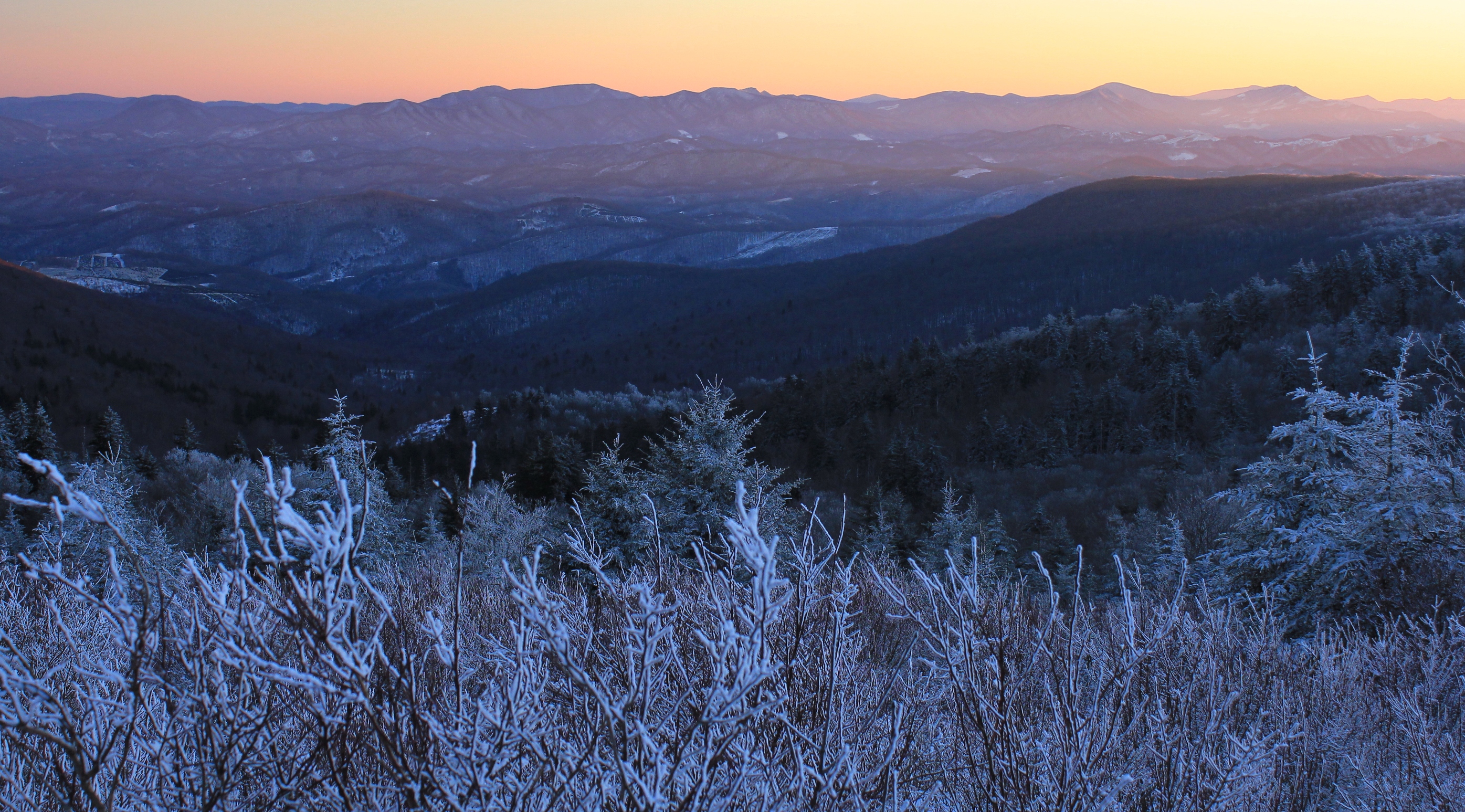
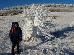
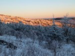
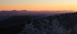
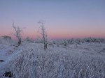
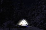
On Saturday, December 22, 2012 we went on a winter backpacking trip that was extremely cold but rewarded us with incredible conditions for photography: massive hoarfrost, remnants from a snowstorm, and true alpenglow lighting—a rare combination anywhere, but especially in the South.

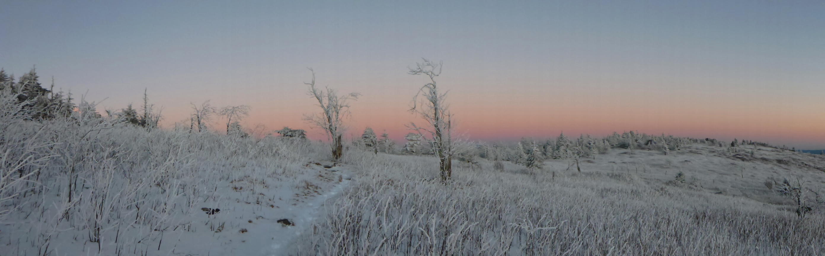
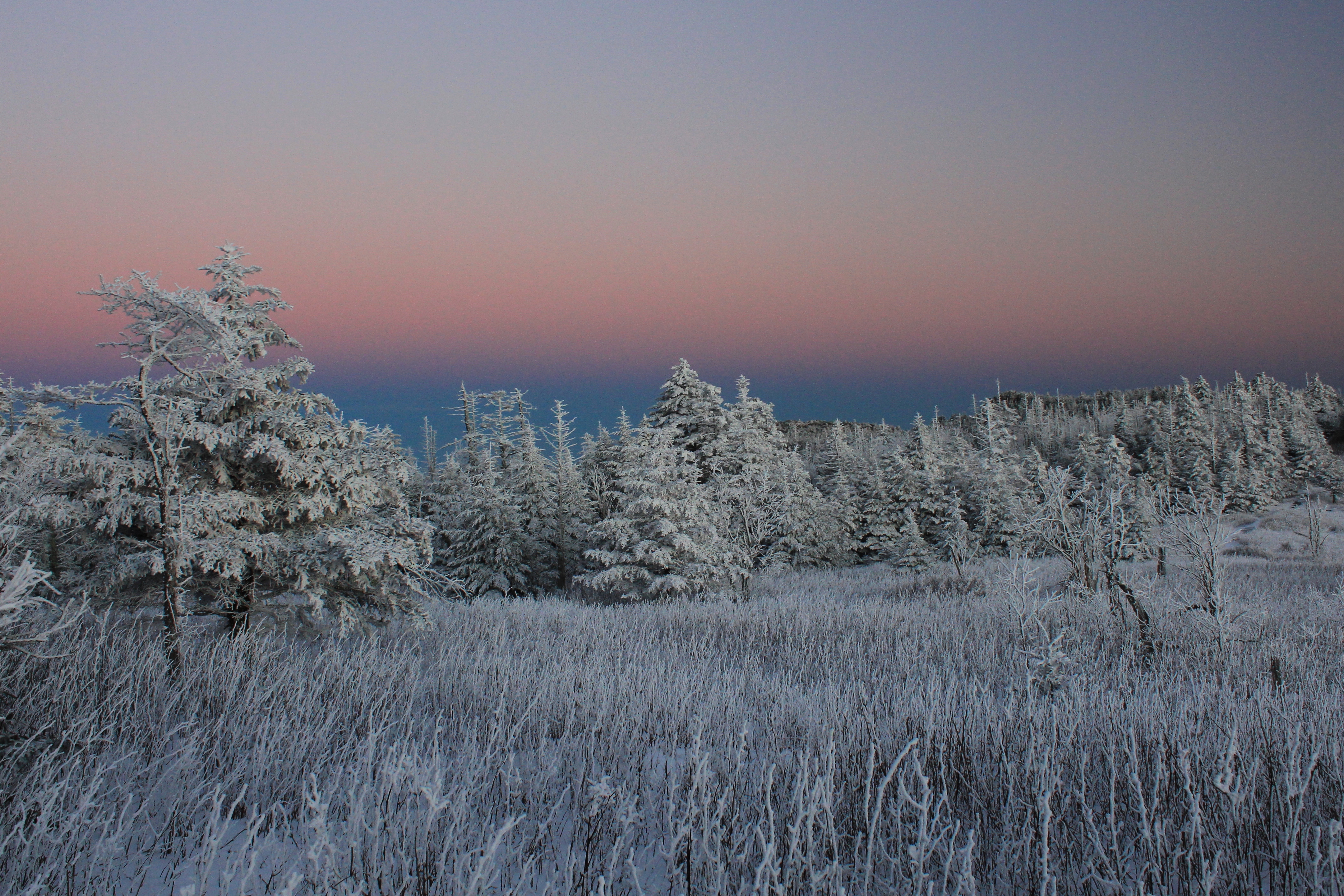
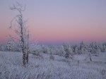
As the evening sun set, the entire sky in the east (the direction opposite from the sun) began to glow pink with a purplish band at the horizon. The rime-encrusted trees and brush, which had their own bluish-white hue, looked otherworldly. The side of the mountain basked in the alpenglow. In the course of my life I have seen this phenomenon on occasion in the Rockies and in the Alps, but never so pronounced in our region as it was this evening.
For a comparison with the same phenomenon on the Matterhorn in Switzerland, see this photo. While the orange light from a sunset is itself beautiful, true alpenglow—when the entire sky is lit with light seemingly emanating from behind or even within the mountains, in the opposite direction from the sun—is amazing.

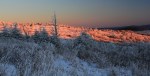
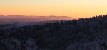
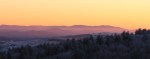
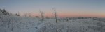
Looking towards where the sun was setting revealed another interesting effect—purple mountains with an orange sky.

As we continued to take pictures until almost all of the light was gone, we were reminded that part of the reason for the great conditions was the cold. And it was getting colder by the minute. Operating the cameras and standing still, the chill began to invade us. Toes and fingers burned. As the last good light disappeared, we continued onward to make camp somewhere near the top of the mountain.
Our planned out-and-back route was straightforward: A one-day hike from the Elk Garden area of the Mount Rogers National Recreation Area up to the highest parts of the southern side of Mount Rogers near the famous Thomas Knob shelter; an overnight in the shelter or at a tent site somewhere in the vicinity; and a return back via the Appalachian Trail and the Virginia Highlands Horse Trail. These trails roughly parallel the Grayson County-Smyth County line for about five miles along the mountain ridge.
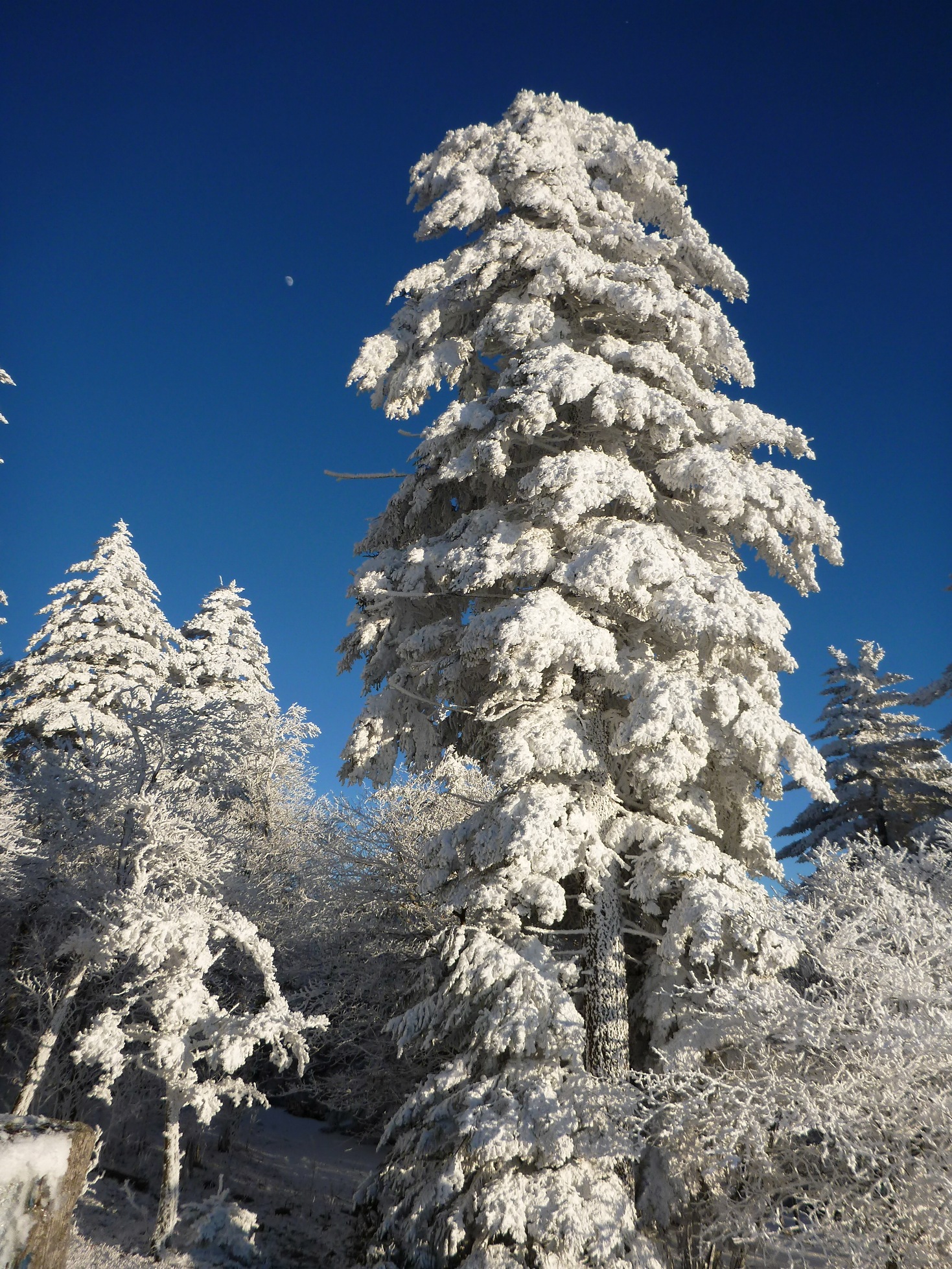
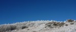
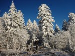
As we approached the mountain, you could clearly see the delineation where the frost began to accent the freshly fallen snow. While you could see the snow between the trees on the bottom half of the mountain, on the top half of the mountain everything—literally every single thing—was covered with brilliant white frost.
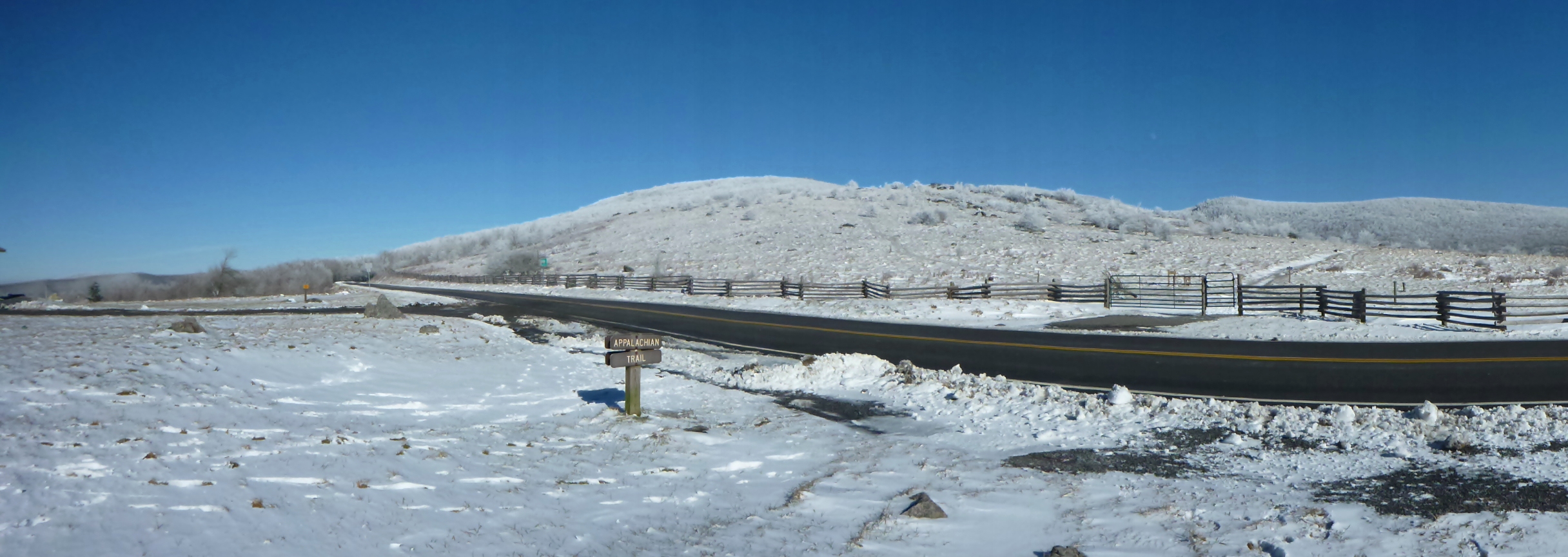
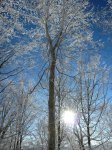
Donning my 44-pound backpack full of winter camping gear and camera equipment, I crossed the road and started up the Virginia Highlands Horse Trail. The hike started through trees, which glistened overhead. The skies were bright to the west, where the sun was already dropping, but were a dark cobalt blue in other directions.
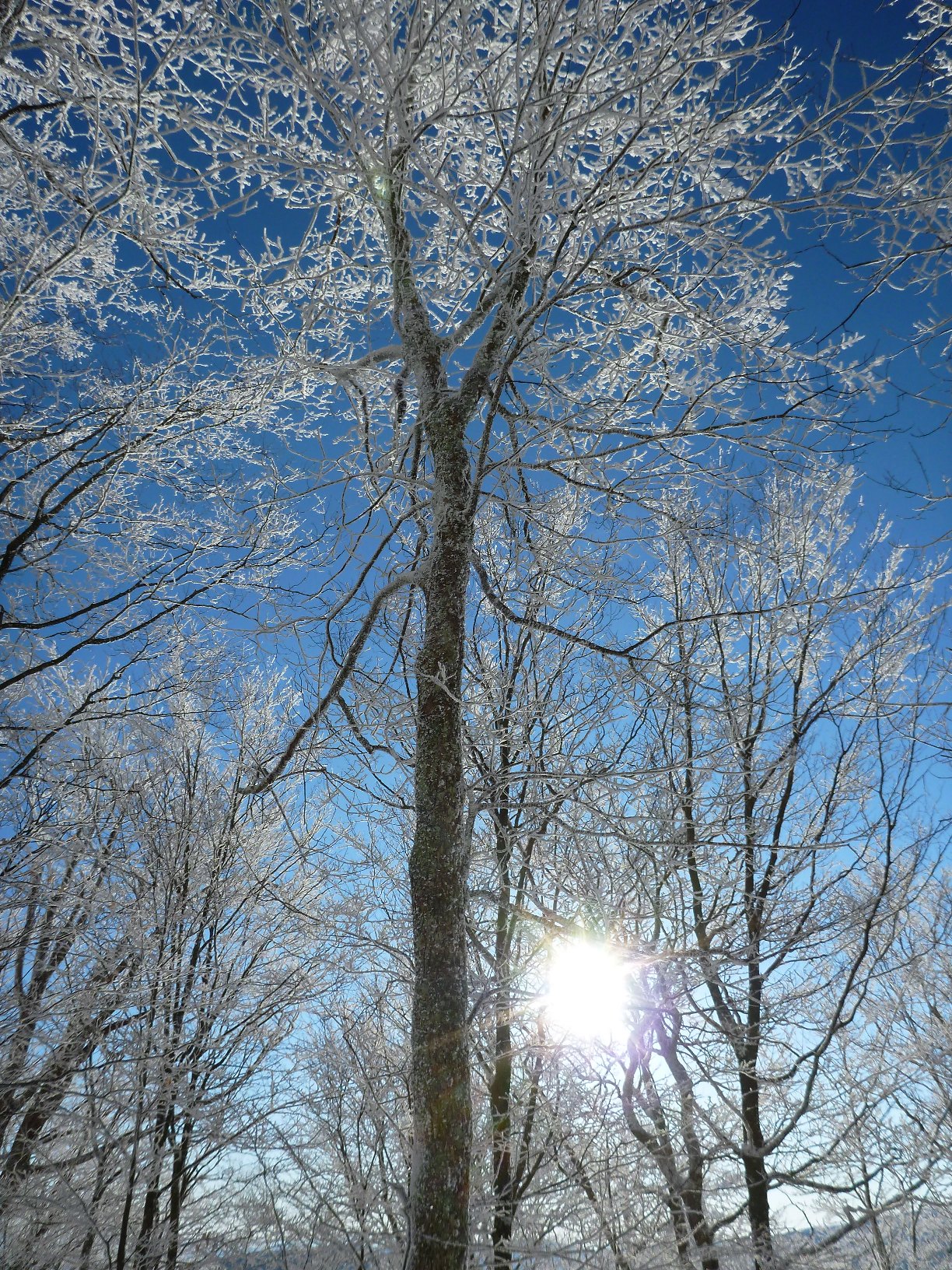
The frost coated everything. Tree branches were twice or more their size due to the hoarfrost.

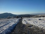
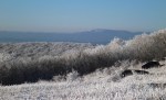
Once up in the balds, you could see great distances. The mountains to the south had snow but little frost; to the north across the valley, Clinch Mountain had frost on its largest southern-exposed face, known as the Bear Town area.
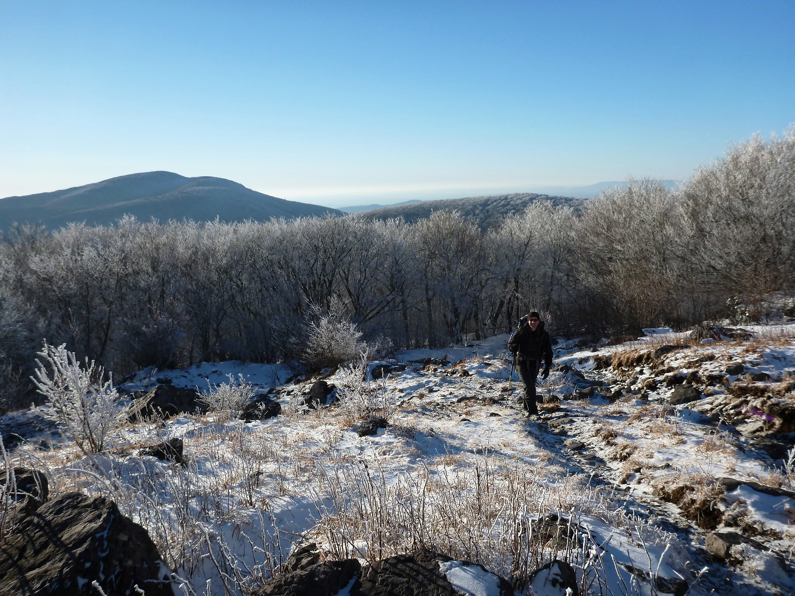
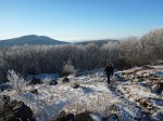
The contrast between blue and white was dramatic.

Hiking in this winter wonderland, you could easily imagine yourself in another part of the United States, or another part of the world, hiking in the Arctic or in true Alpine conditions.

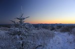
The Frasier firs and other trees at the highest elevations looked almost fake with their limbs and branches so heavily laden with frost.

The moon rose dramatically in the East, signalling that this was the shortest day of the year, the winter solstice.
The entire hike, as awesome as it was, was merely the opening act for the light show we were about to watch.

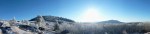
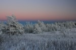
As we rounded the first bend that allowed us a view to the eastern horizon, the whole mountain became aglow in amazing colors.

The photos we took do not adequately show the overwhelming color of the scene. The periphery as well as the main view to the east were bursting with palettes of pink and purple. In the photo below, I used my camera’s panorama feature to show a 180 degree view.
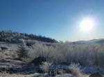
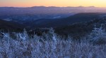
The entire episode of amazing light lasted less than one-half hour. Even the fading light was beautiful, as captured below.
The sunlight disappeared, and the moonlight began to illuminate the mountain. It was not a full moon, but it was sufficient such that you could walk without a headlamp once your eyes adjusted.
The light show over, we set out to make our camp. The temperature seemed to plummet by the minute. The winds, which were not insignificant while we were obsessed with photography, seemed to increase in strength and become more ominous. It was definitely getting colder.
There would be a price to pay to for the incredible optic conditions: suffering through a brutal night of cold and wind.

The next day, when we returned to our vehicle, an older gentleman walked into the parking lot from the other direction–coming down off of Whitetop Mountain. A large white beard, accompanied by a red union shirt, made the man appear as a slim Santa Clause coming from the snowy woods to inspect his winter kingdom. The man was none other than Damascus Dave, a well-known and experienced thru-hiker and outfitter in the region.
He greeted us. “Isn’t it beautiful? That hoarfrost, or rime ice, or whatever you want to call it—it’s whiter than snow.” Then he asked, “Did y’all overnight up there?”
We told him we had, and we began discussing the wind gusts and how cold it got last night. We talked about gear for a while, and how while we were prepared, it was still extremely cold.
“Well, it was pretty cold last night,” he said. “And, I reckon you can’t camp up there in this kind of weather and not experience some pain. No getting around it. That’s just part of it.”
As I stood there in the parking lot, tired but satisfied, I realized that he spoke the truth.
When it comes to hardcore winter camping, especially if you are seeking exposed ridgetops, vistas, and the coldest weather with the most snow, there will be some pain. Not insufferable pain. Certainly not the Beck Weathers’ level of pain. Not nearly the level of pain a depicted in Cold, the movie about climbing Gasherbrum II, a 26,000′ mountain, in the middle of winter. But there is unquestionably some serious discomfort—some pain—involved. It’s truly a case of “no pain, no gain.”
We weren’t cold while hiking. (In fact, while climbing it’s pretty easy to actually overheat.) We moderated our hike so that our pace kept us warm but didn’t cause us to overheat. But when we stopped, the whipping wind would quickly steal body heat. We had to put on our down jackets when we stopped. (You don’t want to overdress, risking sweating too much and the dreaded “wetting out” inside your jacket, but you have to dress sufficiently to keep warm.) It’s a balancing act to maintain warmth in these conditions. Preparation, proper clothing, and layering is key.
However, regardless of your dressing properly, setting up camp when it is really cold can be difficult. The cold seeps through your gloves, burning and then numbing your digits, making it increasingly difficult for you to manipulate them. For example, holding aluminum tent poles firmly while setting up a tent just saps the heat from your hands. Simple tasks require greater concentration and mental focus when it’s freezing and your hands are numb. Standing around while doing these kinds of tasks causes your feet to get cold, too.
By the time we had set up our tent, the water in our one-liter water bottles had almost completely frozen. The sandwich I brought for dinner had frozen. And the gas canister that would allow us to warm up some water for coffee and oatmeal was not functional.
That night, I slept in my 15 degree-rated sleeping bag on a sleeping pad, with polar fleece pants, two undershirts, a fleece jacket, wearing a down jacket, a hat, and gloves. My feet were covered with wool socks and insulated slippers. And yet, my feet and hands were still cold. My friend, who brought his 0 degree-rated “Never Summer” down sleeping bag, fared no better. Let’s just say, it was very cold.
We warmed our water by placing it in our sleeping bags, along with a host of other gear that was generally uncomfortable to have there: batteries from my camera; my headlamp; additional food; the gas canister; and various other items.
The wind was blowing interminably, with gusts that seemed Everest-like. In putting up our tent, we staked through the first inch of frozen ground down into the soft earth, and used some additional rocks to keep if from moving. Nonetheless, the tent flapped incessantly through the night, and the intermittent gusts seemed to have enough force to blow us off the mountain.

Despite the good weather window reported on the news and on the Internet the previous day, the temperatures plunged and the wind whipped with increasing intensity through the night. Using the heat inside our sleeping bags, we were able to thaw the iced-through water bottles.
Little did we know that although the weather was predicted to improve at the lower elevations, the recorded temperature (single digits) and wind chill (below zero) was the coldest in December 2012, and wind gusts were recorded at 65 miles per hour at the Grayson Highlands State Park Weather Station, almost 1500 vertical feet below where we were camping on the exposed ridge at over 5400′.

If we had not been adequately prepared that evening, an uncomfortable night could have been much worse. Instead, we awoke the next morning, broke camp, and went back to the Thomas Knob shelter to brew some coffee to warm up before the hike back to the trailhead. As expected, as we hiked back down the mountain, it got warmer and the winds subsided.
By the time we returned to the parking lot, it was comfortable enough wearing just our fleece sweaters to stand around and chat with Dave regarding harrowing experiences he had heard about in this area. (Many folks have actually been in some real danger up on the mountain). While not uniquely cold, the weather we had experienced was extreme, especially for this region. For us part-time adventurers, you might even call the weather conditions epic.
The evening sunlight, true alpenglow, and whole experience made this a fitting winter solstice backpacking trip, a perfect prelude for Christmas and the New Year. The suffering part? Yes, it was definitely worth it. Meaningful achievement, even something as relatively inconsequential as a winter overnighter, requires some striving and involves a little or more discomfort. It’s in part the difficulty that makes it rewarding. If it were easy, everyone would be doing it, and the solitude sought after in these kinds of trips would not exist.
And for the record, yes, I actually did carry with me and wear insulated slippers.


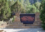
Located in far Southwestern Colorado, Mesa Verde is one of the largest and best preserved ancestral Puebloan ruins in the world. This was the first leg of our trip to the Southwestern United States in 2012. After so much planning and driving, we were excited and full of anticipation to finally be visiting our first national park on the itinerary.

The park is located about one-half hour west of Durango, Colorado, where we stayed the previous night. Leaving Durango and heading to Mesa Verde, you travel across the foothills of the San Juan Mountains and down into the high desert. This was our first taste of the high desert on this trip; indeed, this was the first time ever that my children had been to a desert of any kind.
The aridity; the dusty, sandy soil; the impressive rock formations; strange trees and plants—the conditions were all so different from back East. Above all, what set this place apart was the sheer immensity of the landscape. Having been to Mesa Verde as a child with my parents and brother, I was especially excited to be here now, again, finally able to share this place with my own family.

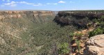
From the park entrance, you climb up onto the mesa, the flat-topped mountain. The two-lane road to the top twists and skirts the edge of the mesa, switchbacking and steadily climbing up onto the top. It’s a steep and scenic ascent, with some sections of the road wedged into the ramparts of the mesa, with signs prohibiting stopping due to the danger of rockfall.

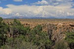
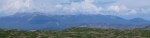
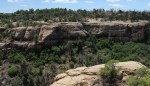
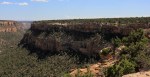
Atop the mesa are expansive views in all directions. To the north the San Juan Mountains rise up from the desert.

Beyond the mesa to the south, the high semi-desert country is composed of hills and more mesas covered with small shrub like trees. I was surprised how green the landscape was; it was late July in the desert after all.

The park visitor center is a circular shaped building with a deck looking out from the top of the mesa into the canyons below. Past the visitor center, there is a single road that travels for about 15 miles to two loops in the southern section of the park. It is here, at the southern end, where the famous ancient cliff dwellings are located. Archeologists believe the dwellings were inhabited between 600 and 1300 A.D. It is believed that at some point during this period the population at Mesa Verde may have exceeded 2000 people. However, archeologists are confident that some time after 1300, perhaps around 1400, the entire population here abandoned Mesa Verde and the cliff dwellings, traveling south or southwest to join with other Native Americans. Why they left when they did remains a mystery today.
The Puebloan people shifted from a hunter-gatherer people to a predominantly agricultural people, raising corn and beans and domesticating dogs and turkeys. They continued to hunt larger game, including deer. They were skillful at basket weaving and, later, at pottery.
The dwellings remained undiscovered until the late 1890s, when some cowboys or prospectors came upon them by accident. In 1906, President Theodore Roosevelt established the Park to preserve the works of mankind.
According to the National Park service, today there are 5000 known archeological sites in the park, although most visitors, like us, come to see one or more of the four famous cliff dwellings: Cliff Palace, Balcony House, Long House, and Spruce House.
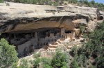
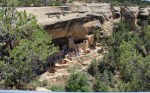
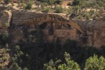
We first visited Cliff Palace, which is probably the most impressive of the cliff dwellings. We visited an overlook that provided some great views of the Cliff Palace.

Cliff Palace has 150 rooms, including 15 Kivas, which are circular-shaped rooms that these Puebloan people used for special ceremonial and perhaps religious occasions.

The Puebloan people lived here between 600 and 1400 A.D. Archeological records show they first lived on top of the mesa, eventually developing significant masonry skills and building stone living quarters. At some point, probably about 1100 A.D., they moved down into the cliff dwellings and built stone living areas there. It is theorized they moved because of increased security and temperature regulation in the cliff dwellings.
In the photo below, you can appreciate that the cliff dwellings are toward the top of the mesa, yet about 100 feet below the upper ridge.

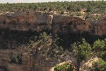
In the photo below, you can see the other side of the canyon viewed from Cliff Palace. Smaller cliff dwellings, perhaps granaries, can be seen on the other side of the canyon above the large boulder-outcropping in the foreground.

During the busy summer tourist season, park visitors must obtain tickets at the visitor center to visit the cliff dwellings. Visitors must be accompanied at all times by Park Rangers on tours; individuals are not allowed to wander about the cliff dwellings by themselves.
We allowed our boys to choose which cliff dwelling they wanted to visit, and they chose the Balcony House because it is supposed to be the most adventurous tour, with several climbing ladders. With 40 rooms, the Balcony House is smaller than the Cliff Palace, with 150 rooms.

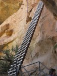
Balcony house is constructed into the sheer cliff on the opposite side of the mesa from Cliff Palace. Entry to Balcony House by park visitors requires climbing down a set of stairs to an area below the dwellings, then a climb up a series of steps and a very tall, nearly vertical ladder.

The ladder is shown in the photos below. The Puebloan people would have accessed the Balcony House via small indented steps chiseled directly into the cliff face from the top of the mesa.

The Balcony House was also built with some narrow passages. It is speculated that the whole Balcony House structure was designed with features like these as fortifications, which would assist in defending it from outside attacks.

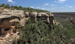
Our youngest child was a bit too small to climb up to Balcony House, so she and I went for a two-mile, out-and-back hike to some vista points that looked out to Balcony House; this is how I was able to get the photos like the one above and below, showing the Balcony House dwelling in the context of the massive mesa. (In the photo below, the cliff dwelling is on the upper right.)

My daughter enjoyed our little hike, though her flushed cheeks show the dry heat had an effect on us. Nothing a couple of Nalgene bottles filled with ice-cold water couldn’t neutralize. This hike, unlike some others that we did later on this trip, did not require me to carry her.
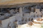
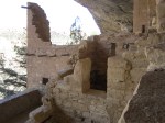
The interior of the cliff dwellings shows remarkable architecture and masonry, especially considering that these structures were designed and built about 1000 years ago. It is likely they were the paragon of architecture and construction in North America at this time. Some of these design elements are still used in modern adobe construction in the Southwest.

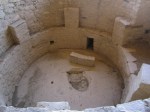
The kivas held a special place for the Puebloan people. Below is one of the better preserved kivas at Balcony House. The center of the kiva was used to build a fire, while the sides are believed to be benches.

Because of Mesa Verde’s special historical significance, it is a UNESCO World Heritage site. By this designation, it is generally considered to be one of most import archeological and historical sites in the world.
If you plan on visiting Mesa Verde, my suggestion would be to give yourself at least one whole day. The trip to the visitor center and the cliff dwellings will consume the better part of the day. You could easily spend more than a day here if you have a special interest in the archeology of the Anasazi or Puebloan people. Fitting in multiple tours within a day can be done; however, it would be almost impossible to visit all four of the major sites in a single day.
What we left with—at least what I hope my children left with, and what I think is a major purpose of the park to inculcate—is not so much a memorization of specific details of the visit, but an overall impression of these impressive structures and their reflection of a relatively advanced civilization of Native Americans that existed long ago, long before Europeans set foot in this continent. That, and the strange, unsolved mystery of why these people apparently left this amazing place.


This month marks the 75th anniversary of the completion of the Appalachian National Scenic Trail. (To be precise, it was finished on August 14, 1937.) The trail is 2,180 miles long, has over 250 three-sided “shelters,” and links innumerable other trails through 14 states.

For three-quarters of a century people from all over the United States–indeed, from all over the world–have been trekking up and down the Appalachian Trail, or A.T., as most folks in the know refer to it. In commemoration of this milestone, this weekend I hiked a section of the A.T. between Mount Rogers and Whitetop Mountain.

Founded by a small group of hikers, particularly one forester named Benton Mckaye, who envisioned an East Coast “super trail”, the Appalachian Trail Conference started work on the A.T. in the 1920s. By 1930 the trail began to take form as small groups of volunteers worked up and down the mountains of the East. According to the Appalachian Trail Conservancy, this was not a government project but the accomplishment of private, local clubs who mapped and routed sections of the trail, negotiated with private landowners and governmental agencies, and did the physical labor to build it in their respective areas.
To this day, although the A.T. is now owned by the governnment, the Appalachian Trail Conservancy and the many volunteer organizations are critical to the maintenance of the trail.

After World War II, volunteers renewed development of the A.T. In 1948, Earl V. Shaffer, an Army veteran who served in the Pacific Theater, completed the first “thru hike,” or continuous hike of the entire A.T., reportedly in order to “walk off” the stress of the war. In the years since, the A.T. has become a cultural phenomenon in addition to being an outdoor experience. Every year hundreds of individuals from all walks of life attempt to thru hike or section hike part of the A.T., seeking solace, self-exploration, or temporary escape from urbanity on the trail.

In 1968, the United States Congress passed the National Trails System Act, and the A.T. was the first completed national trail designated a National Scenic Trail. This added the A.T. to the system of national parks. The A.T. links two national parks (the Great Smoky Mountain National Park and Shenandoah National Park), and includes Abingdon Outdoors’ own Mount Rogers National Recreation Area. While the A.T. has always crossed the MRNA, the trail used to traverse the Iron Mountains to the north of Mount Rogers and Whitetop Mountain. It was re-routed over Mount Rogers and Whitetop due to scenic beauty of these highest mountains in Virginia. The old shelters on Iron Mountain are still maintained as part of the Iron Mountain Trail.

Most folks—like myself—have no intention (at least no immediate intention) of hiking the entire length of the A.T. Most folks hike part of the trail in a day, or at most over the course of a weekend or for a week or two. The trail is also frequently utilized by the Boy Scouts and by church and civic groups for hiking and camping trips.

The trail is designed not to be easy: It randomly meanders and seldom takes the easiest path from point “A” to point “B”. At points it certainly appears as if the A.T.’s designers purposely placed obstacles such as rocks and roots in the way. This keeps the trail challenging.

The A.T. is different things for different people: A place for solitude and meditation; a place for a communal outdoor experience; a training ground for other pursuits; a naturalist’s place to study flora and fauna. Perhaps Benton MacKaye best answered the question, “What’s the ultimate purpose of the Appalachian Trail?”
He said, “To walk. To see. And to see what you see.”
Happy Birthday, A.T. . . . See you on the trail.

Hiking today with my daughter and faithful hound up on Forest Road 90 and the Iron Mountain Trail amidst the still lush, dark green foliage I saw a few leaves (just a very few, mind you), that seemed to be anxious for the next season.

Most traveling for summer vacations is finished or nearing completion; we are well into the 2012 Summer Olympics; young people and teachers are gearing up for a new school year; and here in Abingdon the Virginia Highlands Festival is in full swing. I can sense a collective sense of just a bit of anticipation all around as we know the summer is slowly drawing to an end. There’s still time to get outdoors and enjoy this season, though, which I encourage you to do.
