Thanksgiving is tomorrow. During this time we often reminisce and reflect on what’s happened in the past year and give thanks for the good things we have in our lives. Along the themes of reminiscence and reflection, here are some tranquil, reflective photos from a trip my son Karl and I took to Hidden Valley Lake one evening in this November.
Reflections on Hidden Valley Lake
We approached the eastern side of the lake just as a series of interesting cloud formations developed in the otherwise clear evening sky. The lake was very still—there was no wind—and the reflections looking back toward the sun were magnificent. (Click on any of these photos to enlarge them.)
Shoreline Reflections
The leaves had already mostly fallen, but as can be seen in the above photo, there were still oaks on the far side of the lake that clung to some of their dark auburn foliage.
Surrounded by Clouds
We were the only two people in the valley. There was absolute quiet except for the sound of the rushing water in the distance at the dam.
The air was crisp and had a unique, slightly sweet scent. I have since come to learn that Hidden Valley at one time may have been a high elevation bog. There are some unusual plants in the valley that give off the unique scent in the late fall. I have discussed with Virginia Game and Inland Fisheries that it may be Possum Haw aka Shawnee Haw or Nanny Berry, or it may even be the bark from some of the trees after the leaves have fallen and they are more exposed to the air and sun.
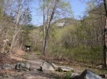
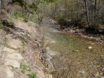
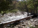
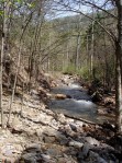
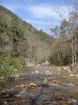
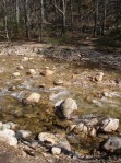
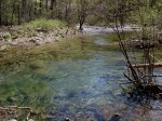
Karl and I went for a hike to explore upper Brumley Creek. The creek’s headwaters are formed from the lake’s drainage, high elevation springs, and smaller creeks in the valley.
Upon our return, most of the clouds had rolled away. In the stillness of evening, the lake made an almost perfect reflecting pool. Faint light and muted features caused the scene to look like an impressionist painting:
Reflecting back on this year, I’ve spent a lot of time in the outdoors with my family. That’s one thing, among many other things, for which I am thankful.
While the most spectacular hike in Virginia is, in my opinion, the ascent of Wilburn Ridge (as described in one of my previous articles), perhaps the best “bang for the buck” hike in Southwest Virginia is the short hike known as Twin Pinnacles. This is a 1.6 mile hike in Grayson Highlands State Park. On September 25, 2011 after visiting the Grayson Highlands Festival my family did this little hike.
View from the Little Pinnacle
The trail begins right behind the Visitor Center. The trail is a loop that takes you out to two pinnacles, or rock outcroppings, that have great views of the surrounding mountains. The first pinnacle can be reached in less than 300 yards from the trailhead. The pinnacles afford 300 degree views. The view in the above photograph is looking south towards the North Carolina/Tennessee state line. The view below is toward the north. The rounded, frasier fir-covered hump at the top of the photo is Mount Rogers, the highest mountain in Virginia.
Mount Rogers View
Notice anything unusual in the photo above? My son Isaac noticed the hawk on one of the outcroppings. I have circled it below. You can click on the photo below to enlarge it and see the bird a bit closer. After a few minutes, it flew away, taking advantage of the thermals that rise up the mountainside.
Large Hawk at the Pinnacles
Looking back towards the north, you can also make out Wilburn Ridge as it rises from Massie Gap and climbs towards Mount Rogers. In the photo below, it is the rocky ridge on the right side of the photo’
Wilburn Ridge View
On the second part of the trail, which involves some up-and-down climbing through some forest, we came across a resident in the middle of the trail who would not move. Eventually, I had to get a long stick and move it out of the path. The snake was almost three feet in length. It was an eastern gartner snake, although I had not seen one this large before. My daughter was not scared of it, and it seems to have been the most memorable part of the hike for her!
Gartner Snake on the Pinnacles Trail
After the hike, on the way down the mountain in our vehicle we saw a whole group of gobblers crossing the road. Seeing wildlife like this in the Mount Rogers National Recreational Area is not unusual.
Wild Turkeys
Overall, this was another nice day in the mountains. The Twin Pinnacles Trail is a bit short in and of itself to justify a long trip to Grayson Highlands State Park. It is, however, a perfect complement to a picnic or a nice side trip while visiting. It is also a really good family hike: Just the right distance for younger children or those looking for a less strenuous, shorter hike with great views.
This past Sunday afternoon my sons Isaac, Karl and I went for a five mile loop hike on the Iron Mountain Trail / Forest Road 84 off of State Route 600 in Smyth County. These photos were taken at the Skulls Gap scenic parking lot, which is about 3500′. The colors are starting to change at higher elevations and all foliage is taking on that golden hue in the evening that signals autumn has arrived. Click on any of the photos to enlarge to appreciate the panoramic views.
View from Skulls Gap of the ValleyView from Skulls Gap of the Valley. Clinch Mountain is barely visible on the horizon.Skulls Gap Parking Lot
Driving south along I-81 in Wythe County, you cannot help but notice that there is one aesthetically appealing mountain on your left that notably rises from the valley floor much closer to the interstate than the surrounding mountains. This is Glade Mountain.
View from Glade Mountain
The mountain becomes visible to the south of the interstate just past Rural Retreat (Exit 60). Glade Mountain parallels the interstate for almost 10 miles, receding only as you approach Atkins (Exit 50).
Glade Mountain is part of the Mount Rogers National Recreation Area and lies entirely in the Jefferson National Forest. It is distinctive in that it is separated from the main part of the recreation area, yet is one of the largest mountains in terms of mass within the area. Despite its proximity to I-81, it is seldom visited other than by local Wythe and Smyth County residents and Appalachian Trail thru-hikers. Thru-hikers get their first view of Virginia’s valley and ridge mountains when they cross the mountain. Glade Mountain affords views of Big Walker Mountain, Clinch Mountain, and even part of East River Mountain (the West Virginia state line) to the north.
Most out-of-the-area hikers pass up Glade Mountain for other more written about and better known mountains further down the interstate. This leaves Glade Mountain to those of us who appreciate its solitude. I have hiked this mountain on several Saturday afternoons, and the only other hikers I have ever met on the mountain are a handful of thru-hikers in spring and early summer on their way north. I also once met a single thru-hiker on his way south in the fall.
The AT crosses Glade Mountain on a north-south axis. The base of the trail leaves the Settlers Museum of Southwest Virginia in Groseclose, and after about ½ mile through the forest heads up the mountain in a due south direction. Once climbing the mountain, the trail parallels a very small creek (about 1-2 feet in width). In June the mountain laurel on the north side of the mountain bloom profusely.
Mountain Laurel Thicket at base of Glade Mountain
The northern section of the trail (the side closest to the Settlers Museum) has huge rhododendron thickets and mountain laurel thickets. At some points you travel through a tunnel of rhododendron that barely allows room for a backpack.
Mountain Laurel on Glade Mountain
The trail travels uphill for about 3 or 4 miles, crossing Forest Road 86 (identified on some maps as Forest Road 644). The trail continues south and higher up the mountain to the Louise Chatfield Shelter, a fairly nice shelter on the mountainside close to a year-round creek.
Chatfield Memorial Shelter
The trail then continues for another approximately 1 ½ to 2 miles to the top of the mountain. There are a few places on the trail where the trees open up enough for a brief view of the valley and to the north. The views are much better in winter, when the canopy does not obscure the view. Towards the summit there are expanses of ferns over four feet in height under the trees. There is no designated spot or clearing that identifies the location of the summit.
Massive Ferns
The trail then descends the south side of the mountain until it crosses Forest Road 86 again, eventually crossing Route 16 approximately 4 miles further.
Forest Road 86 forms a band around the entire mountain about ½ way up from the base. Forest Road 86 is open to mountain bikes (and even off-road vehicles), and can be combined with the AT to form a large loop run (approximately 12 miles).
Rhododendron Tree Over Trail
Directions
Access to the trailhead of this mountain is easy. Simply take Exit 54 off of I-81 and follow the signs to the Settlers Museum. The trailhead is about 6 miles from the interstate. More detailed directions are here:
From I-81 South (follow signs to the Museum):
1. At bottom of exit ramp at Exit 54 on I-81, turn left
2. Continue about 0.1 mile to Rt 11
3. Turn left on Rt 11, travel 1.3 miles to Rt 679
4. Turn right on Rt 679, travel 0.8 mile to Rocky Hollow Road
5. Turn right on Rocky Hollow Road, continue 1.2 miles to Museum
St. Mary’s Wilderness is in the George Washington National Forest in Augusta County. St. Mary’s River, a small river that is better characterized as a large creek, empties a large drainage area on the west slopes of the Blue Ridge Mountains. It’s about three hours from Abingdon via I-81. In fact, it’s as close to Washington, DC and Richmond as it is to Abingdon.In April 2011 I hiked and did some trail running up the main St. Mary’s “trail”—if you would call it that—on a weekend trip to the Shenandoah Valley. The last time prior to this that I hiked in the St. Mary’s Wilderness was as a student and member of the Washington & Lee University Outing Club in the late 1980s. Unlike most hiking areas, St. Mary’s Wilderness has become more inaccessible since my trips there when I was in college.
There is a sign at the entrance to St. Mary’s Wilderness that states that the trail was destroyed during Hurricane Katrina in 2005. There was a well-established trail prior to the hurricane. Now it starts out as a trail but within a half-mile deteriorates to sporadic rocky areas and only remnants of a trail. There are numerous areas where the “trail” is blocked by blow-downed trees, and where the trail meanders or peters out and then reappears several hundred feet further along the river. The trail also runs along some embankment areas that are somewhat dangerous, requiring hand-holds on tree branches. This trail could be challenging with a large, heavy pack for these reasons.
Due to limited time, I was only able to get several miles up the trail, so I cannot comment on the further reaches of the trail. However, the lower areas are not in very good condition. In fact, the conditions were so poor that I carefully retraced my hike back to the entrance parking lot, to make sure that I had not missed the trail somehow. Considering that this was early in the season, with the leaves not fully out and the underbrush not obscuring the trail, I do not think was this the case.
While there are interesting cliff faces, views up the gorge, and glimpses of the Blue Ridge mountains above, the reason to hike this trail is the St. Mary’s River itself. The river is clear, runs over a light-colored stone bed, and has a couple of waterfalls. There are also numerous deep pools, several which are suitable as swimming holes or places to take a dip on a hot day. Here is a typical deep water pool:
The St. Marys River is purportedly a good trout fishery. The river is not part of Virginia Department of Game and Inland Fisheries’ stocking program, however it is a designated special regulation trout water. Only single hook artificial lures may be used; no bait may in possession of the angler; and all trout less than the minimum—for St. Mary’s River, a 9-inch minimum—must be released.
Comprising 9,835 acres, St. Mary’s Wilderness is one of the largest federally designated wildernesses area in Virginia. Under the Wilderness Act of 1964 a federally designated wilderness is described as: “A wilderness, in contrast with those areas where man and his own works dominate the landscape, is hereby recognized as an area where the earth and community of life are untrammeled by man, where man himself is a visitor who does not remain.”
Although designated as a wilderness, it is not remote compared to many areas of national forest southwest of Roanoke in the Abingdon area such as the Mount Rogers National Recreation Area, parts of the Clinch Mountain Ranger District, or the Cherokee National Forest in Upper East Tennessee. St. Mary’s Wilderness is nonetheless remarkable for being such a large, contiguous wilderness area so close to the major metropolitan areas of Virginia.
Here are some additional thumbnail photos of the St. Mary’s Wilderness. Click to enlarge them.
This is the Appalachian Trail footbridge that crosses Straight Branch Creek near Damascus, Virginia. This photograph was taken on Saturday, July 9, 2011. If you click on the photo and enlarge it, you can see the white blaze on the anchor tree on left of the footbridge in the background. In order to obtain this composition, I waded into the center of the creek and set up a tripod. I slowed the shutter speed slightly in order to capture the movement of the water in the foreground.
The ascent up Wilburn Ridge is the most spectacular hike in Virginia. I usually avoid superlatives in describing the outdoors, because descriptions such as “most spectacular” are of course necessarily subjective. However, in many years of hiking across the Commonwealth, this route remains my personal favorite. If you are reasonably fit and only do one hike in Southwest Virginia, this should be it.
This hike is one for all seasons: Spring, summer, fall and winter each bring a different hiking perspective. Because of the elevation, the winters can be harsh up here, and summer comes later than it does to the valleys. In the middle of June, the balds boast the largest open rhododendron thickets in Virginia. In the fall, the trees burst forth with color. The peak brilliance of fall foliage occurs several weeks earlier here than in the rest of the region—usually the last week of September or first week of October.
The Views
These photos were taken on a day hike on Memorial Day Weekend in 2011. Some the trees were still in the early leafing out stage that has long past the rest of the Virginia. This provided an interesting contrast between the lighter greens of early foliage and the darker colors of the Fraser firs that are spread across the higher elevations.
The following photo taken of hikers ascending Wilburn Ridge shows the grand views from practically the outset of this hike. Click on this photo to enlarge it and appreciate the expansive views into North Carolina along Wilburn Ridge.
Most of Wilburn Ridge is above treeline in “balds,” huge sections of the mountain where there are only grass, underbrush, and rocky outcroppings. This is more like hiking in the Western mountain ranges than anywhere else in the Southeastern United States.
Wilburn Ridge is a ridge climb that is the southern rampart of Mount Rogers, the highest mountain in Virginia at 5700′ above sea level. The highest point on the ridge itself is approximately 5500′. The rock outcroppings rise like embattled parapets on a castle as you ascend the ridge. From the northern part of this ridge the Appalachian Trail continues west across additional balds towards the true peak of Mount Rogers, and there is a short spur trail that ascends the final 200′ to the summit. The actual summit of Mount Rogers is forested and has no view.
The trails surrounding Mount Rogers provide views in all directions. There are some outcroppings that provide literal 360 degree views. The further you ascend on this route, the better the views become. In the midsection of the ridge, the views to the southwest show the Appalachian Range that separates North Carolina and Tennessee.
At the northern end (the highest end) of Wilburn Ridge, you can view almost 100 miles of the North Carolina-Tennessee state line. Clicking to enlarge the photo below, you can see Grandfather Mountain in the foreground on the left side (about 1/4 from the left side). It has a unique “U” shape in the middle of it. The mountains in the middle include Sugar Mountain in North Carolina, while the largest mountains on the center-right hand side of the photo include Roan Mountain that divides North Carolina and Tennessee.
At the northern end of Wilburn Ridge, you can look west back down towards the valley and ridge section of Virginia. In the photo below, you can see where the Appalachian Trail, Crest Trail, and Pine Mountain Trail intersect. Click to enlarge this photo and you can see the horses and riders on the trail. Iron Mountain is the long straight mountain behind them that runs along the top of the picture. In the very upper left of the photo is the valley back towards Abingdon. While not visible in this photo, Abingdon is less than 30 miles as the crow flies from this viewpoint.
To the north, Wilburn Ridge overlooks Pine Mountain. As shown below, Pine Mountain appears as a semi-circular mountain that has huge bald sections but is also partially forested. Pine Mountain has tremendous views itself looking back up to Wilburn Ridge and towards the southern mountains in North Carolina. The Appalachian Trail traverses the entire ridge of Pine Mountain. The Crest Trail can be seen on the left of the photo below. Click to enlarge it for a more detailed view.
The Trail
The Wilburn Ridge Trail is part of the Appalachian Trail. The quickest way to access the trail is to enter Grayson Highlands State Park and drive to the Massie Gap parking area. A short 1/2 mile spur trail leaves the parking lot and rapidly ascends to meet the Appalachian Trail and Virginia Highlands Horse Trail. This photo shows the view looking up Wilburn Ridge at the beginning of the hike once on the Appalachian Trail.
Photo by Karl Thiessen
The views begin immediately climbing the trail. The photo below was taken along the Virginia Highlands Horse Trail less than 1 mile from the parking lot in Grayson Highlands State Park. If you click on it and enlarge it, the horse trail is clearly visible to the left-center of the photo, while the AT is just above it in the center of the photo. These two trails parallel one another during the first 1.5 miles up Wilburn Ridge, until reaching the gate that separates Grayson Highlands State Park from Mount Rogers Wilderness.
The trail alternates between a series of rocky step climbing and traverses across fields. Here is one of the fields showing rock outcroppings both near and far:
The following shows typical trail conditions while descending back down towards the parking lot:
The Ponies
Wilburn Ridge and the surrounding area are known not only for the views, but also for the herds of feral ponies that live in Grayson Highlands State Park and in the high country or “crest zone” of the Mount Rogers National Recreation Area. This is one of only two areas in Virginia where wild ponies roam (the other is almost 400 miles away on Assateaugue Island National Seashore). The ponies here endure tremendous temperature changes from the heat of summer to the winters at 5000′.
The ponies graze across the high country throughout the summer, preserving the character of the balds. In the winter they migrate to lowers areas of the park. The ponies can be seen on the trails that crisscross the balds:
The photo below shows ponies along Wilburn Ridge. The mountain in the distance is Whitetop.
The Wilburn Ridge Pony Association, a private organization, assists managing these animals. In the spring some of the female ponies give birth, and in the fall the ponies are rounded up, and a certain number of them are auctioned off during the Grayson Highlands Festival.
The ponies are awesome to observe as you are hiking up the ridge. While completely wild, they are not afraid of the hikers and usually continue grazing. I have even experienced them waking up backpackers by grazing close to tents in the early morning hours. Here is a mother with her young:
Here is another young pony up close:
So there you have it: The combination of views, miles of balds which provide above-treeline hiking conditions, wild ponies, and rugged country make this the most spectacular hike in Virginia.
Directions
From Abingdon, drive east to Damascus on Route 58. Stay on Route 58 through Damascus. Route 58 itself is a beautiful drive as it parallels Whitetop Laurel Creek. You will continue on Route 58 east until you enter Grayson County; when you reach the community of Whitetop you have about 20 minutes left until you will reach the entrance to Grayson Highlands State Park.
There is a $3 entrance fee to drive into the park. The drive to the Massie Gap parking lot is another 3 miles or so.
The best map for hiking in the high country that is currently published is the National Geographic Trails Illustrated Mount Rogers Map 786, available at the outdoor stores in Abingdon, Bristol, and Damascus.
This week perhaps the worst set of tornadoes in history hit the South. In Washington County, Virginia, where I live, we experienced tornadoes unlike anything in the last 60 years. This tragic event prompted me to recall some of my own personal experiences with extreme weather, and to contemplate the fierce, uncontrollable power of nature from the perspective of those who love the outdoors.
Ignorant of the Danger
On Wednesday, April 27, 2011, I came home for dinner and went back to work at my office in Abingdon, unaware of severity of the impending storm. My wife called me around 8:00 PM, telling me we were in a tornado watch area, and that a neighbor who was coming back from Knoxville had his vehicle pelted with hail while driving up Interstate 81. I told her to call back “when it got closer.”
She called me again at 10:30 PM, and told me in a raised, nervous voice, “Get home. It’s here!”
“What’s here?” I asked.
“Where the #%^* have you been? What do you think? The Tornado!”
I quickly closed down the office and drove home. As I drove home, there was lightning and thunder all around in the sky.
Our family spent the night in our unfinished basement. My wife and I sat in lawn chairs, watching the weather reporters who broke into the regular TV evening programming, while our children lay in sleeping bags on the basement floor. We experienced some anxiety and fear, but I also was curious and strangely fascinated in what was happening. Having grown up in the Midwest, I had experienced tornado watches and had done innumerable tornado “drills” in school, but I did not recall ever previously being in the direct projected path of one.
Actually, there was some disconnect between my view outside of our house and the weathermen’s Doppler radar graphics showing the super cells and tracking them in real-time. I periodically opened our basement door, looked outside, and never did I hear the locomotive engine roar that was associated with tornadoes. There was no incredible wind or horrible hail as was being reported on TV. The closest we got to the action were the sounds of hail pounding the television station studio coming through the TV, thunder in the distance, and the shrill call of Abingdon’s fire engines and ambulances through the night. The worst thing that we physically experienced that night was lack of sleep.
I had to awake and leave early for work Thursday. Our cable TV went out in the early morning, so I did not know the state of affairs until my wife called me and told me the news that a tornado directly hit the small community of Glade Spring. Later that day, my office manager, who lives near Glade Spring (and who thankfully was alright), explained what she saw on her drive to work. “It would make you cry,” she said.
I would later appreciate how bad it was: Glade Spring looked like a war zone, and individuals with whom my family has connections were killed. Numerous students whom my wife teaches at Patrick Henry High School in Emory, Virginia suffered damage to their homes. Virginia Governor Bob McDonnell declared a state of emergency that morning, and as of this writing the roads are still closed in Glade Spring and a curfew is still being imposed there.
Glade Spring is just a few miles from my house in Abingdon. The tornado that hit there would have come right through the middle of Abingdon if it had been on a trajectory just a mile or so to the north. We were fortunate that it did not come through our neighborhood, like the tornado did in 1944.
The storm spawned a series of tornadoes that traveled northeast at high speeds, some as fast as 100 miles per hour. Their glide path essentially paralleled I-81. This may have been what allowed them to maintain themselves. In our region, tornadoes coming from the Tennessee and Ohio valleys usually peter out by the time they come across the Appalachian Mountains. Not this time.
Chastened
On Thursday afternoon I was sent a photo of Virginia Creeper Trail Trestle No. 7. This is one of the longest and most beautiful trestles on the trail. It spans (or spanned) a large dry creek bed on the Smith Farm between Watauga Road and Alvarado, and is the only trestle wholly located in open pastureland, allowing the intricacy of its curved design to be viewed from an approach from either direction on the trail.
The photo was jaw dropping, not only because it showed the trestle completely demolished, but because my son and I had traveled over it and had stopped to take pictures of it barely a month earlier. I could remember the feeling of the cool March breeze across the trestle, the sound of the trestle while running over it (running on the trestles creates a unique, woody, slightly dampened thud with each footstep), and the smell of its aged railroad ties and wooden planks as if we had just completed our workout a few minutes ago. Now I was looking at a photograph of it utterly obliterated.
Photo of Trestle No. 7 taken by Karl Thiessen in late March 2011. This may be the last photo of Trestle No. 7 before it was destroyed.Photo of former Trestle No. 7 taken April 28, 2011
We often forget—or take for granted—the danger of extreme weather and how paltry human frailty is in comparison. It takes an event like the one on Wednesday to humble us and renew our respect for nature’s power.
“So Fast, So Sudden” read the newspaper headline in the print edition of the Bristol-Herald Courier print edition on Friday morning. Seeing the photos of the devastation in Glade Spring, I was chastened to realize how cavalier I had been on Wednesday evening about the power of the storm and the seriousness of the situation.
Measuring Risk
Those drawn to the outdoors know that there is some element of danger in every adventure, and we cannot go outside without accepting some risk. Driving on the highway to and from the trailhead remains the most risky element of most adventures most of the time. Yet the longer it is since we have personally experienced nature’s power, the less conscious and less respectful of it we usually become.
Similarly, those who come away from first-hand encounters with extreme weather completely unscathed also may develop a hubris that leads to being less cautious when the weather may turn poor. We misinterpret our good fortune and consciously or unconsciously convince ourselves that it was not but for the Grace of God that we were spared, but that we have acquired some kind of mastery over nature. Of course, nothing could be further from the truth. It takes something dramatic to shock us into recognition of that which we should know without a reminder.
Sign at the Trailhead to Wilburn Ridge and the Appalachian Trail at Grayson Highlands State Park in Virginia announces "WARNING: Extreme Weather Change - Be prepared for drastic temperature changes"
In the mountains, the weather can change in a heartbeat, and those who go unprepared or ignore the reality of our frailty sometimes suffer serious, even deadly, consequences. The harrowing tale of the storm on Mount Everest in 1996 may be the most held out example of this phenomenon. As reported in Into Thin Air, in 1996 a number of climbing teams, whose leaders were trained and experienced with protocols concerning safety and “turnaround” times lost sight of these rules in their aspiration to get their clients and themselves to the summit of Everest. The teams’ leaders ignored the warning signs and their own protocols when the weather turned bad. As a consequence eight climbers perished and a number of others were permanently injured.
“Summit fever,” as it is known in mountain climbing, manifests whenever people outdoors lose respect for nature’s power, become consumed with themselves and their own personal objectives, and as a result make poor choices that may end in dire consequences. The storm on Everest in 1996 was not predicted and came upon the climbers suddenly. While the climbers could not have avoided all adversity related to the storm, the previous years’ relative safety may have lulled the climbers into apathy or lack of appropriate concern regarding the ever-present danger of extreme weather.
Nature’s Fickleness
I personally experienced an unpredicted and uncanny swift change of weather while on a mountain climbing expedition last year on Mt. Shasta in California. Mt. Shasta, 14,000+ feet above sea level, is the southernmost intact volcano in the Cascade Range (Mt. Lassen, 70 miles away, is technically the southernmost volcano, however Mt. Lassen is not fully intact due its eruption in 1915 that blew most of the top cone off of it).
The main climbing route up Mt. Shasta, known as the Avalanche Gulch route, is easier than the main climbing routes up Mt. Rainer in Washington. We were climbing with several folks who had successfully summited Mt. Rainer the previous year. Therefore, in planning this trip we decided to climb Mt. Shasta via the Hotlum-Bolam Ridge route, a much more difficult, less taken, and semi-technical route with some 45 degree pitches that ascended a ridge between two glaciers on the on the northeast side of the mountain.
We had planned and coordinated the Mt. Shasta climb for months—actually for almost a year. We carefully chose to do the climb during the best “weather window” based upon studies of previous years. We chose the last week of June/first week of July, based upon the fact that the snowpack would still be good but the weather and chances of storms would be minimal.
The weather forecasted for the climb was perfect. No rain or snow was predicted. The first day of the climb, we had great conditions, a blue sky and warm temperatures. At base camp at 10,000’, we were ready for the final ascent the next day and were awoken by the guides at 2 am. We got ready quickly and started climbing in the dark for the summit push.
View of the Hotlum-Bolam Route on Mt. Shasta taken June 28, 2010, the first day of the climb. There was not a cloud in the sky, and perfect climbing conditions were forecasted.
We were surprised, however, that it was colder than expected—mainly because of the wind chill. None of us remembered seeing anything on the weather reports before the trip about the wind chill. With the wind chill, the temperatures were below freezing. At one rest stop at about 12,000’, I began to shiver uncontrollably. The guide told me to take some ibuprofen, that the altitude may have caused some swelling in my blood vessels that could be affecting my circulation. As we continued to climb, I would warm up while moving, but the wind chill was making our rest stops, which were a necessity at the altitude, difficult because we were cooling down so fast every time our movement stopped. And with each stop higher on the mountain, the wind’s intensity increased and made it still yet colder.
The route required us to climb more or less straight up the northeast side of the mountain until we were almost at the summit. About 200 yards from the summit our route required us to traverse around the north side of the mountain to the western side, where we would walk across a flat section near the top about the size of a football field and then climb just a few feet to the true summit on the southwestern peak.
As we began the traverse, the wind velocity continued to increase with each step. The wind was blowing 40+ miles per hour in our faces. Walking forward with crampons became difficult. With two groups of five climbers roped together, our purchase on the rocks and snow during the traverse was becoming increasingly more treacherous due to the winds. As we continued to travel around the mountain, gusts began literally blowing us backwards. Each of us looked like a news reporter getting blown by hurricane force winds on the beach. Except unlike at the beach, if one of our groups fell, the plunge was 1500 vertical feet down a steep ice and rock covered slope.
Climbing towards the summit around the north peak of Mt. Shasta. Ferocious wind velocities began as we rounded the bend on the left of this photo.
As we came around towards the west side, several of us slipped and almost fell. The guides huddled us together, each of us lying down so that we would not get blown away. We conferenced about whether it was safe to continue. We had to scrunch our heads close together to hear each other in raised voices over the howling of the winds. Several of the members of the group pleaded to continue. The guides explained we were still in a protected position on the lee side of the mountain. They told us that when we went around the mountain—only about another 100 feet or so—the wind speeds would pick up to 70+ miles per hour based upon how they were ripping around the mountain to where were currently located. We were told the summit was a no-go: “When you go around the corner, it will be like sticking your head straight into a hurricane. We cannot cross the flat area. You will get blown off.”
We could see where we had to go. It was just behind those rocks above us . . . you could almost reach out and touch it . . . it was so close. You could smell it, too—the sulphurous odor coming from the top of the volcano was detectable notwithstanding the ripping winds. After eight bleary-eyed hours of climbing in the wind, after tramping up to base camp with fully loaded packs the previous day, after assembling the whole group in California, after many of us individually traveling across the United States from Virginia, after all the anticipation, planning, and effort . . . it was so damn close. There was a strong temptation just to ignore the safety concerns and continue onward.
We agreed to a compromise: We would try to attain the north summit, only about 100 vertical feet up the mountain. One group would proceed about 40 feet in front of the other. Being in the second group, I followed the first group climb up the final section of the mountain. After about thirty steps, each of which seemed to be in slow motion, I glanced up and saw more spindrift than usual swirl up around the corner of the mountain, exactly where we were headed. An instant later, a huge gust of wind hit us. It blew the group in front of us down. In unison, just as we had been taught, each member of the fallen group self-arrested. (Self-arrest is the alpine technique to drop and plunge your ice axe into the snow to stop, or arrest, a fall down the slope of the mountain). All of the members of the first group were chest down on the snow, but they were not sliding and were secure in their place. The group’s lead man, one of our guides, turned his head and squarely looked back at us. He raised his hand to the front of his neck and very deliberately moved it back and forth in a chopping motion. Although he spoke no words, the message was clear: “We’re done.”
We were less than a hundred vertical feet from the summit, and yet nature had turned us back. That afternoon, back at base camp, we knew we had done the right thing. The conditions had been too dangerous to proceed. The guides suggested we should count the climb as a success, since it was not lack of physical conditioning or human error that caused the summit to elude us. We were practically there. Practically. Sometimes, reflecting back on the trip, it continues to gnaw on me to this day that we were so close yet had to turn around right at the summit. On the other hand, the weather added an epic perspective to the trip and provided an up close glimpse of the physical and psychological conditions world-class mountain climbers experience when confronted with extreme weather.
While the Southern Appalachians and the Blue Ridge may not have the altitude of the higher mountain ranges, there are similar dangers in our region that are inherent in outdoor activities in relatively remote locations. A good friend and I went on a winter backpacking trip once in the Mount Rogers National Recreation Area, and we almost got stuck in a two foot snowstorm. That snowstorm was totally unpredicted.
Late season snow can hit higher elevations even in the South. We once were caught in a huge snowstorm in the Smoky Mountain National Park and were forced to stay in an overcrowded shelter. When we got back home, we saw that the freak storm had caused an unheard of snow delay during the spring race at the Bristol Motor Speedway. While on both of these occasions we were prepared with equipment and clothing, the weather took us by surprise and changed the scope of the trips.
I am sure there were backpackers and campers in the Cherokee and Jefferson National Forests when the tornadoes came through our region. Some were probably shocked by the change in the weather even if they were on the periphery of the tornadic activity.
Nature’s Mercy
Summer storms can be the most dangerous type of weather in the mountains. Perhaps the scariest weather phenomenon I have experienced was in Rocky Mountain National Park in July 2002. My wife, young son Karl, and I went to Colorado for a vacation. We camped in the national park, and one of the days I went for a day hike with my son in a Kelty child carrier. This is a carrier that has a child seat built into an external aluminum frame that the adult wears like a backpack. My son and I were traveling up one of the lower approaches to the Keyhole Route, the famous hike that climbs Longs Peak, the highest mountain in the park. My idea was to hike up the trail for a few hours, and then head back to the parking lot.
Photo taken a few days before the climb on the Keyhole Route in Rocky Mountain National Park in June 2002
We left the parking lot in the middle afternoon on a beautiful, warm summer day. The sky was cloudless and cobalt blue. After about an hour of hiking, during which we passed other hikers, a single, low-lying cloud became visible as it skirted across the mountains we were approaching. The cloud hugged the mountains, snaking over them and towards us, expanding as it approached. At first it was innocuous but became ominous as it got closer. The sky above us started to turn from blue to grey, even though the sky was blue everywhere else. The dark, grey mass came right at us. We turned around and started back down the trail. I walked as quickly as I could with Karl in the backpack carrier.
Then I could feel the electricity in the air. The hair on my neck literally started to stand on end. My three-year old son, sensing the danger, started to cry uncontrollably. Lightning flashed everywhere, in the heavens and with crystal-clear sharp, white bolts striking the foot of the mountains immediately behind us. The thunder reverberated in the amphitheater of peaks surrounding us, amplifying the already deafening sound. The dark cloud with wispy white tendrils swirled around us, seemingly inescapable, as if we were being drawn into a grey whirlpool above.
I had experienced this kind of weather before in the East and Midwest, but with less intensity. I had also read about what was happening to us. Anyone who has researched hiking out West has read about the quick developing, high altitude summer lightning storms prevalent in the Rockies. I knew I was about to be in the middle of one, and I knew they could be deadly. And I was acutely aware that I had my helpless toddler son strapped on my back in what amounted to a high-tech version of a lightning rod.
Telling Karl everything would be alright in the most soothing voice I could manage in the middle of a full-on lightning storm and saying a silent prayer for both of us, I walked still faster to get below the treeline. Then, just as quickly as it developed, the storm cloud dissipated. “So fast, so sudden,” it was gone. In fact, by the time we made it back to the trailhead, the sun was shining again. Nature had been merciful on this day.
Respect
While I have not had an experience quite as scary as the one in Rocky Mountain National Park with my son, I have been in several situations that are comparable while hiking and running, and I have been caught out on the road cycling numerous times and subject to unpredicted torrential downpours. Indeed, afternoon lightening and thunderstorms are practically de rigueur during the summertime in the Southern Appalachians.
As we have known since time immemorial, as Robert Burns wrote in 1785, nature may cause men’s best laid plans to go awry. Sometimes the effect of nature’s power cannot be avoided—the devastation in Glade Spring is an example of this. From our perspective as outdoorsmen and women, such incidents serve as reminders that we should always respect nature’s power, be humble, and not allow our vanity and hubris to ever lead us to underestimate the dangers when we go outdoors.