One of the places in Southwest Virginia that most ardently celebrates Memorial Day is Marion.
The courthouse square becomes a memorial to those men and women from Smyth County who have served the United States in the Armed Forces. Hundreds of flags and crosses are placed to recognize their service to our country.
Smyth County Courthouse, May 22, 2014
On Thursday, May 22, 2014, the Town of Marion and Rolling Thunder held an outdoor ceremony in front of the Smyth County courthouse to memorialize those soldiers who have been missing in action in each of the U.S. military conflicts since World War I. The weather outside was perfect for the ceremony.
Panoramic View of the Rolling Thunder Ceremony at the Smyth County Courthouse, May 22, 2014
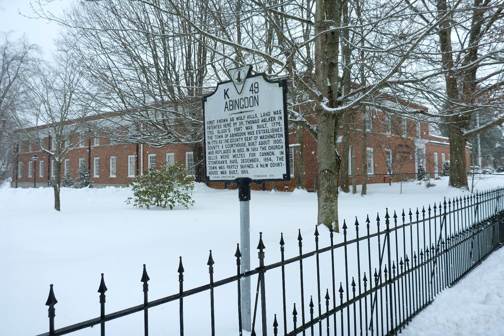
The grounds in front of the courthouse were literally covered with flags and crosses. The historical marker on the courthouse lawn, seen below, provides some history about Smyth County and the courthouse.
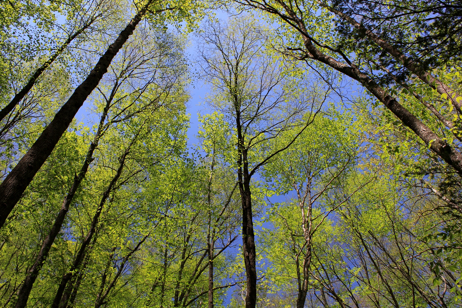
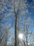
The emergence of an abundance of foliage in the Appalachians is the surest sign that Spring is in full force. Every week the hues of green change on the mountains and in the valleys as the leaves grow on the hardwoods. These photos were taken today, Sunday, May 11, 2014, during a hike in the area where Virginia, Tennessee, and North Carolina meet.
Appalachian Hardwoods Leaf Out, May 11, 2014Leafing Out, May 11, 2014
Spring has arrived, and we finally have warm weather after a colder than usual winter. These two mourning doves have been on and about my property for the last three weeks, providing us with entertainment during their courtship.
Mourning doves on a maple tree in Abingdon, Virginia, late March 2014
North of the Sun, a movie about two young Norwegians who live on a desolated beach north of the Arctic Circle through the sunless winter to surf and snowboard, cleaning up trash and flotsam that washes up on the beach. This film was the overall grand prize winner at the 2014 festival in Banff, Canada.
Last night, after the films, we had a very small taste of extreme conditions as we made a short but harrowing trip up to Blowing Rock in 40 mph winds and blizzard-like blowing snow. This morning, it was reported that there were 50-60 mph wind gusts in Boone and Blowing Rock, and up to 97 mph (that’s not a typo) on Grandfather Mountain, where we were planning to hike. Needless to say, the hiking trip we planned was cancelled. When the storm moved out, blue skies shined over the snow-blanketed mountains.
Here is what it was like in the morning, note the lamp posts that are bent in the wind:
As we left this morning, a 20 foot pine tree had been blown over in the parking lot. Not exactly the 60 degrees forecasted earlier this week. March went out with a roar, but we nonetheless enjoyed a nice weekend of adventure film watching.
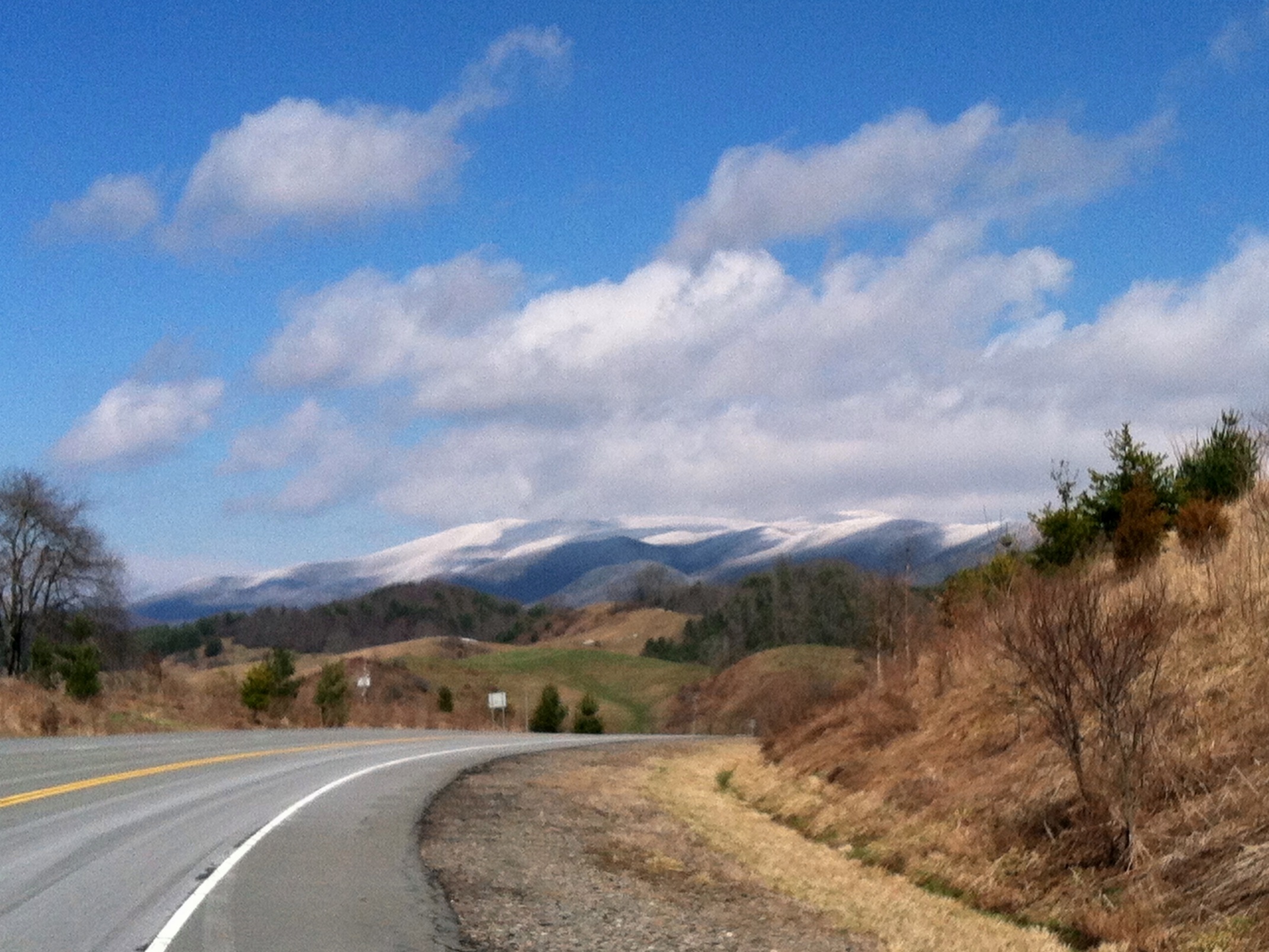
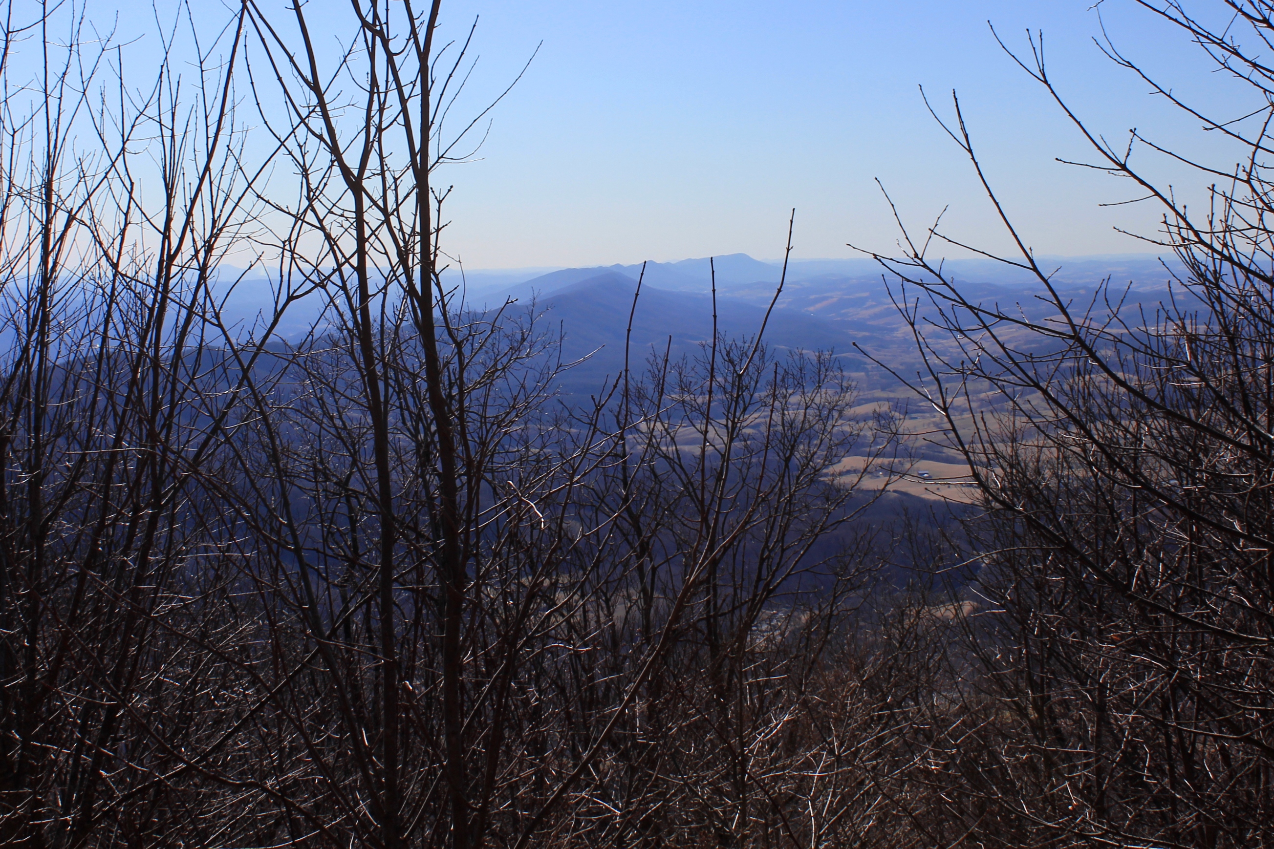
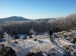
Because of its prominence, Clinch Mountain affords some of the best views over the Holston River and Clinch River watersheds. The best views are available during the winter when there is no foliage. On clear winter days you can see almost 100 miles south. On Saturday, February 22, 2014, I drove to the Hidden Valley Management Area and hiked the southeastern section of Clinch Mountain on access roads and trails in that area.
Southern Spine of Clinch Mountain
Clinch Mountain overlooks the small community of Hansonville and Moccasin Creek. Clinch Mountain divides two significant river basins: the three forks of the Holston River drain the valleys to the east and south of the mountain (which is to the left of the ridge in the photos), and the Clinch River to the west and north of the mountain (which is to the right in the photos).
South View Panorama
In the photo above, the view shows the spine of Clinch Mountain to the southwest, and further to the south the valley through which I-81 travels, with the Iron Mountains (and Holston Mountain) bordering the other side of the valley, with the much higher Unaka Mountains (including Roan Mountain) on the horizon.
Long Range Views to the South, including the Unaka Mountains
The western side of Clinch Mountain hase similarly long range vistas, with some cliff outcroppings. On this hike, however, I stayed on the southeastern side of the mountain.
Big Moccasin Creek
In the photo above, Clinch Mountain is on the left, and the much smaller hill on the right is Big Moccasin Ridge. Together they frame in the Big Moccasin Creek and the valley.
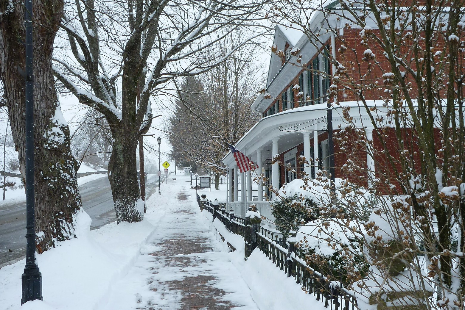
This has been a cold winter in Abingdon Outdoors country, yet thus far we have not had the big snowfall that neighbors to the north have had. That was remedied on Wednesday, February 12, 2014, when we finally got hit with a blizzard.
Come Thursday, school was closed, court was closed, public offices were closed, and most businesses were closed.
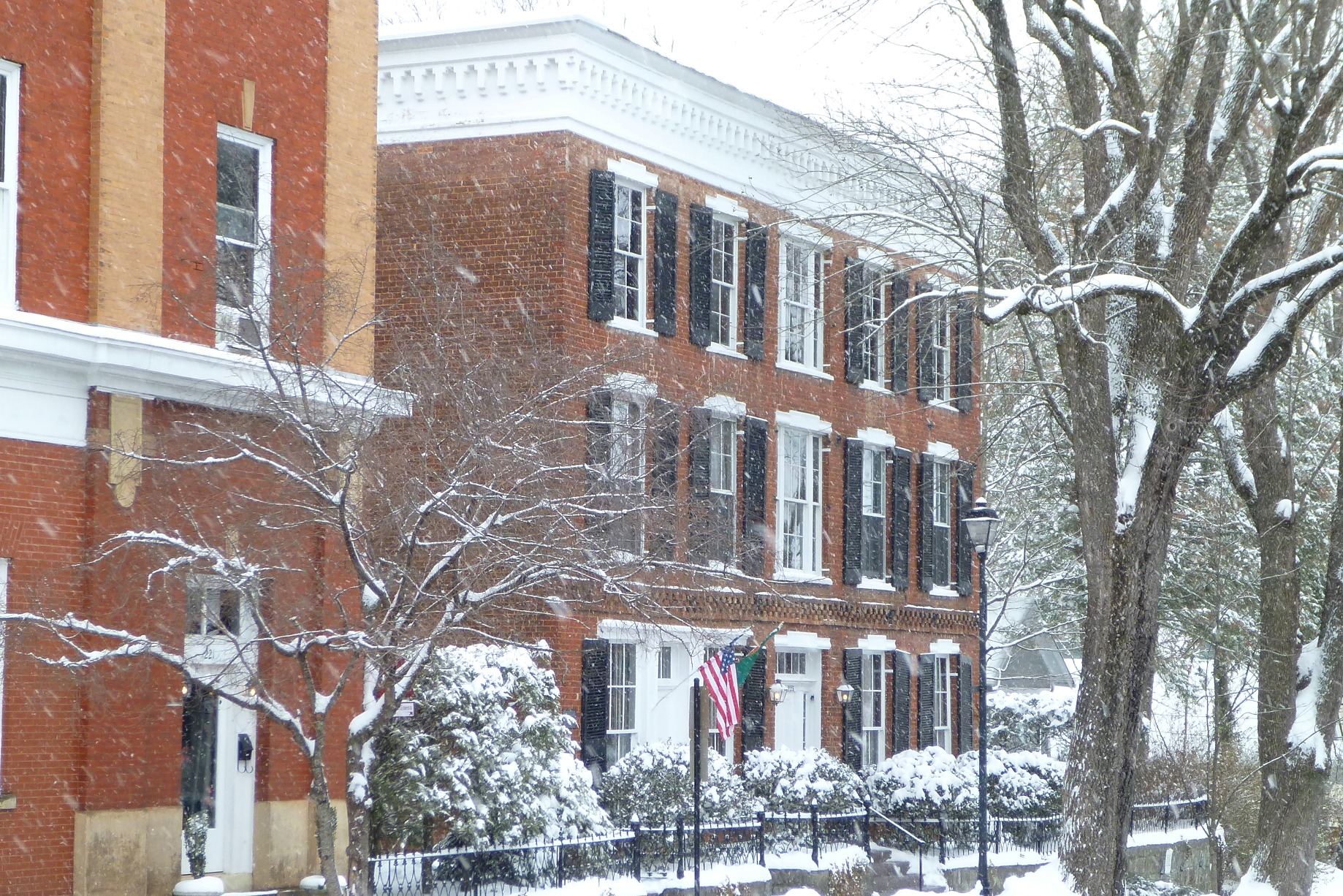
My wife and I walked through Abingdon around noon, and usually busy downtown was largely abandoned, allowing for unobstructed photos of the snow-laden historical buildings around town.
Sinking Springs Presbyterian Church
Walking west on Main Street:
United Methodist Church Parsonage
View of the Abingdon United Methodist Church. The exterior of the church was renovated in 2013. Note the freshly painted white parapets on the bell tower.
Abingdon United Methodist Church
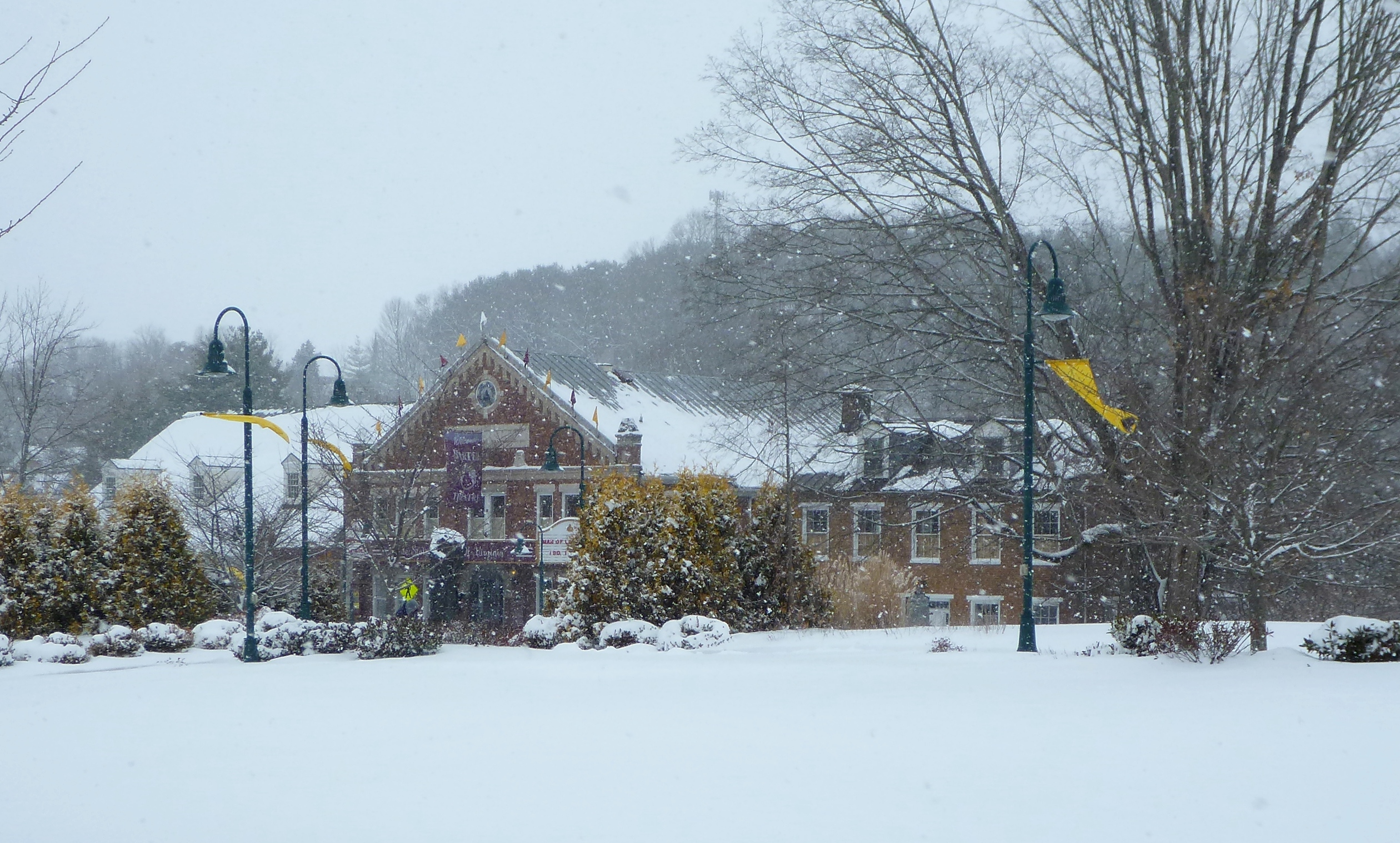
Continuing west, we climbed snow-covered stairs to the “Barter Green,” the area across Main Street from the Barter Theatre.
The Barter Green
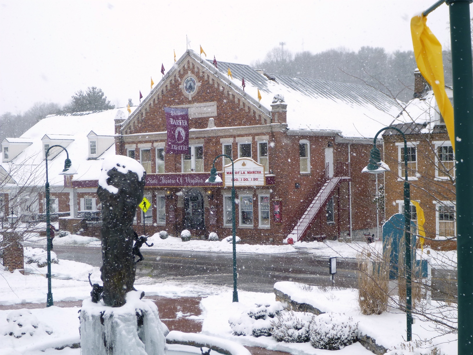
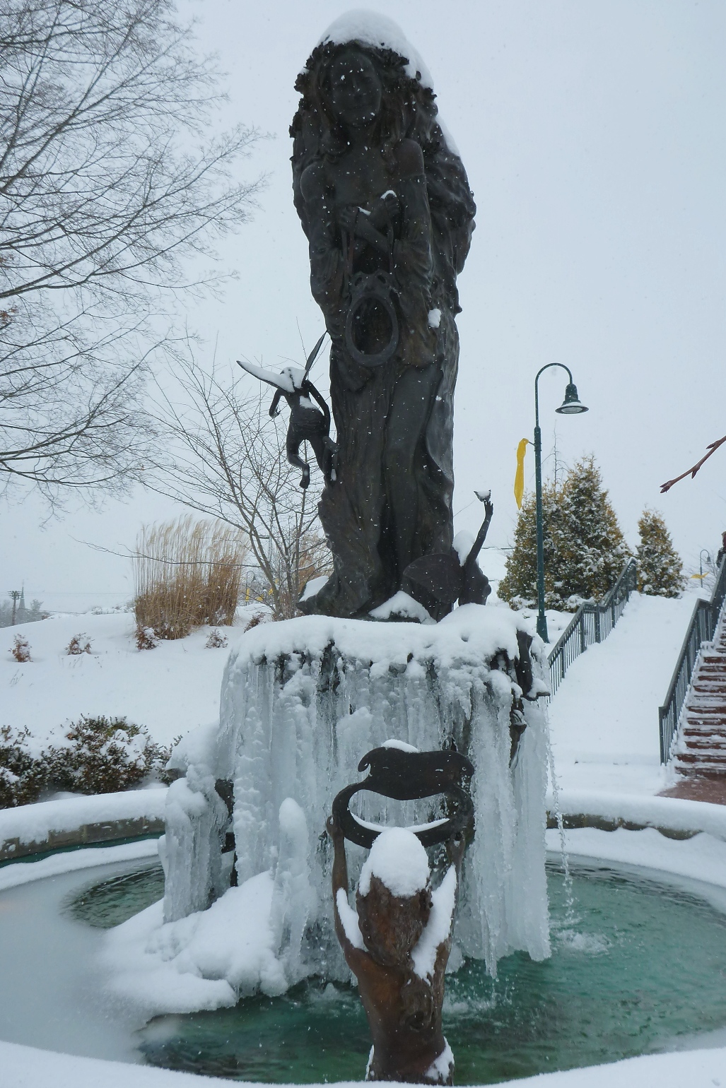
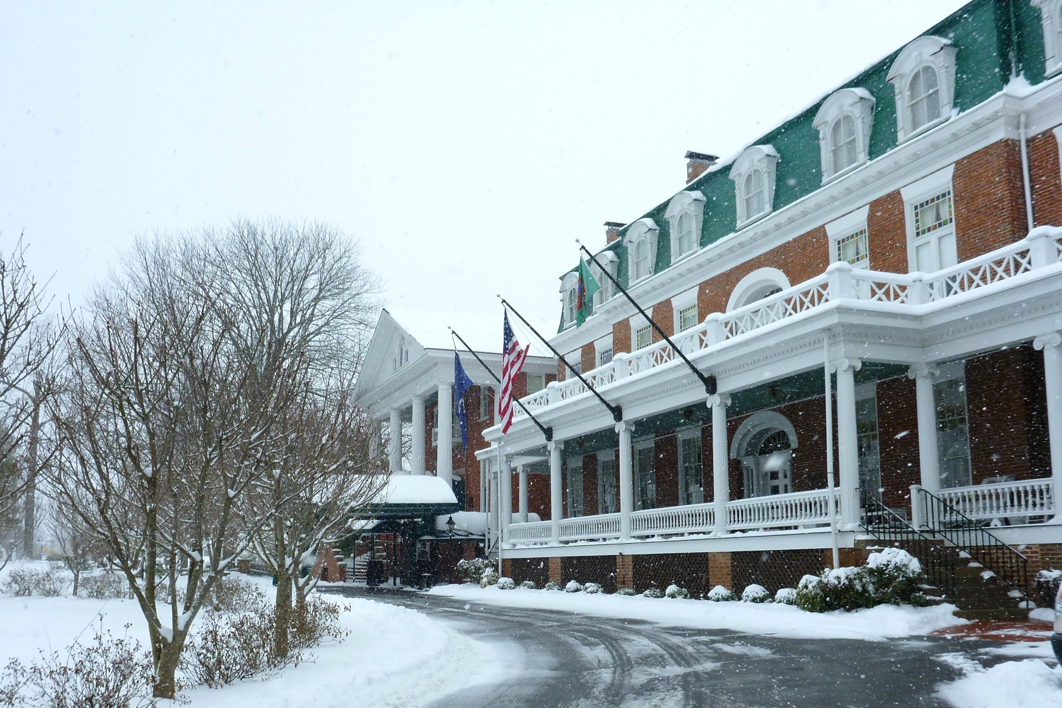
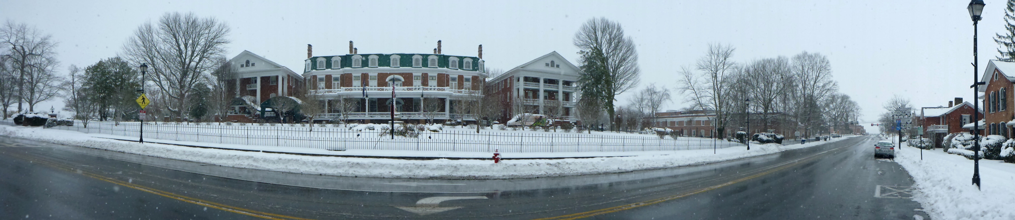
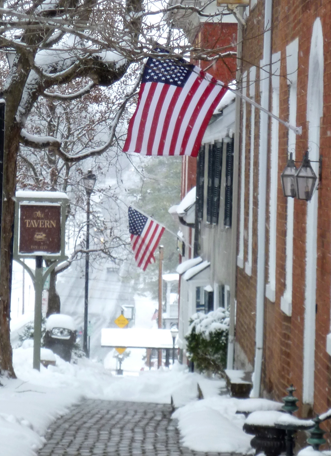
We continued towards the Barter Theatre and the Martha Washington Inn.
The Barter TheatreFrozen Fountain at Barter Theatre
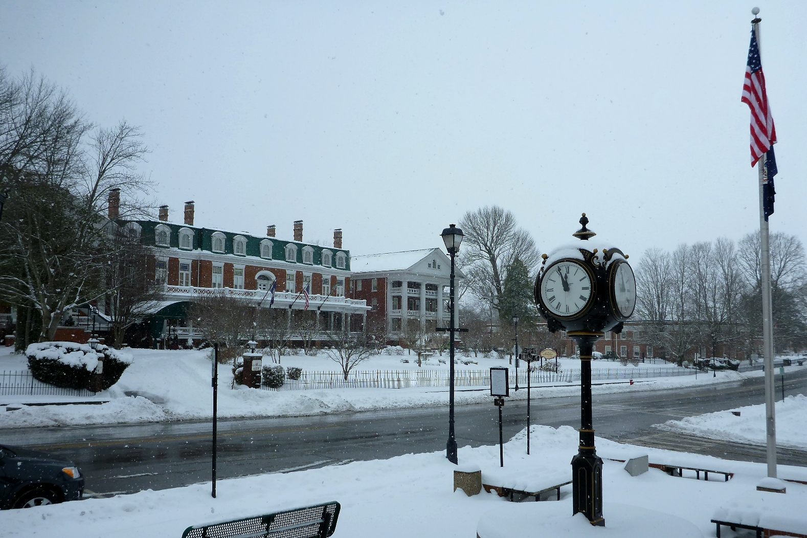
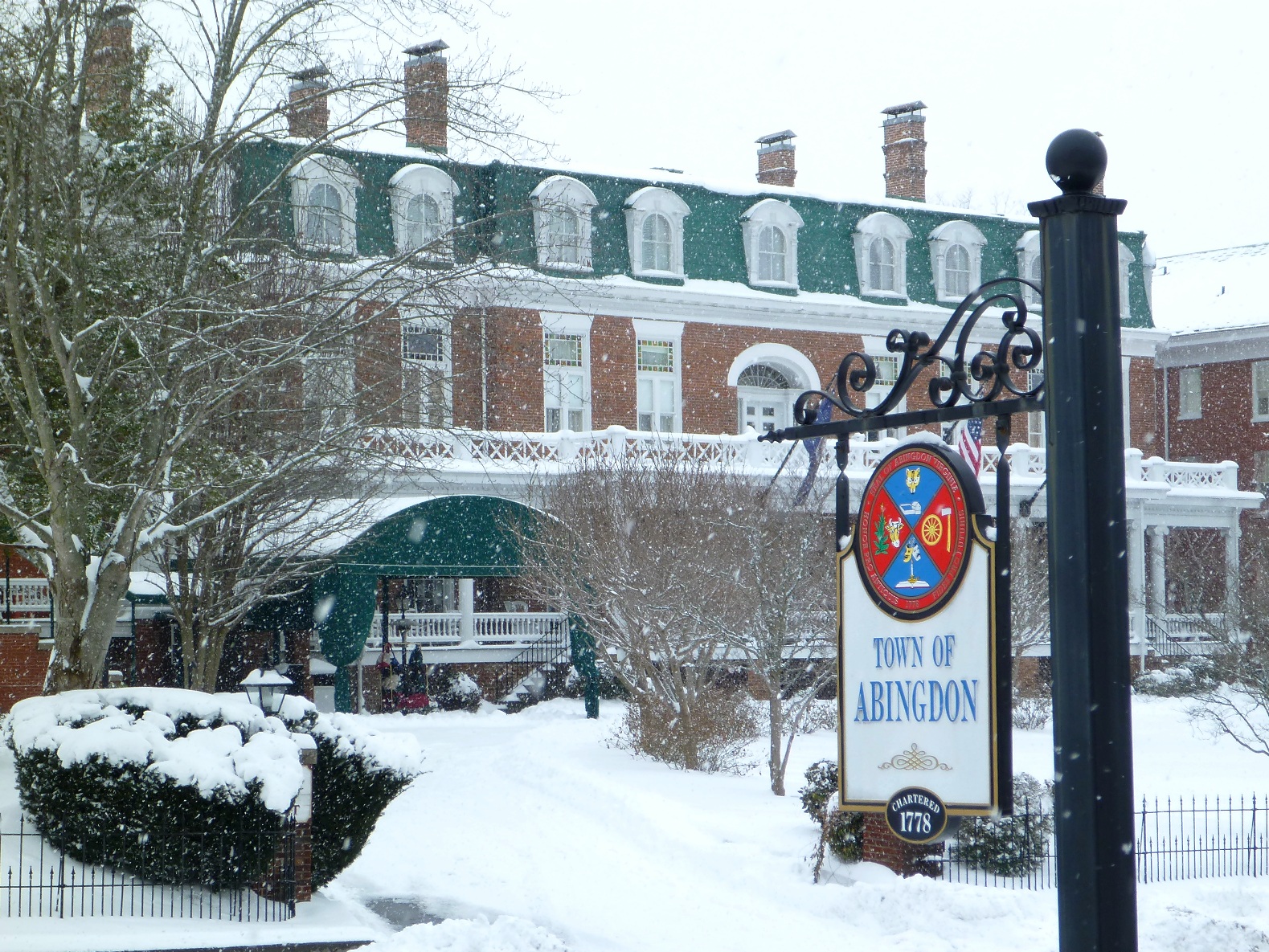
The LOVE sign in front of the Martha Washington Inn, appropriate for Valentine’s Day, February 14:
LOVE at the Martha Washington InnThe Martha Washington Inn viewed from Town HallTown of Abingdon, Town Hall sign, Circa 1778Martha Washington PanoramaAbingdon Sign and Wrought Iron Fence between the Martha Washington Inn and the Federal CourthouseTown Historical Sign with Snowflakes
Walking through the snow past a former employer:
United States District Court, Western District of Virginia, Abingdon Division
The Martha Washington hotel driveway was empty (except for the shuttle that is used to drive cyclists to the Virginia Creeper Trail):
The Martha
Walking through town, we had the winter wonderland to ourselves:
Desolated Main Street
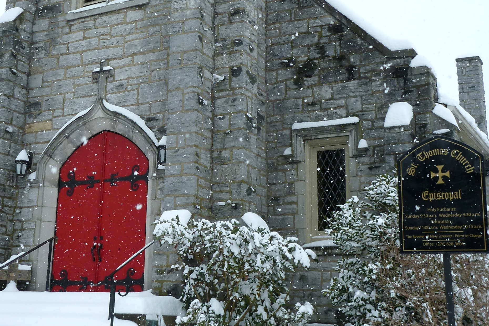
Turning back east, we headed towards “courthouse hill,” where the county courthouse is located.
St. Thomas, Abingdon’s Episcopal ChurchWhite snowflakes dot red doorsFederal Style Private ResidenceThe Nature Conservancy
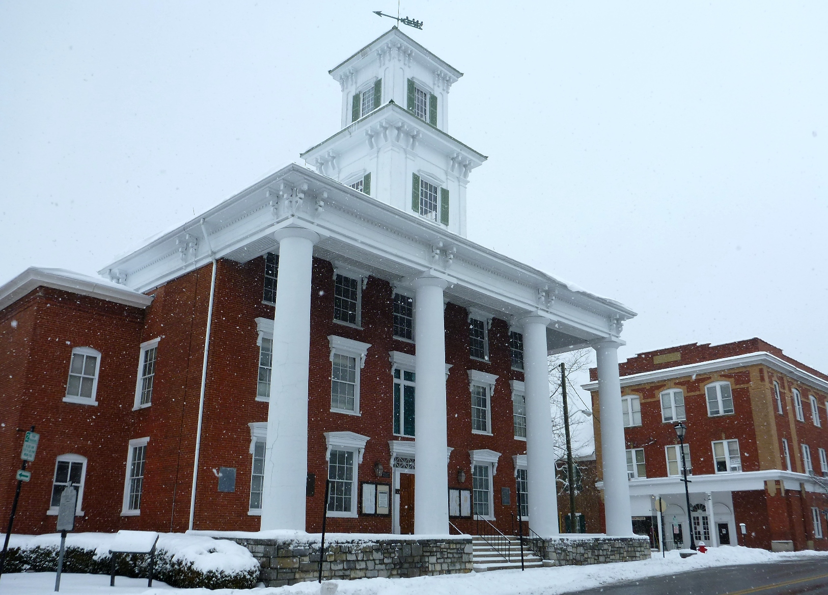
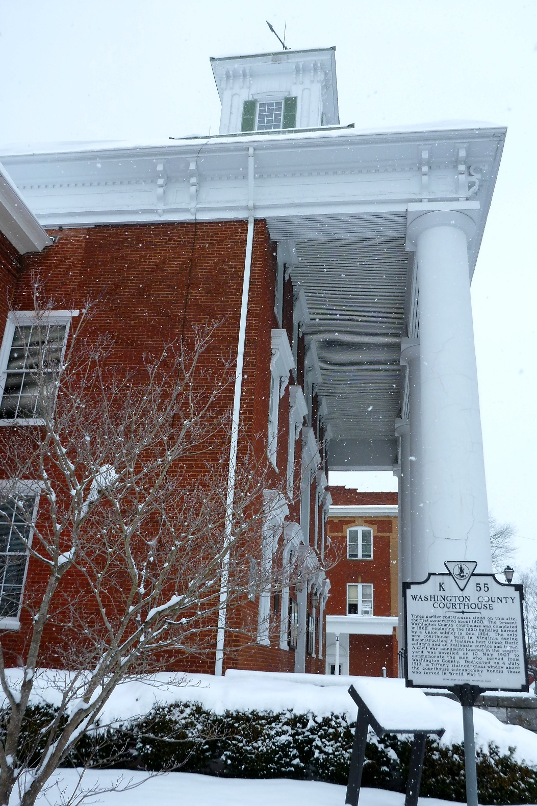
Empty courthouse:
Washington County CourthouseWashington County Courthouse – Side View
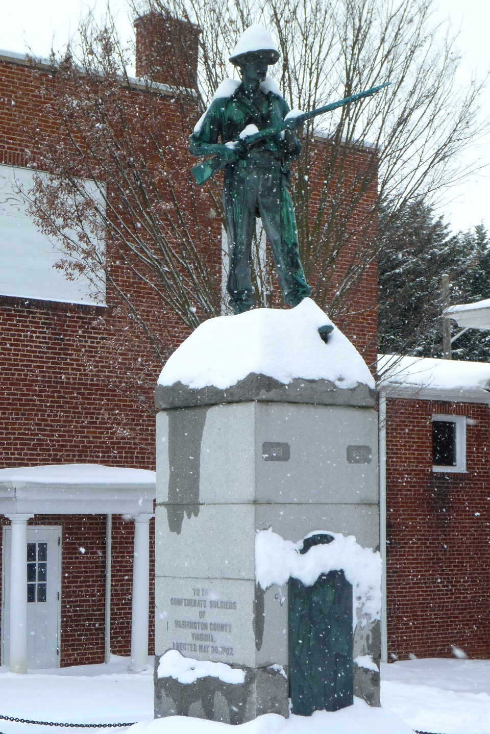
Snow-covered hat makes for a cold soldier:
Confederate Memorial at Washington County Courthouse
Headed east on Main Street:
Private Residence known as The BankSidewalk east of Courthouse HillEast Main Street
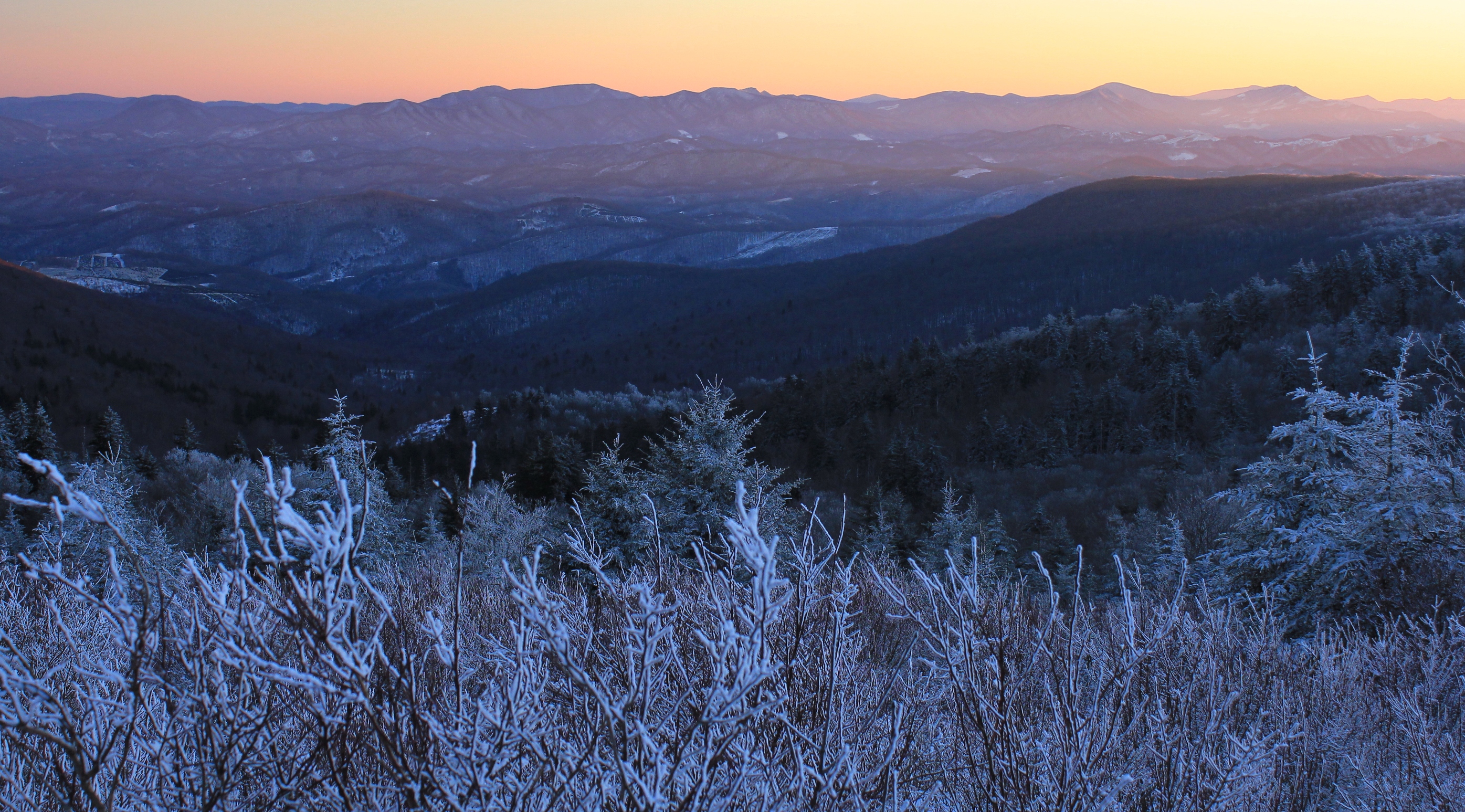
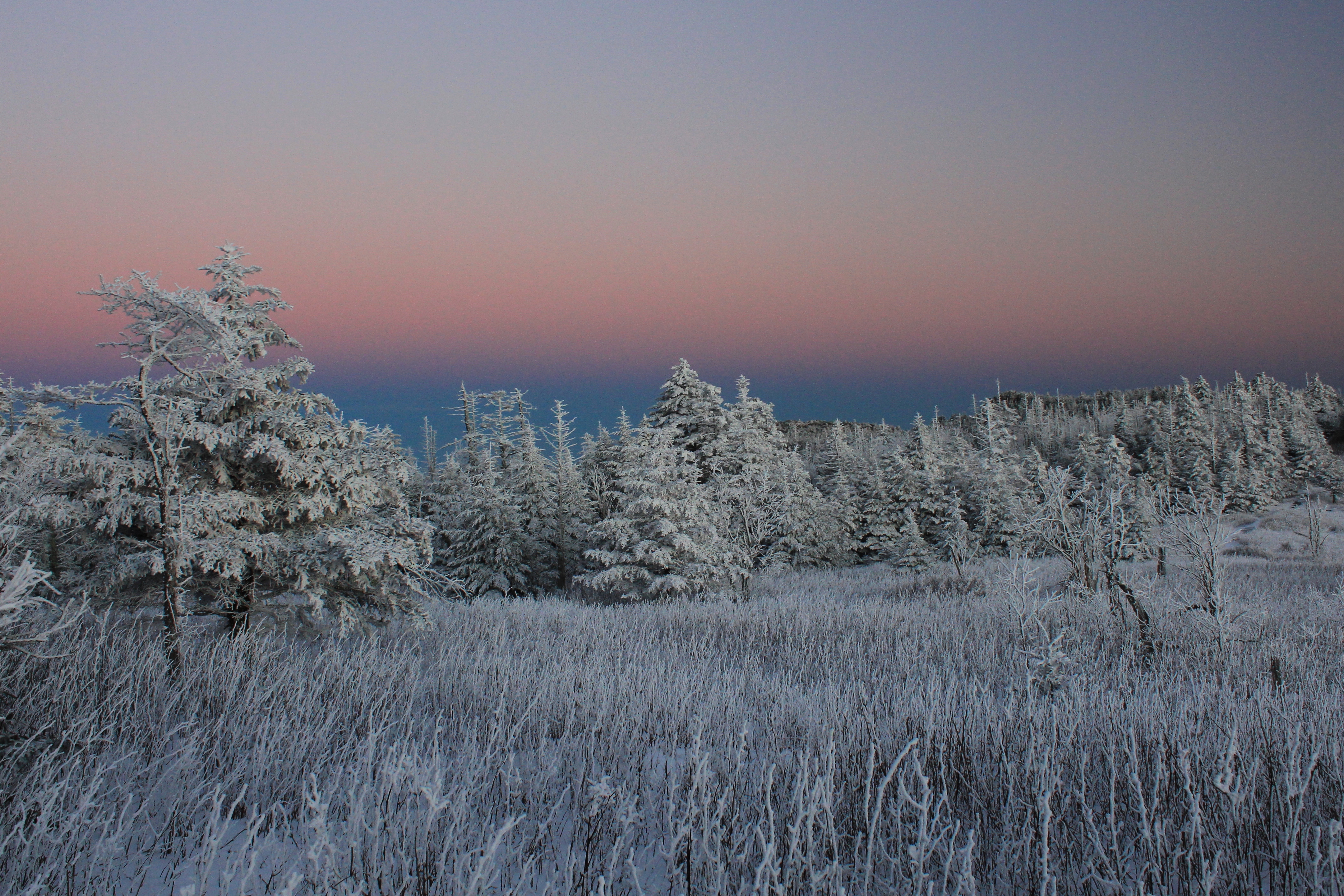
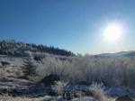
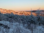
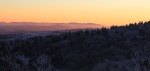
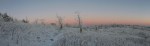
On Saturday, December 22, 2012 we went on a winter backpacking trip that was extremely cold but rewarded us with incredible conditions for photography: massive hoarfrost, remnants from a snowstorm, and true alpenglow lighting—a rare combination anywhere, but especially in the South.
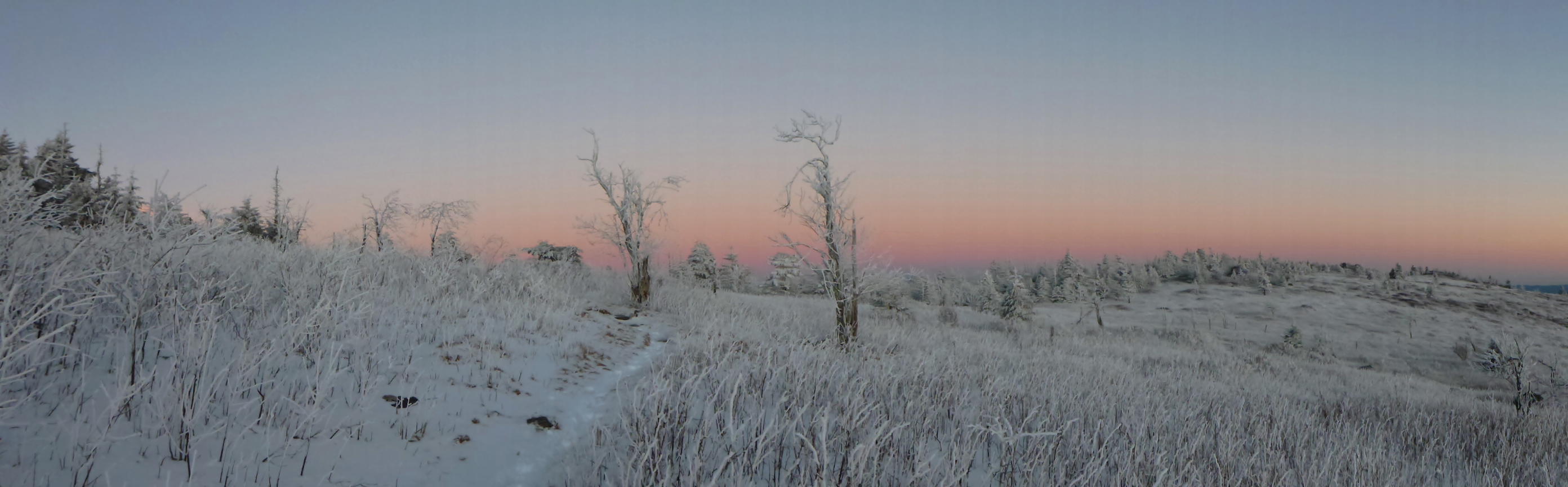
Otherworldly Alpenglow
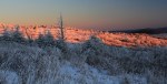
As the evening sun set, the entire sky in the east (the direction opposite from the sun) began to glow pink with a purplish band at the horizon. The rime-encrusted trees and brush, which had their own bluish-white hue, looked otherworldly. The side of the mountain basked in the alpenglow. In the course of my life I have seen this phenomenon on occasion in the Rockies and in the Alps, but never so pronounced in our region as it was this evening.
For a comparison with the same phenomenon on the Matterhorn in Switzerland, see this photo. While the orange light from a sunset is itself beautiful, true alpenglow—when the entire sky is lit with light seemingly emanating from behind or even within the mountains, in the opposite direction from the sun—is amazing.
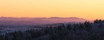
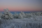
Dark pink and orange light on the mountain
Looking towards where the sun was setting revealed another interesting effect—purple mountains with an orange sky.
Purple Mountain Majesty
As we continued to take pictures until almost all of the light was gone, we were reminded that part of the reason for the great conditions was the cold. And it was getting colder by the minute. Operating the cameras and standing still, the chill began to invade us. Toes and fingers burned. As the last good light disappeared, we continued onward to make camp somewhere near the top of the mountain.
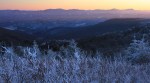
The Blue Ridge Mountains in all their glory
The Hike
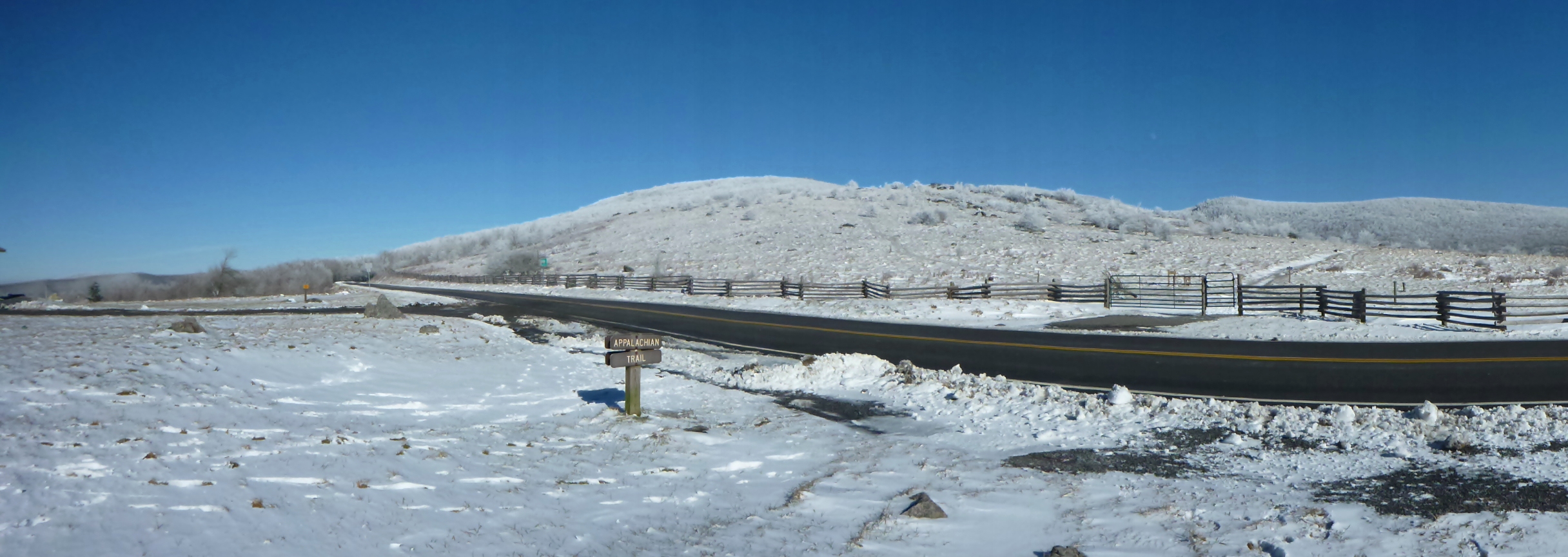
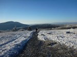
Our planned out-and-back route was straightforward: A one-day hike from the Elk Garden area of the Mount Rogers National Recreation Area up to the highest parts of the southern side of Mount Rogers near the famous Thomas Knob shelter; an overnight in the shelter or at a tent site somewhere in the vicinity; and a return back via the Appalachian Trail and the Virginia Highlands Horse Trail. These trails roughly parallel the Grayson County-Smyth County line for about five miles along the mountain ridge.
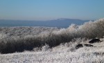
As we approached the mountain, you could clearly see the delineation where the frost began to accent the freshly fallen snow. While you could see the snow between the trees on the bottom half of the mountain, on the top half of the mountain everything—literally every single thing—was covered with brilliant white frost.
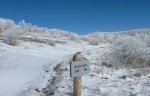
The Appalachian Trail at Elk Garden, Virginia
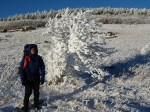
Donning my 44-pound backpack full of winter camping gear and camera equipment, I crossed the road and started up the Virginia Highlands Horse Trail. The hike started through trees, which glistened overhead. The skies were bright to the west, where the sun was already dropping, but were a dark cobalt blue in other directions.
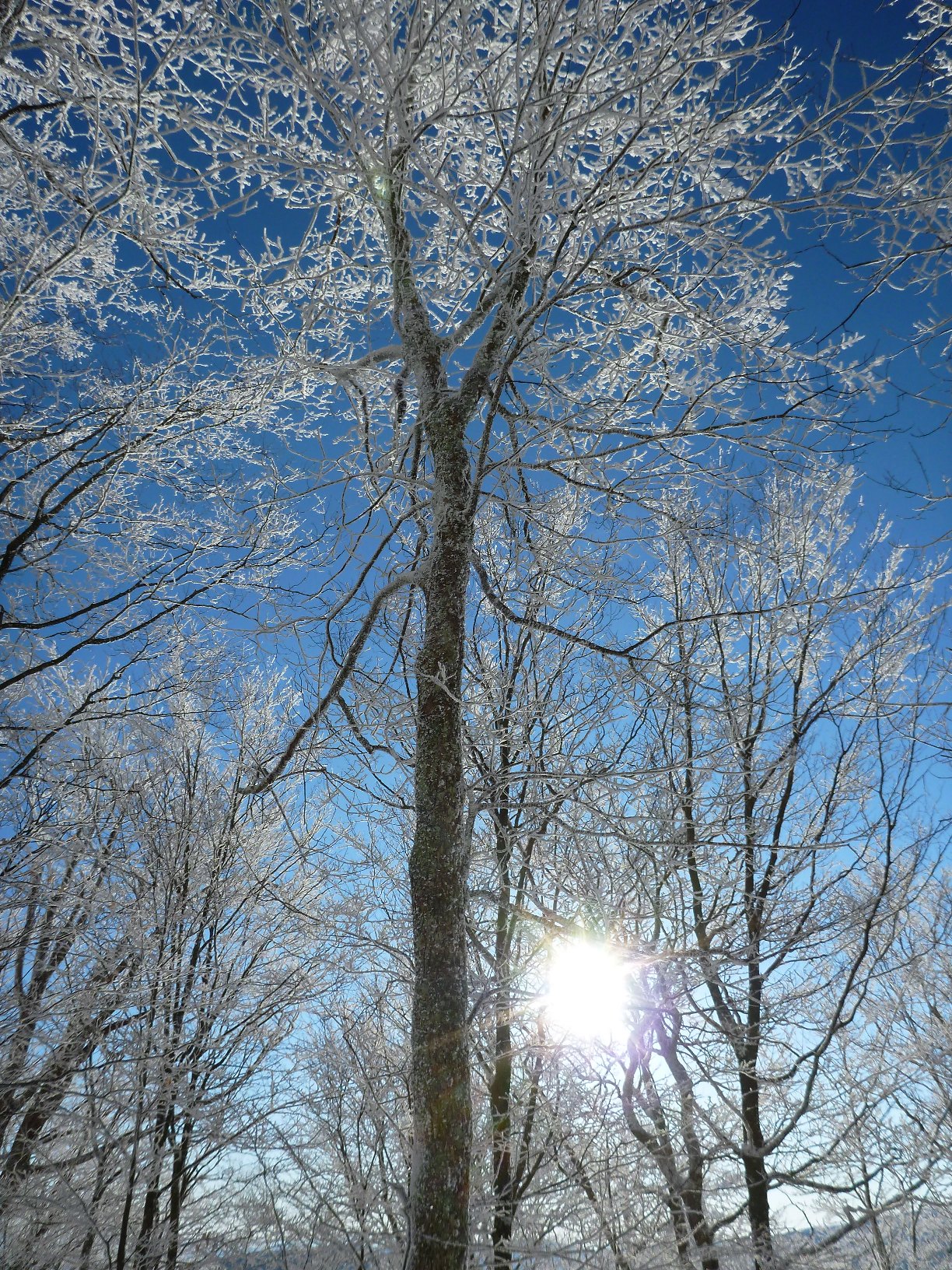
Hoarfrost Coats Tree Branches on the Virginia Horse Trail
The frost coated everything. Tree branches were twice or more their size due to the hoarfrost.
Cobalt Blue Background for White Branches
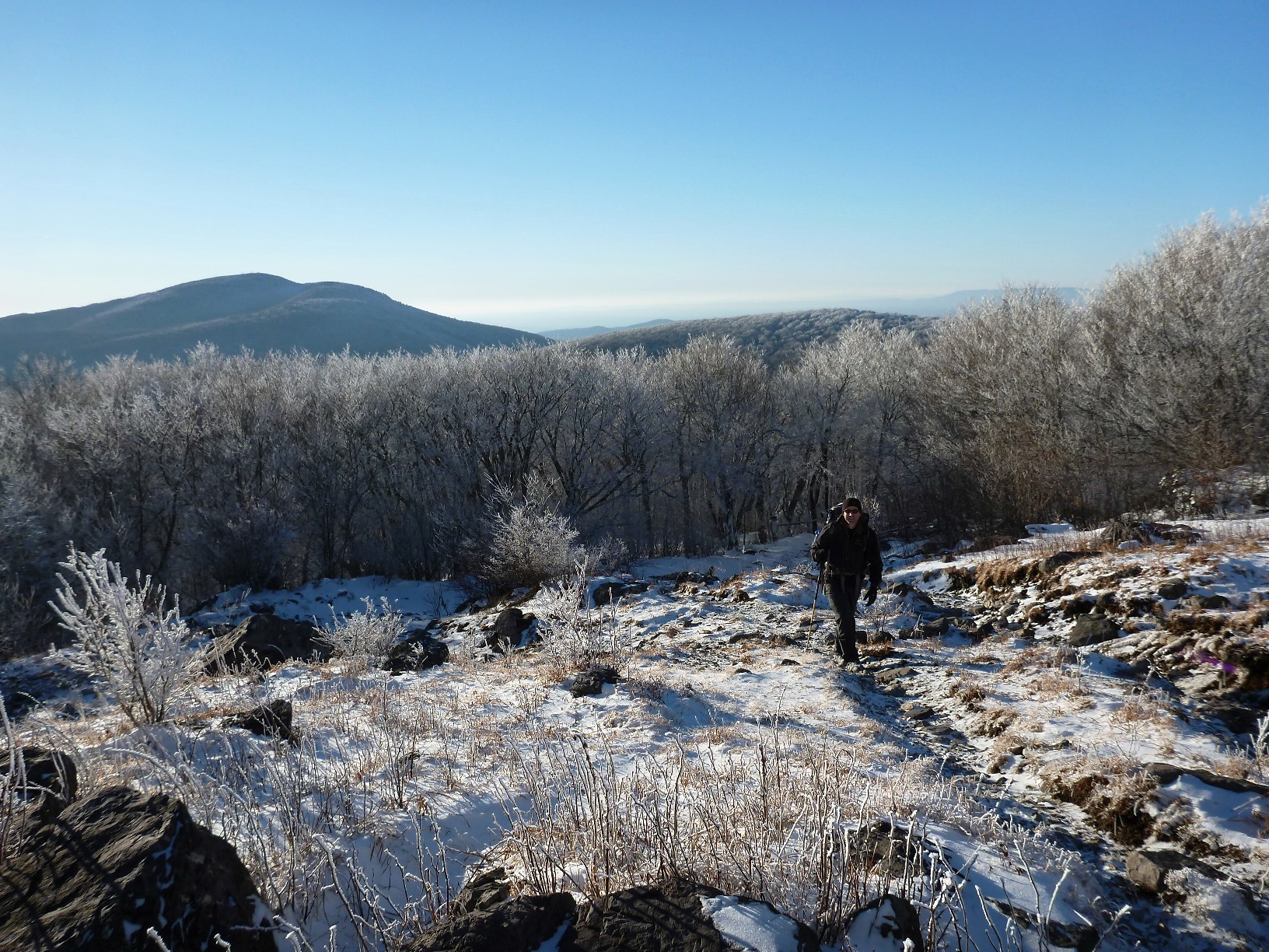
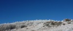
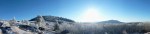
Once up in the balds, you could see great distances. The mountains to the south had snow but little frost; to the north across the valley, Clinch Mountain had frost on its largest southern-exposed face, known as the Bear Town area.
Reaching the First High Country Bald
The contrast between blue and white was dramatic.
Blue and White Contrast Nicely
Hiking in this winter wonderland, you could easily imagine yourself in another part of the United States, or another part of the world, hiking in the Arctic or in true Alpine conditions.
Big Sky Country . . . in Virginia
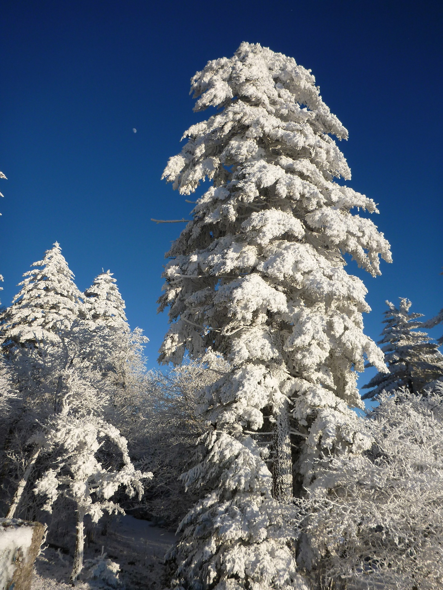
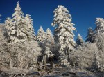
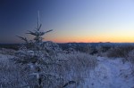
The Frasier firs and other trees at the highest elevations looked almost fake with their limbs and branches so heavily laden with frost.
Rime and Snow on High Elevation Frasier Firs
The moon rose dramatically in the East, signalling that this was the shortest day of the year, the winter solstice.
Reentering the Forest
The Show
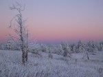
The entire hike, as awesome as it was, was merely the opening act for the light show we were about to watch.
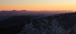
North Carolina and Tennessee Mountains
As we rounded the first bend that allowed us a view to the eastern horizon, the whole mountain became aglow in amazing colors.
Evening Alpenglow on the Appalachian Trail
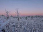
The photos we took do not adequately show the overwhelming color of the scene. The periphery as well as the main view to the east were bursting with palettes of pink and purple. In the photo below, I used my camera’s panorama feature to show a 180 degree view.
True Alpenglow
The entire episode of amazing light lasted less than one-half hour. Even the fading light was beautiful, as captured below.
Last vestiges of evening Alpenglow
The sunlight disappeared, and the moonlight began to illuminate the mountain. It was not a full moon, but it was sufficient such that you could walk without a headlamp once your eyes adjusted.
The light show over, we set out to make our camp. The temperature seemed to plummet by the minute. The winds, which were not insignificant while we were obsessed with photography, seemed to increase in strength and become more ominous. It was definitely getting colder.
There would be a price to pay to for the incredible optic conditions: suffering through a brutal night of cold and wind.
Looking back on a great hike
The Pain Factor
The next day, when we returned to our vehicle, an older gentleman walked into the parking lot from the other direction–coming down off of Whitetop Mountain. A large white beard, accompanied by a red union shirt, made the man appear as a slim Santa Clause coming from the snowy woods to inspect his winter kingdom. The man was none other than Damascus Dave, a well-known and experienced thru-hiker and outfitter in the region.
He greeted us. “Isn’t it beautiful? That hoarfrost, or rime ice, or whatever you want to call it—it’s whiter than snow.” Then he asked, “Did y’all overnight up there?”
We told him we had, and we began discussing the wind gusts and how cold it got last night. We talked about gear for a while, and how while we were prepared, it was still extremely cold.
“Well, it was pretty cold last night,” he said. “And, I reckon you can’t camp up there in this kind of weather and not experience some pain. No getting around it. That’s just part of it.”
As I stood there in the parking lot, tired but satisfied, I realized that he spoke the truth.
When it comes to hardcore winter camping, especially if you are seeking exposed ridgetops, vistas, and the coldest weather with the most snow, there will be some pain. Not insufferable pain. Certainly not the Beck Weathers’ level of pain. Not nearly the level of pain a depicted in Cold, the movie about climbing Gasherbrum II, a 26,000′ mountain, in the middle of winter. But there is unquestionably some serious discomfort—some pain—involved. It’s truly a case of “no pain, no gain.”
We weren’t cold while hiking. (In fact, while climbing it’s pretty easy to actually overheat.) We moderated our hike so that our pace kept us warm but didn’t cause us to overheat. But when we stopped, the whipping wind would quickly steal body heat. We had to put on our down jackets when we stopped. (You don’t want to overdress, risking sweating too much and the dreaded “wetting out” inside your jacket, but you have to dress sufficiently to keep warm.) It’s a balancing act to maintain warmth in these conditions. Preparation, proper clothing, and layering is key.
However, regardless of your dressing properly, setting up camp when it is really cold can be difficult. The cold seeps through your gloves, burning and then numbing your digits, making it increasingly difficult for you to manipulate them. For example, holding aluminum tent poles firmly while setting up a tent just saps the heat from your hands. Simple tasks require greater concentration and mental focus when it’s freezing and your hands are numb. Standing around while doing these kinds of tasks causes your feet to get cold, too.
By the time we had set up our tent, the water in our one-liter water bottles had almost completely frozen. The sandwich I brought for dinner had frozen. And the gas canister that would allow us to warm up some water for coffee and oatmeal was not functional.
That night, I slept in my 15 degree-rated sleeping bag on a sleeping pad, with polar fleece pants, two undershirts, a fleece jacket, wearing a down jacket, a hat, and gloves. My feet were covered with wool socks and insulated slippers. And yet, my feet and hands were still cold. My friend, who brought his 0 degree-rated “Never Summer” down sleeping bag, fared no better. Let’s just say, it was very cold.
We warmed our water by placing it in our sleeping bags, along with a host of other gear that was generally uncomfortable to have there: batteries from my camera; my headlamp; additional food; the gas canister; and various other items.
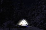
The wind was blowing interminably, with gusts that seemed Everest-like. In putting up our tent, we staked through the first inch of frozen ground down into the soft earth, and used some additional rocks to keep if from moving. Nonetheless, the tent flapped incessantly through the night, and the intermittent gusts seemed to have enough force to blow us off the mountain.
Exposed winter campsite at 5400 feet. Brrr! If you click and enlarge this photo, you can see the stars visible between the trees.
Despite the good weather window reported on the news and on the Internet the previous day, the temperatures plunged and the wind whipped with increasing intensity through the night. Using the heat inside our sleeping bags, we were able to thaw the iced-through water bottles.
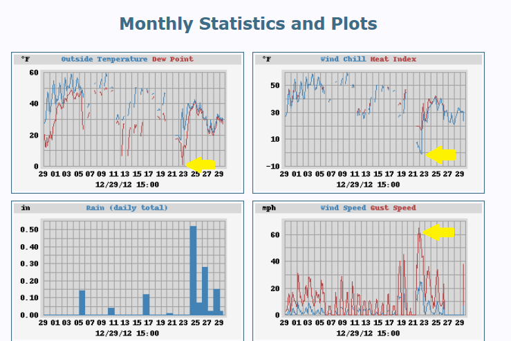
Little did we know that although the weather was predicted to improve at the lower elevations, the recorded temperature (single digits) and wind chill (below zero) was the coldest in December 2012, and wind gusts were recorded at 65 miles per hour at the Grayson Highlands State Park Weather Station, almost 1500 vertical feet below where we were camping on the exposed ridge at over 5400′.
December 2012 Weather Graphs for Grayson Highlands State Park. Note the yellow arrows showing December 22, 2012 statistics: Single digit temps and 65+ mph wind gusts. This weather station is 1500′ below the campsite in this article. (Click to enlarge)
If we had not been adequately prepared that evening, an uncomfortable night could have been much worse. Instead, we awoke the next morning, broke camp, and went back to the Thomas Knob shelter to brew some coffee to warm up before the hike back to the trailhead. As expected, as we hiked back down the mountain, it got warmer and the winds subsided.
By the time we returned to the parking lot, it was comfortable enough wearing just our fleece sweaters to stand around and chat with Dave regarding harrowing experiences he had heard about in this area. (Many folks have actually been in some real danger up on the mountain). While not uniquely cold, the weather we had experienced was extreme, especially for this region. For us part-time adventurers, you might even call the weather conditions epic.
The evening sunlight, true alpenglow, and whole experience made this a fitting winter solstice backpacking trip, a perfect prelude for Christmas and the New Year. The suffering part? Yes, it was definitely worth it. Meaningful achievement, even something as relatively inconsequential as a winter overnighter, requires some striving and involves a little or more discomfort. It’s in part the difficulty that makes it rewarding. If it were easy, everyone would be doing it, and the solitude sought after in these kinds of trips would not exist.
And for the record, yes, I actually did carry with me and wear insulated slippers.
Gallery
The Appalachian Trail at Elk Garden, Virginia
Hiking along the Virginia Horse Trail – Snow and Hoarfrost Everywhere
Blue and White Contrast Nicely
Hoarfrost Coats Tree Branches on the Virginia Horse Trail
Cobalt Blue Background for White Branches
Reaching the First High Country Bald
Wind whipped and exposed section of trail
Hoarfrosted Tree
Hoarfrost on the face of Clinch Mountain visible across the valley
Big Sky Panorama
Big Sky Country . . . in Virginia!
Rime and Snow on High Elevation Frasier Firs
Reentering the Forest
Afternoon Pink and Orange hint at the color display coming soon
Bluish white rime and snow contrast with dark pink and orange on the mountain